
The Vale of Avoca – A Site Analysis and Exploration
THE SITE

THE LARGER RAVINES CONTEXT – EXPANDING AND CAPTURING
The Vale of Avoca ravine is part of a connected system that includes Mount Pleasant Cemetery, the Don Valley Brickworks and other numerous small rivers and tributaries that flow into the Don Valley and extend over to the Lake Ontario Waterfront. Consequently, this connected system while context bound is nevertheless a deterritorialized and more nomadic connectivity, in which separate elements in context ‘share’ their infrastructures and amenities within an expanded context. While again a new element or institution has a local relation, it also has and belongs to an expanded metropolitan context and scale of relationship of cultural and social amenities.
That its new elements and future expansion have a contribution value to the larger systems, again nomadic and strategic users explore the whole space of possibilities within their local as well as their expanded contexts of ravines, parks, and adjacent neighbourhoods. This includes the proposed accessible ramp and a next stage exploration large shade trellis within a connected system.
Elements are not context bounded but part of an expanded and connected network of open spaces and urban areas.
EXPERIENCE MATTERS
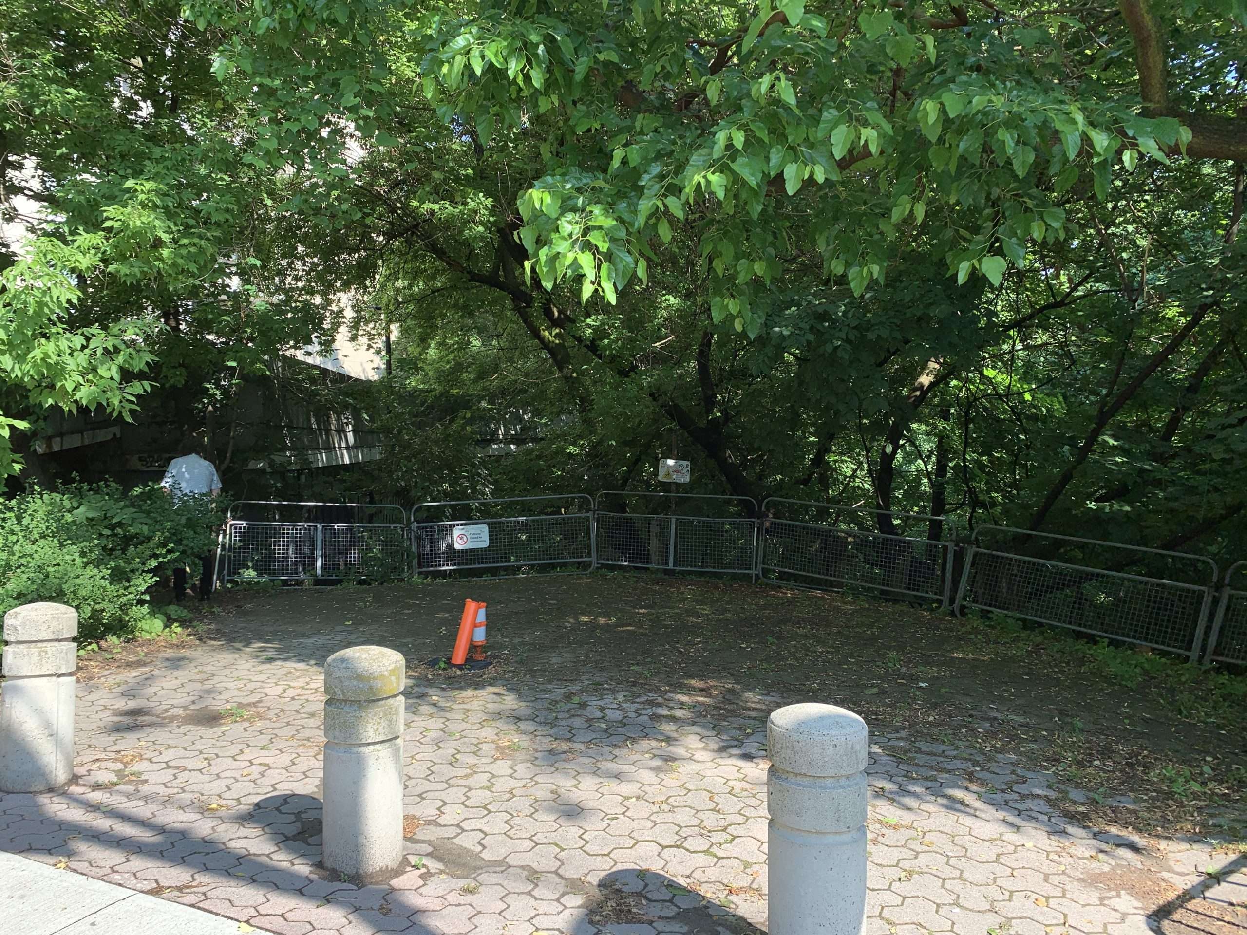
The Vale of Avoca and David Balfour Park has to be understood as an important place with regard to its location and amenity in the city, the growing population of ‘new apartment dwellers’ along the Yonge Street corridor will require more outdoor amenities beyond their apartment balconies. This new public and the expansion of many new users will re-constitute the ravine park space demanding more accessibility, more amenities, and renewed experiences that make the park experience more important and intensified in a cultural and ecological sense. Experience matters and is the most important objective the ravine park can have. The improvements to the ravine park require being satisfied. Speculating new propositions around the parks organization it’s elements, and environments and landscapes has to be mindful of this new public their wants and desires. The example of a new accessible ramp for example, offers a visual and actual new element that has the potential to ‘lure’ these new users and change the current state of decline of the park, uniquely sorted to incite a change and new direction in the parks environment. More positive than negative given the environmental circumstances that presently exist, but has the potential to be re-constituted in a better direction attracting new users and new functions.
The most pertinent argument beyond the concerns for environment and ecological issues is that of experience and what makes it important.
YONGE ST. BIA
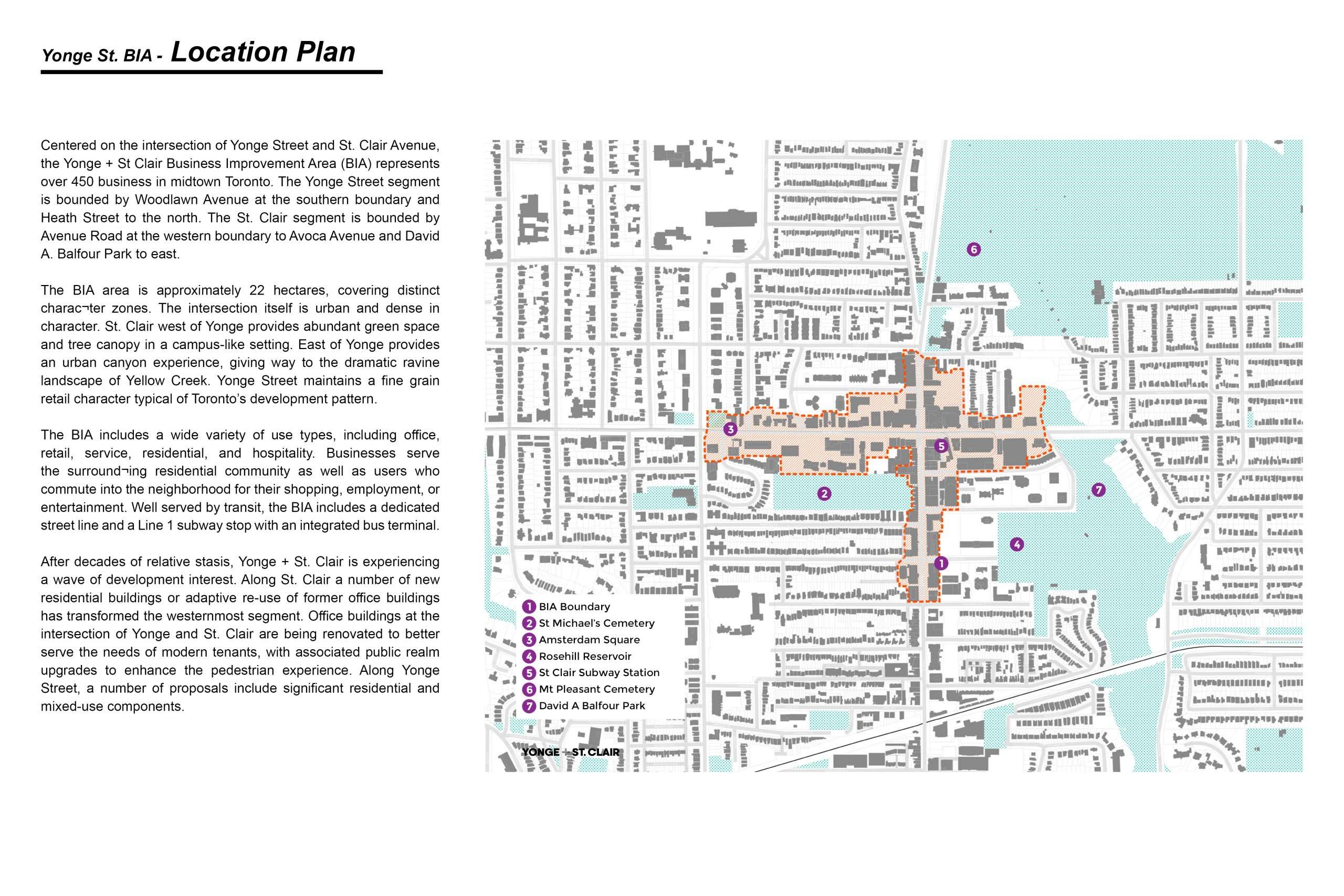
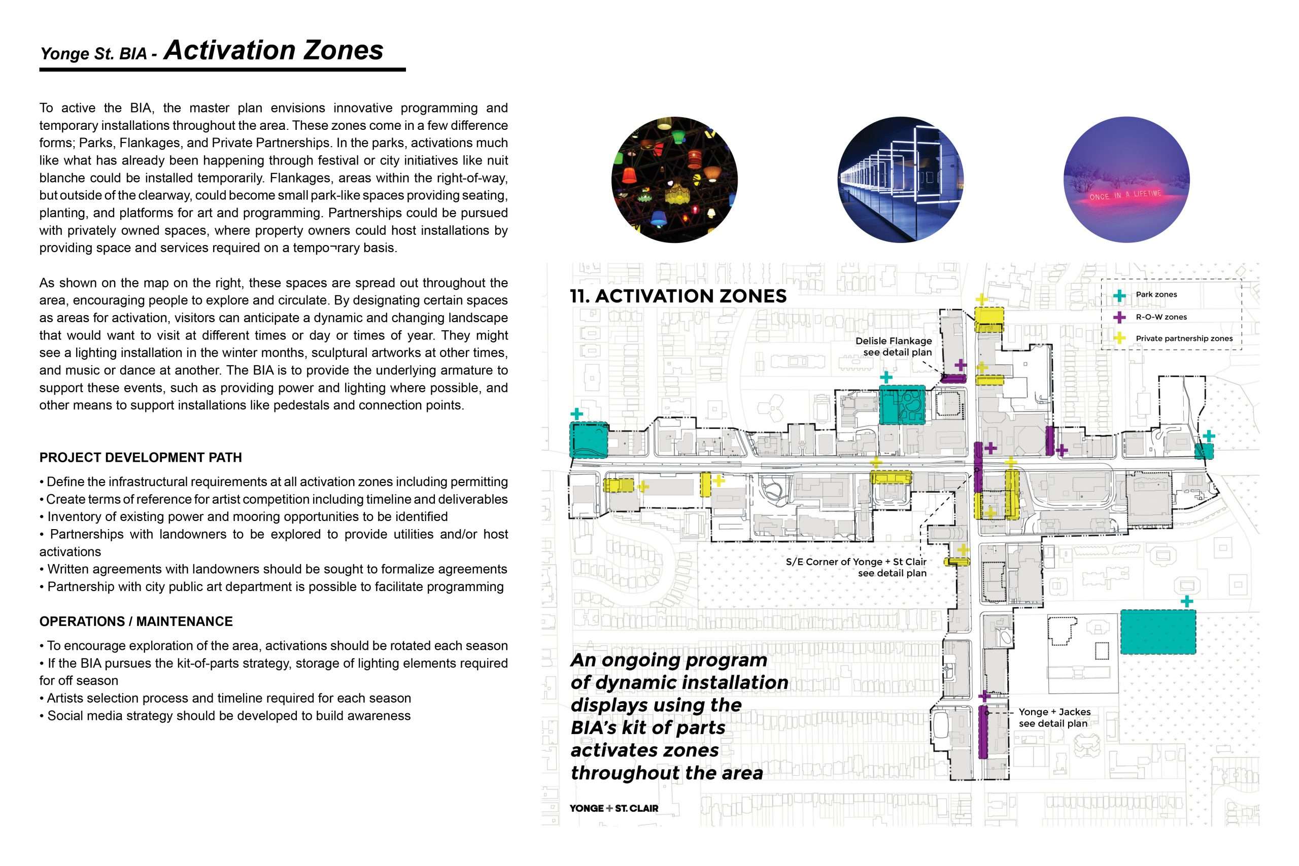
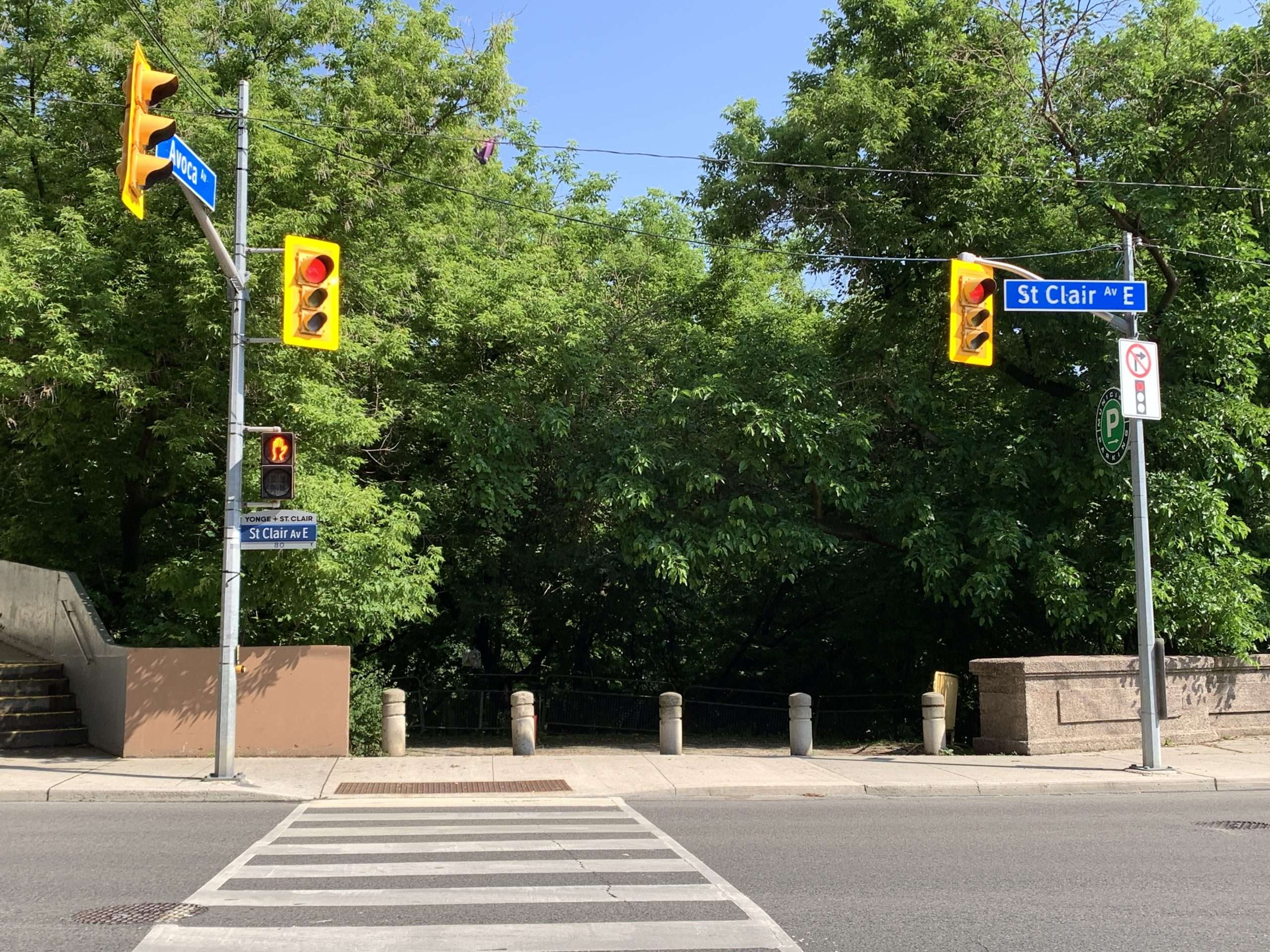
The masterplan for the BIA points out a number of locations in which they have located and named activation zones, one of which coincides with the accessible ramp site at St. Clair and Avoca Avenue. They talk about ‘greenery’, ‘park improvement’, and ‘street infrastructure’ for these zones and the point is that their BIA boundary ends at the edge of the ravine, so there is an adjacency. The combination of the accessible ramp, bridge improvements, lighting and enhanced lookouts makes the bridge a gateway location to both St. Clair and to the ravine public access ramp and plaza. The potential of this gateway combines the themes of shopping, retail, and street public space, with the experience of a nature ravine and unique example of places of nature in the city. As a combined theme and new gateway, there could be a shared interest and partnership all of which they are also talking about. A new marked bus stop and canopy would also enhance and mark the gateway idea. The smaller bridge ‘outlook canopies’ can be enlarged in scale and fitted into the street frontage and alignment of Avoca Avenue, which could also include a similar canopy marker to initiate and connect to the ramp off Avoca Avenue into the ravine. In a similar gesture, the larger lookout canopy could mark the new improved park location at the eastern end of the bridge with a potential lookout and combined patchwork landscape.
The secondary plan area expands outward from the BIA’s street plan and boundary, including the Vale of Avoca, David Balfour Park, and the ravine. This larger mapping area captures and identifies a larger scope in which the BIA’s site forms a part of. It is very clear that David Balfour Park and its environment are an extremely important component of the plan, hence St. Clair and Yonge Street recognize the importance of the Park/Ravine relationship to implement the BIA’s hard surface, commercial urban landscape.
HISTORICAL SITE PHOTOS + DRAWINGS
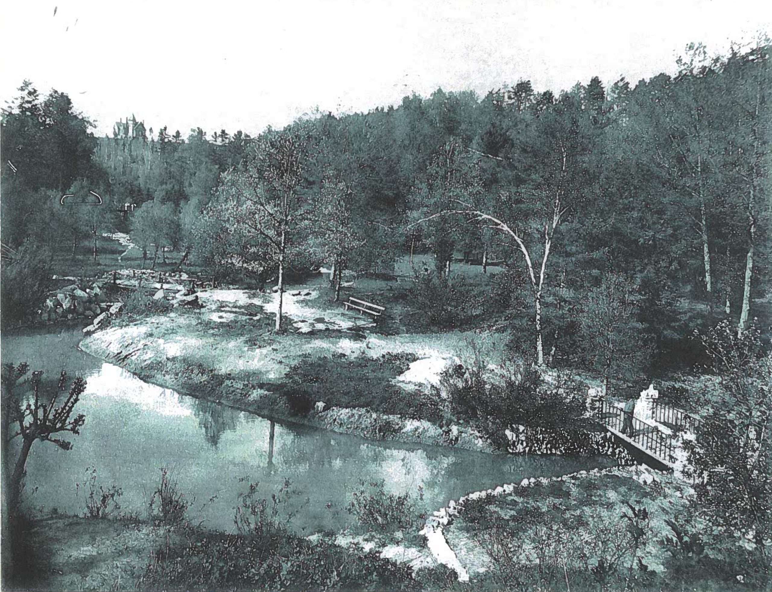
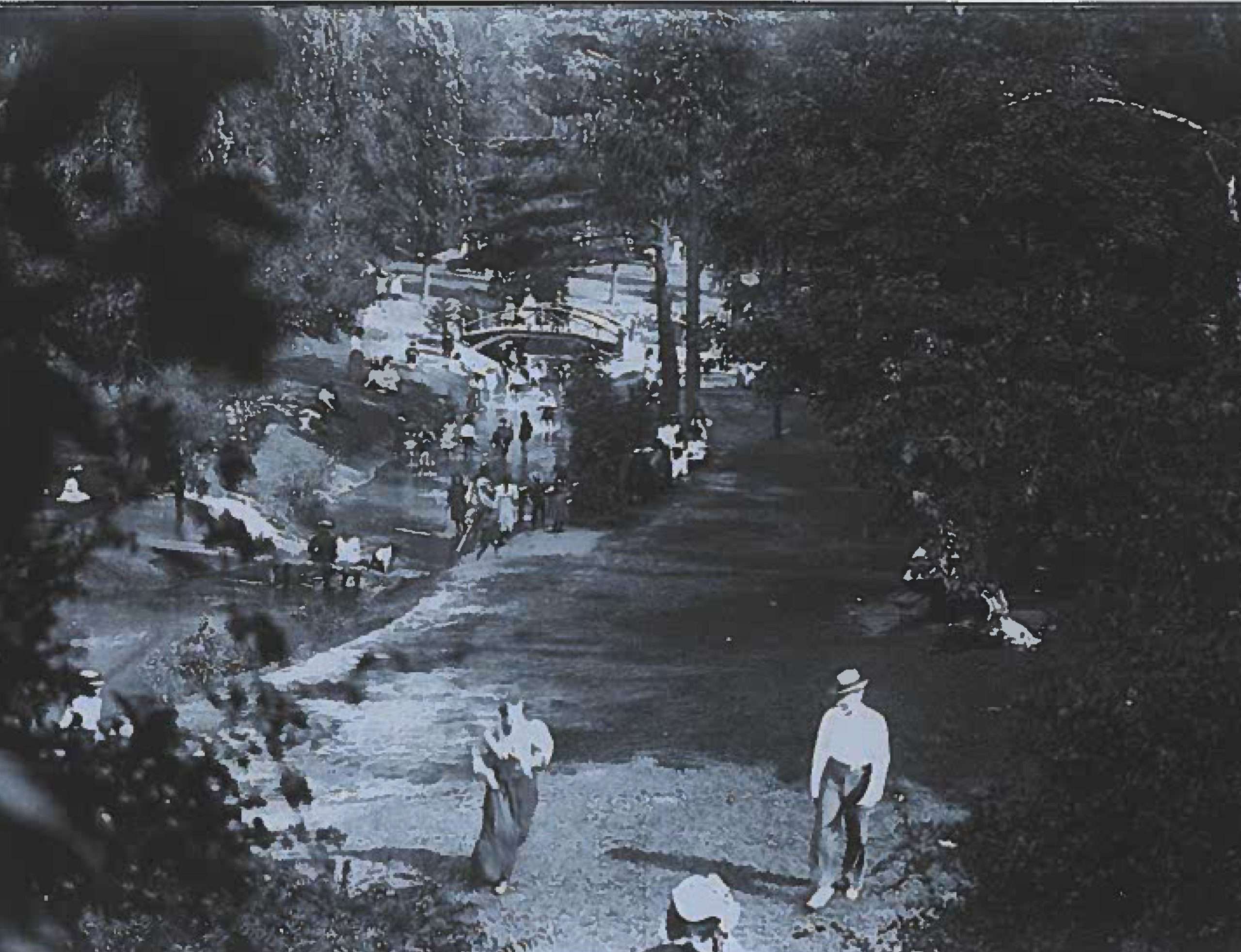

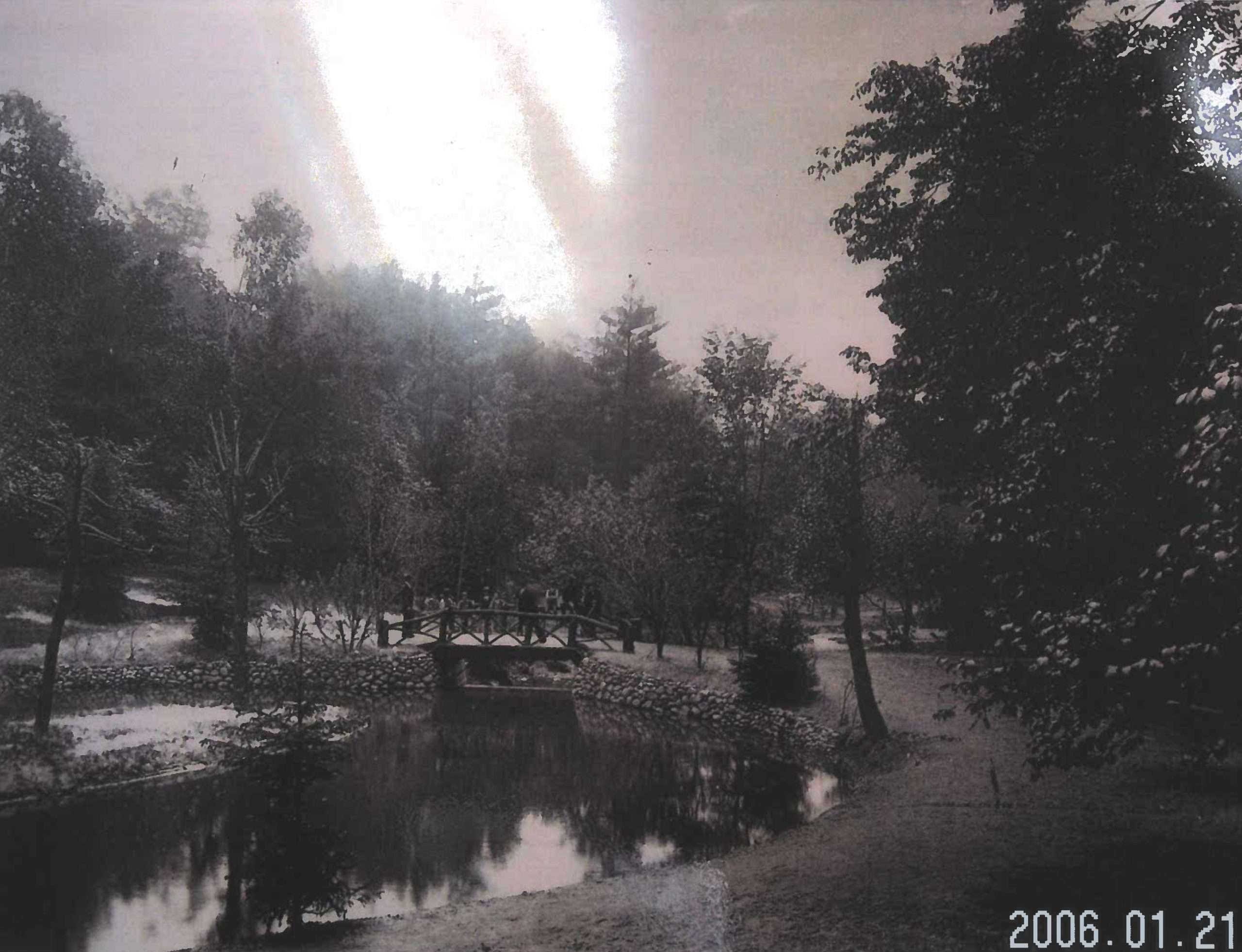
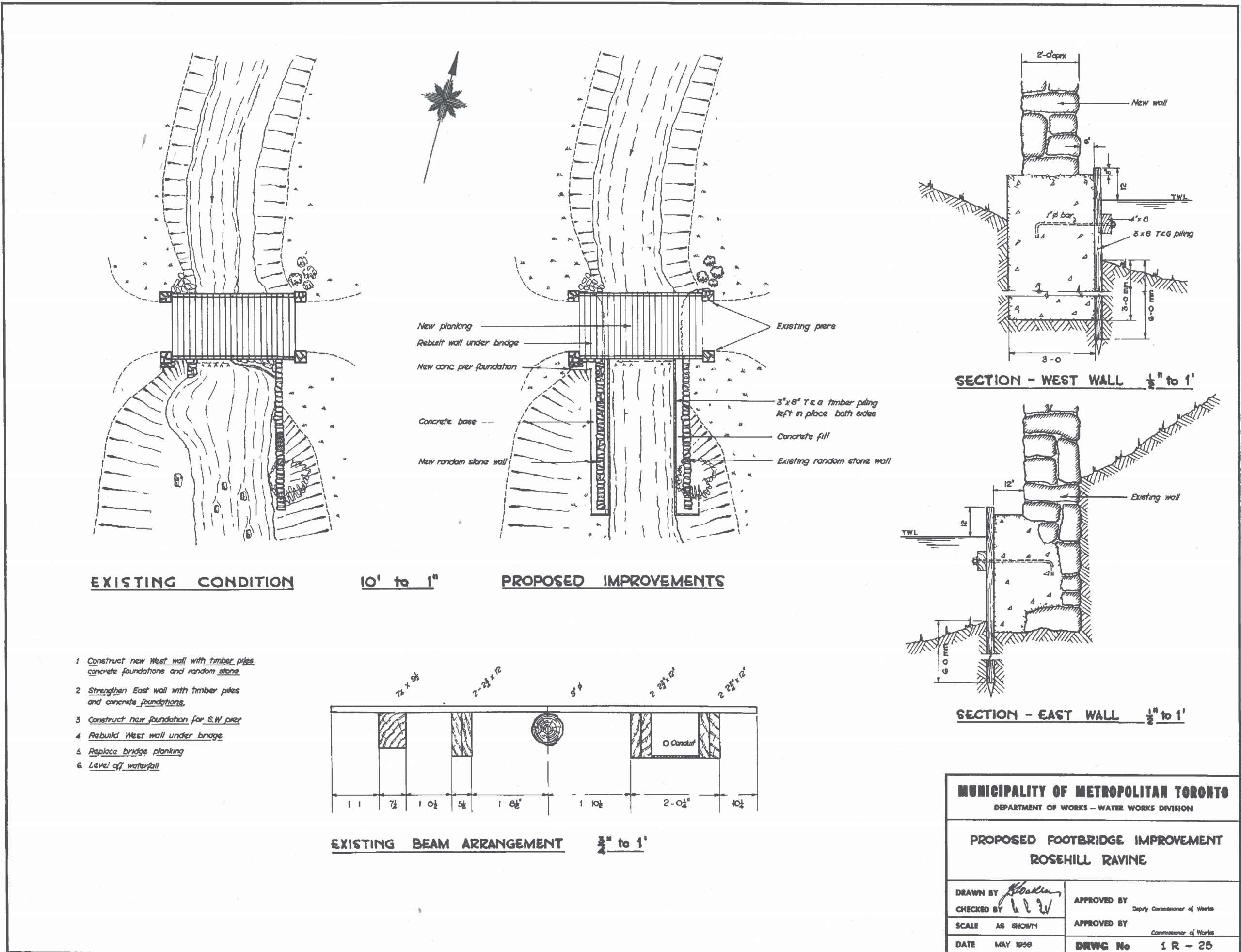
Having began its historical ecological beginning as a ‘natural ravine’ to become a ‘pleasure garden’ in the 19th century to its current state of abuse and lack of maintenance; and natural erosion, the park needs a new beginning again to set a future that is healthier and well performing. A cultural and natural landscape that insures the ongoing health of its nature and cultural attributes in a more environmentally embedded set of goals and aspirations in a new embodied active form and organization.
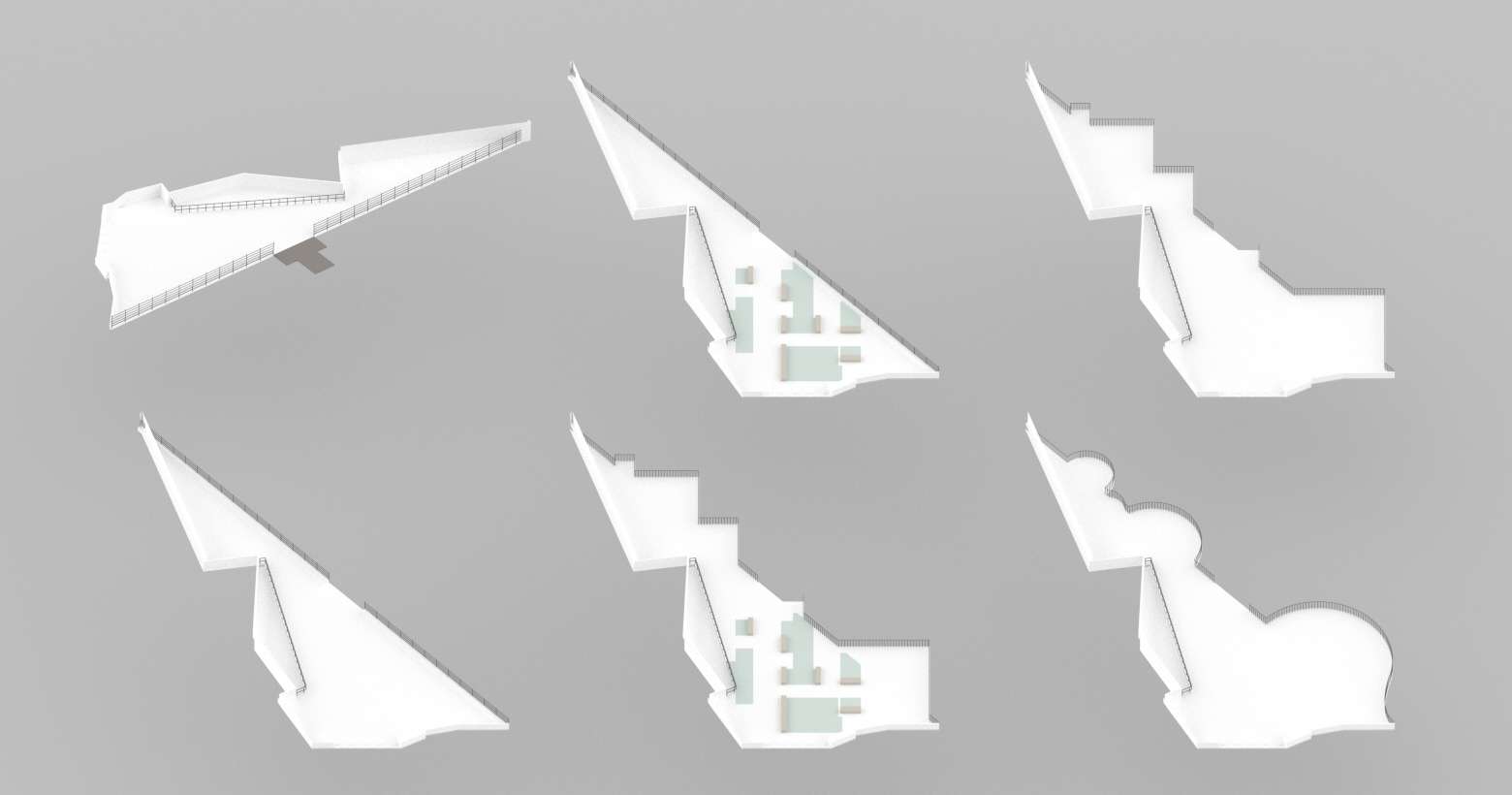
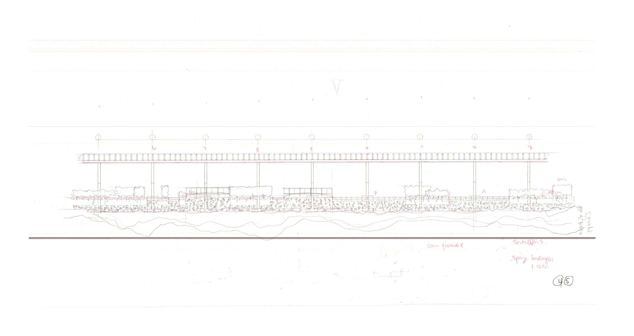
PRELIMINARY RAMP STUDIES
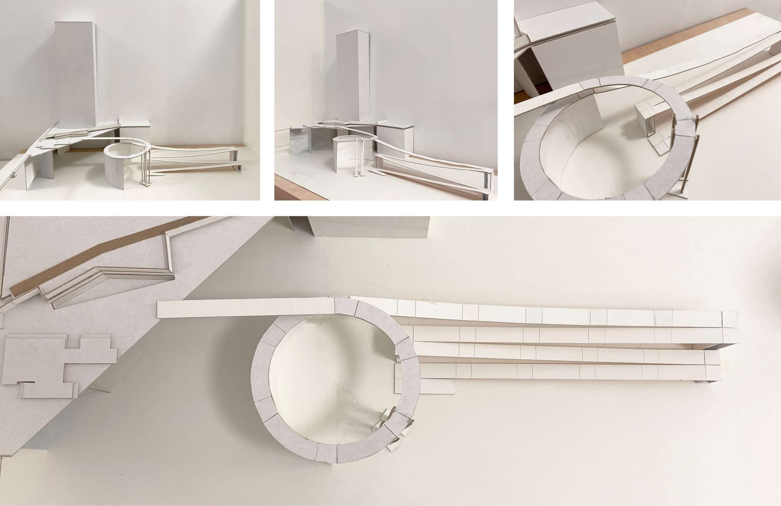
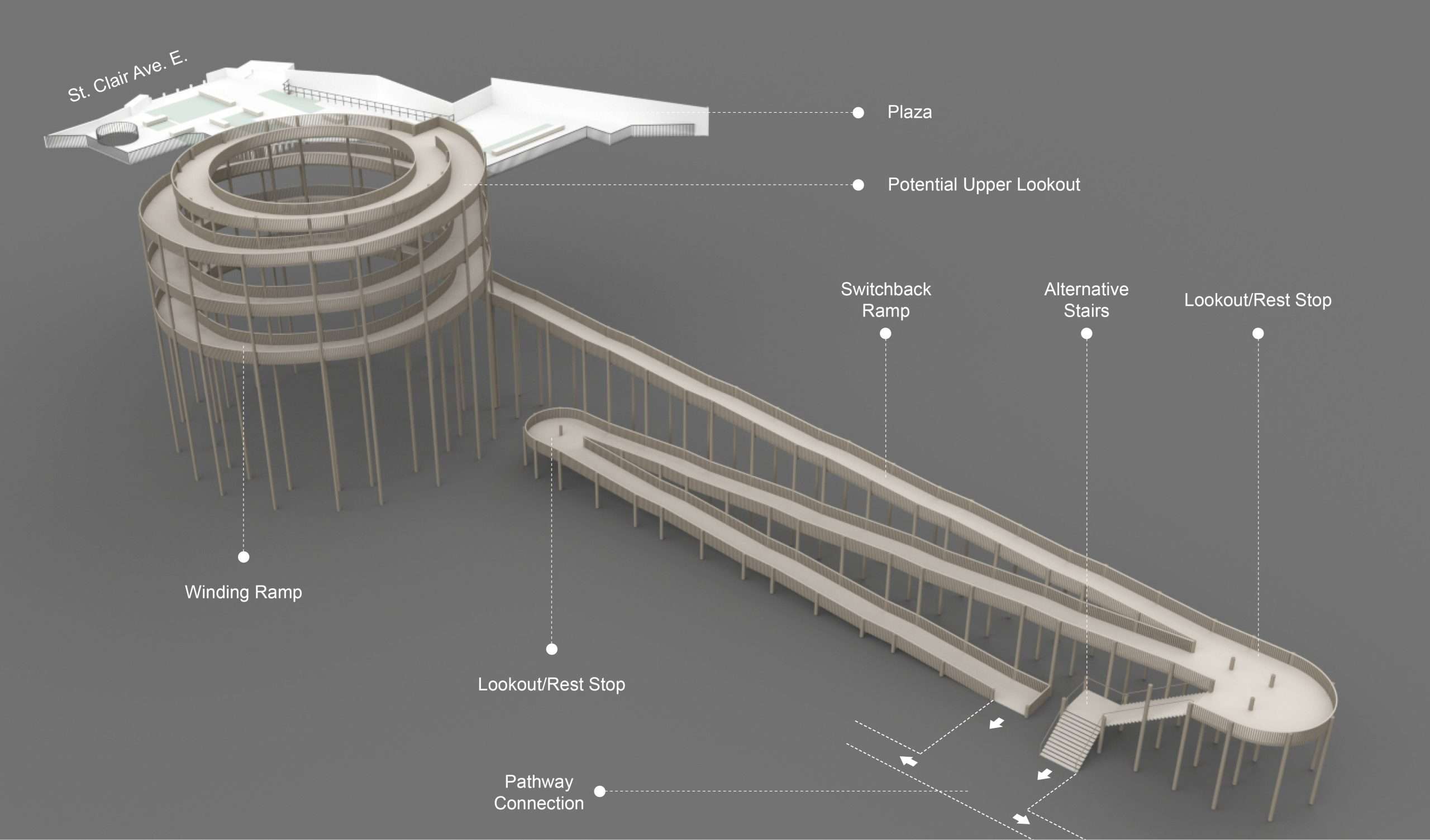
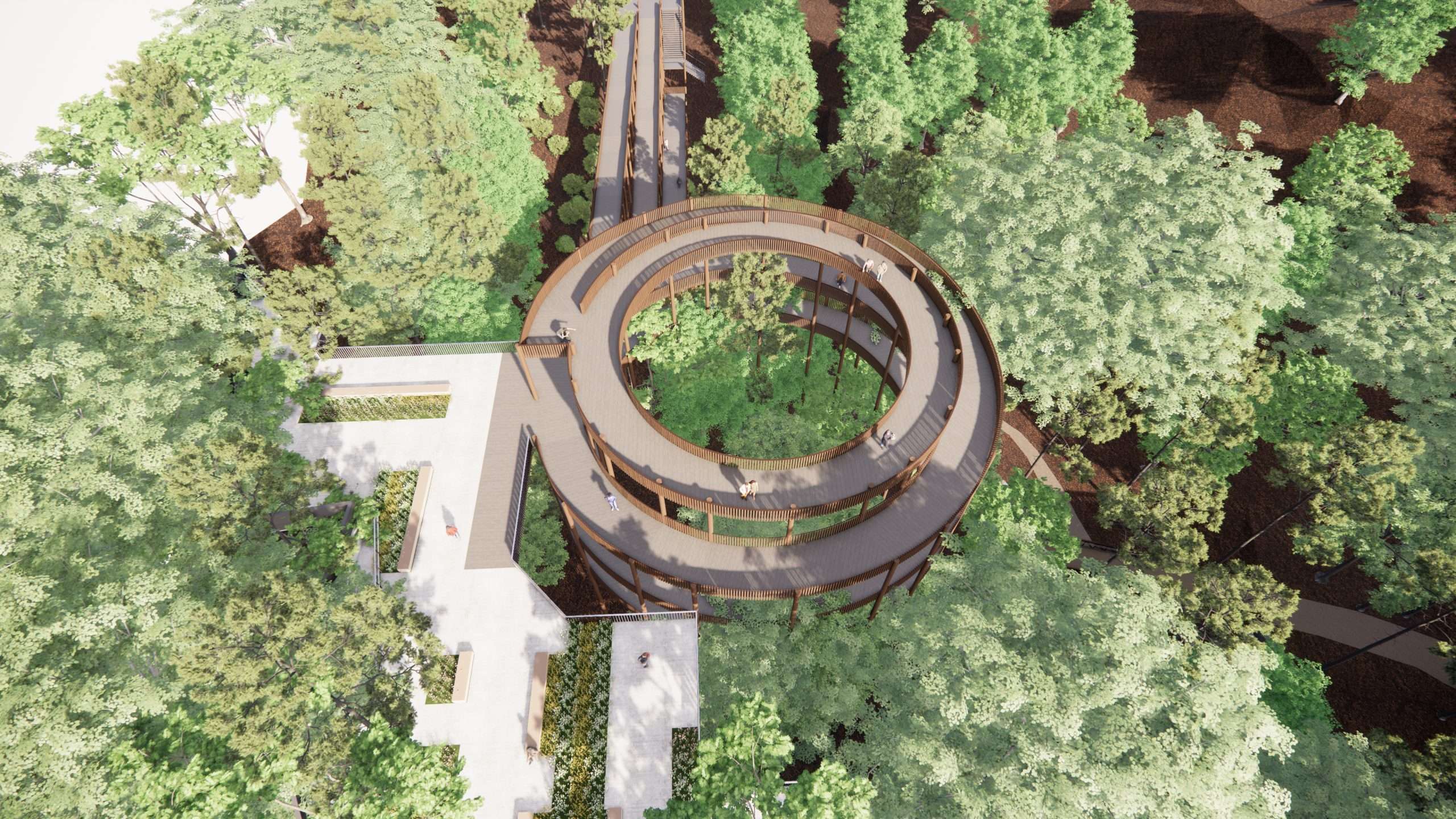
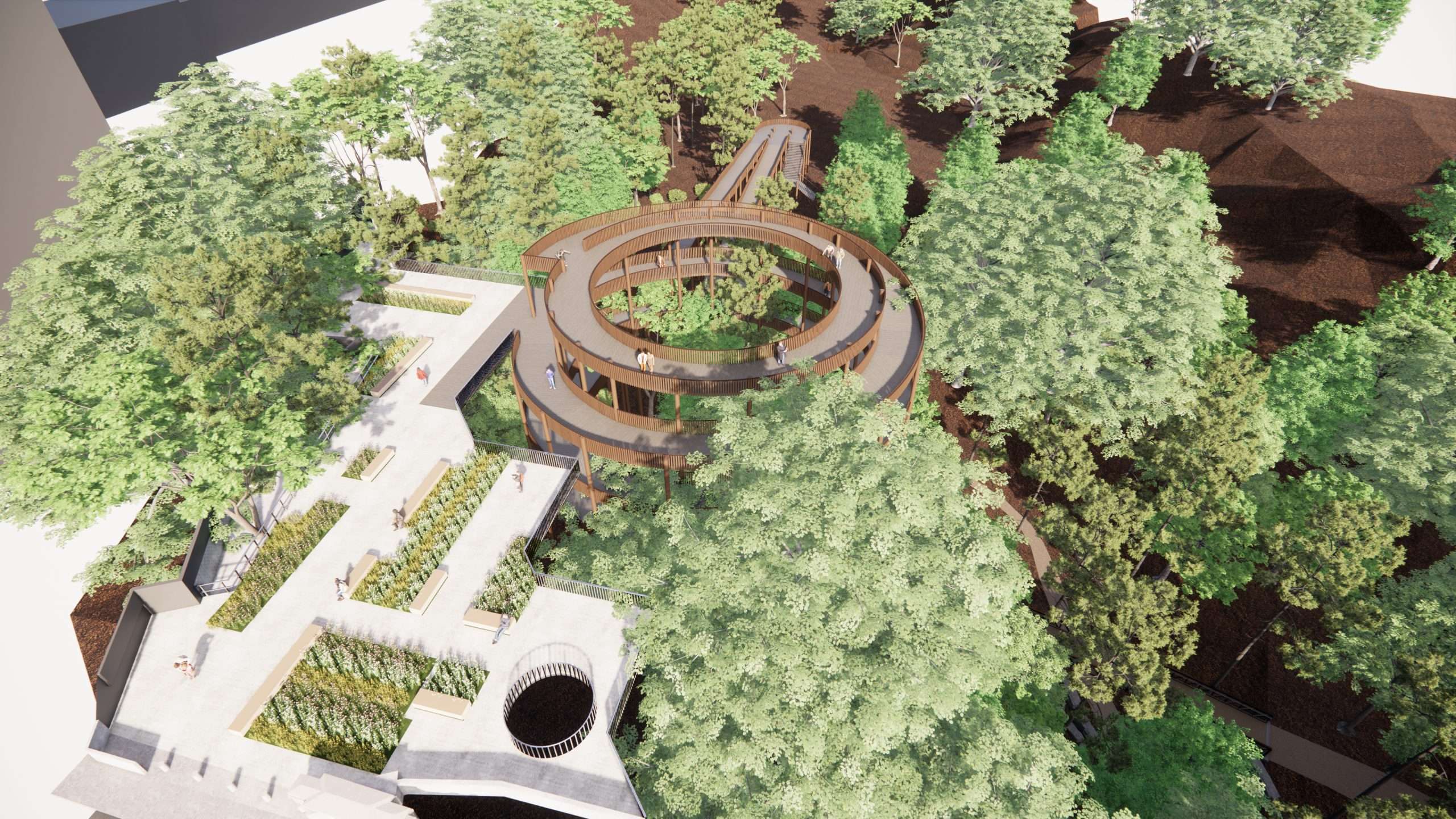
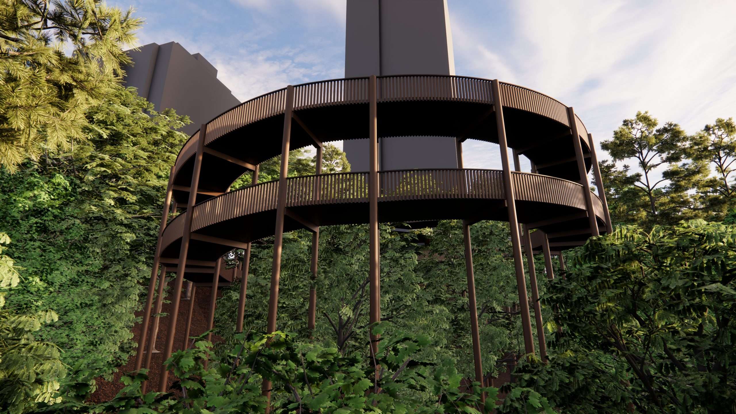
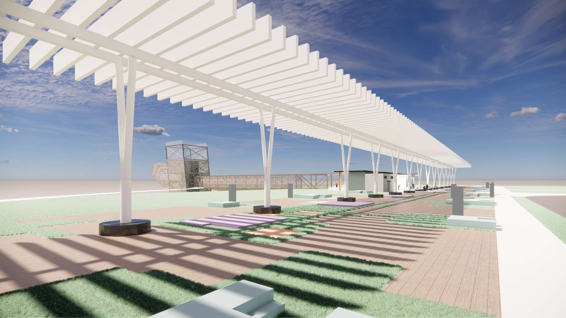
The accessible ramp is connected to a floating plaza-like space edged with seating and viewing points, this public plaza as a space is designed with the larger St. Clair bridge improvements, and initiates the bridge and it’s North Western starting point. The plaza interacts with the tree landscape below as a strata like cartography, and maps a sectional relationship with the lower ravine and it’s upper city location.
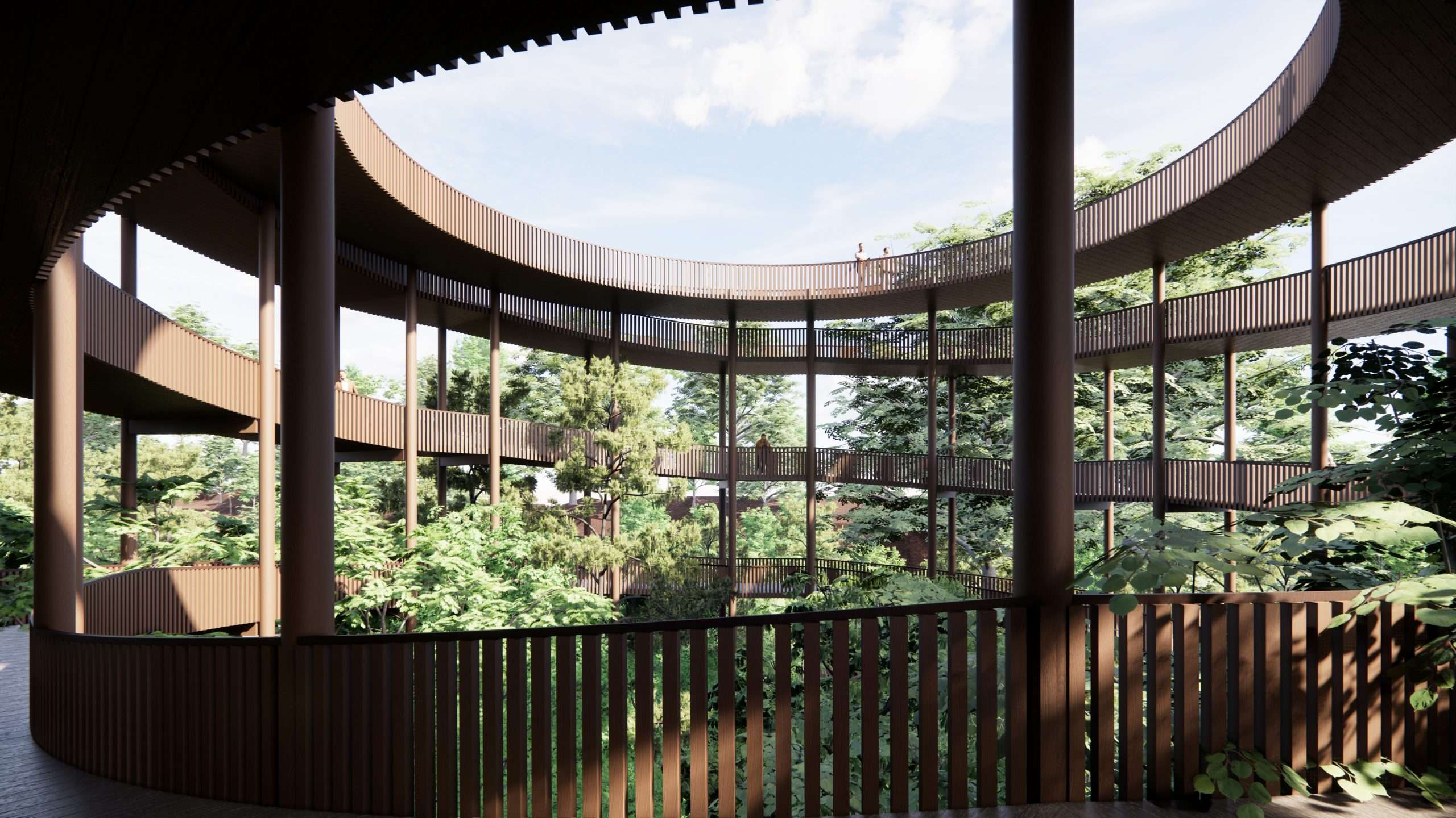
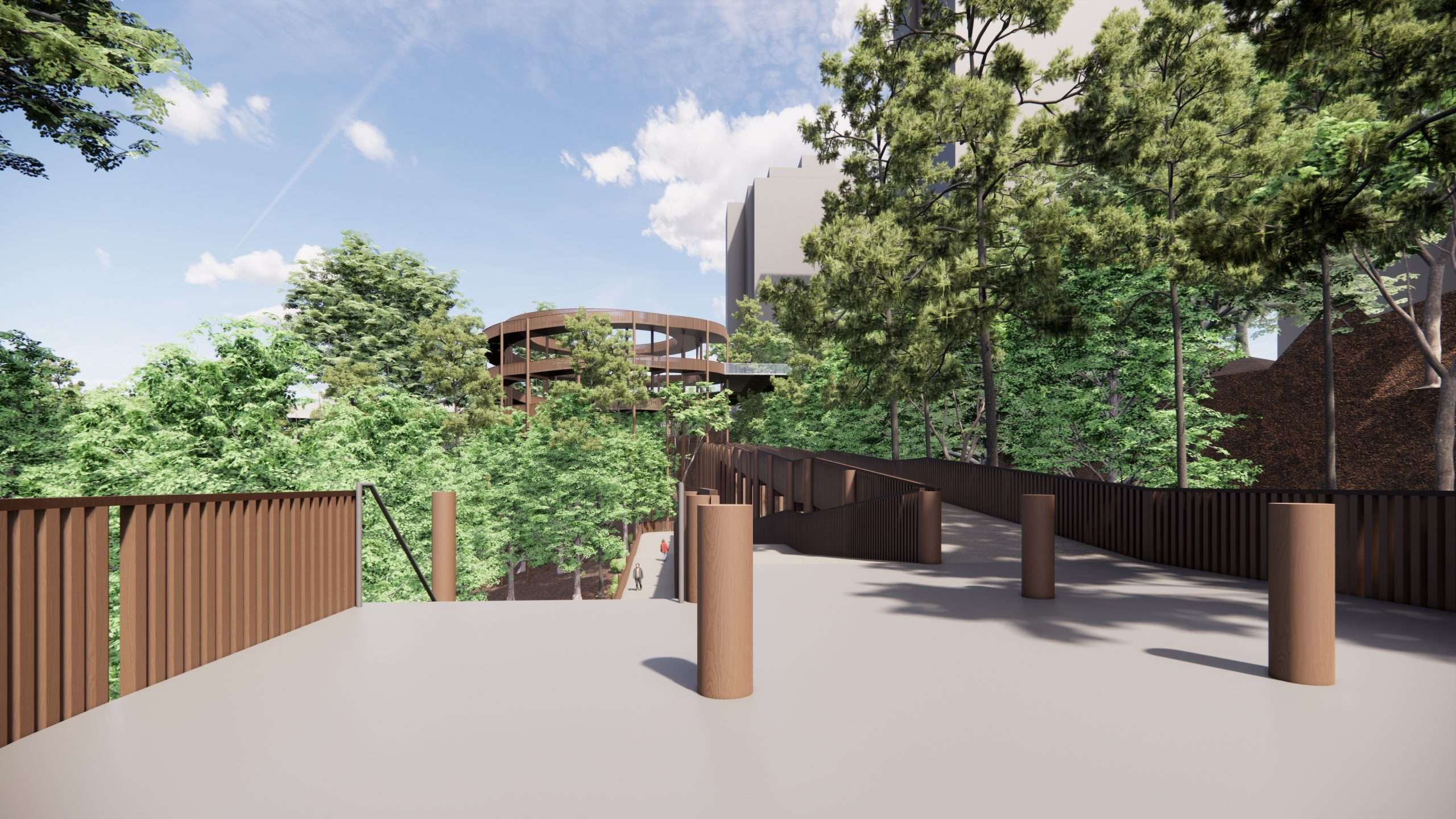
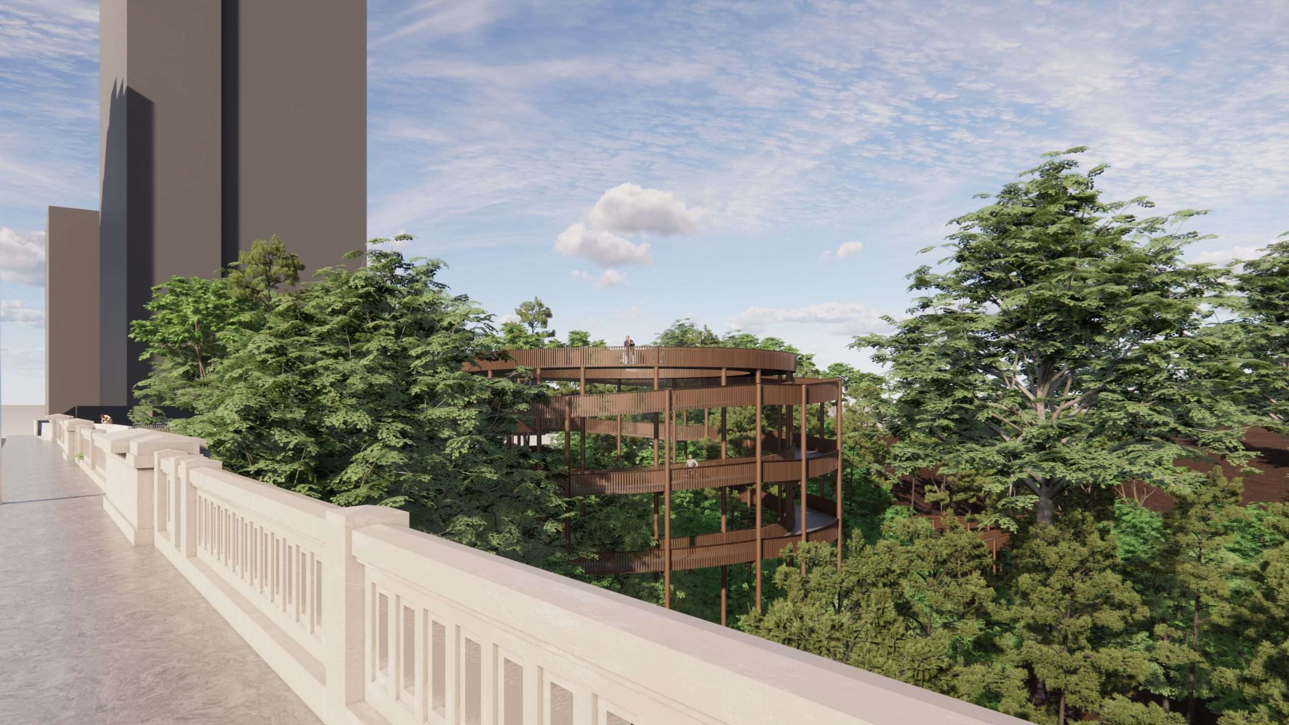
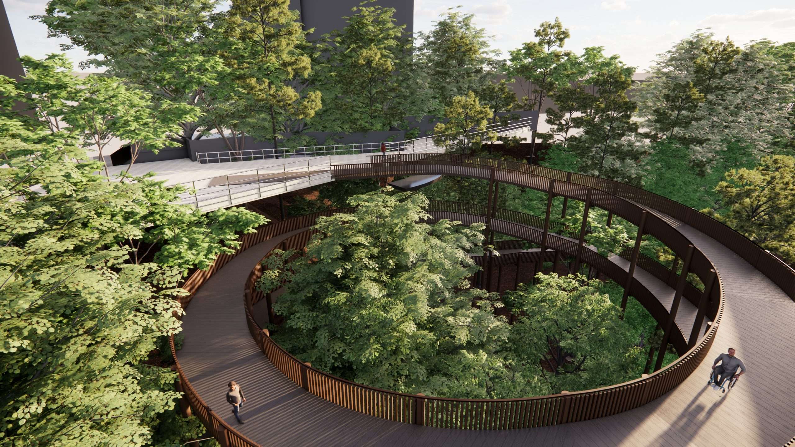
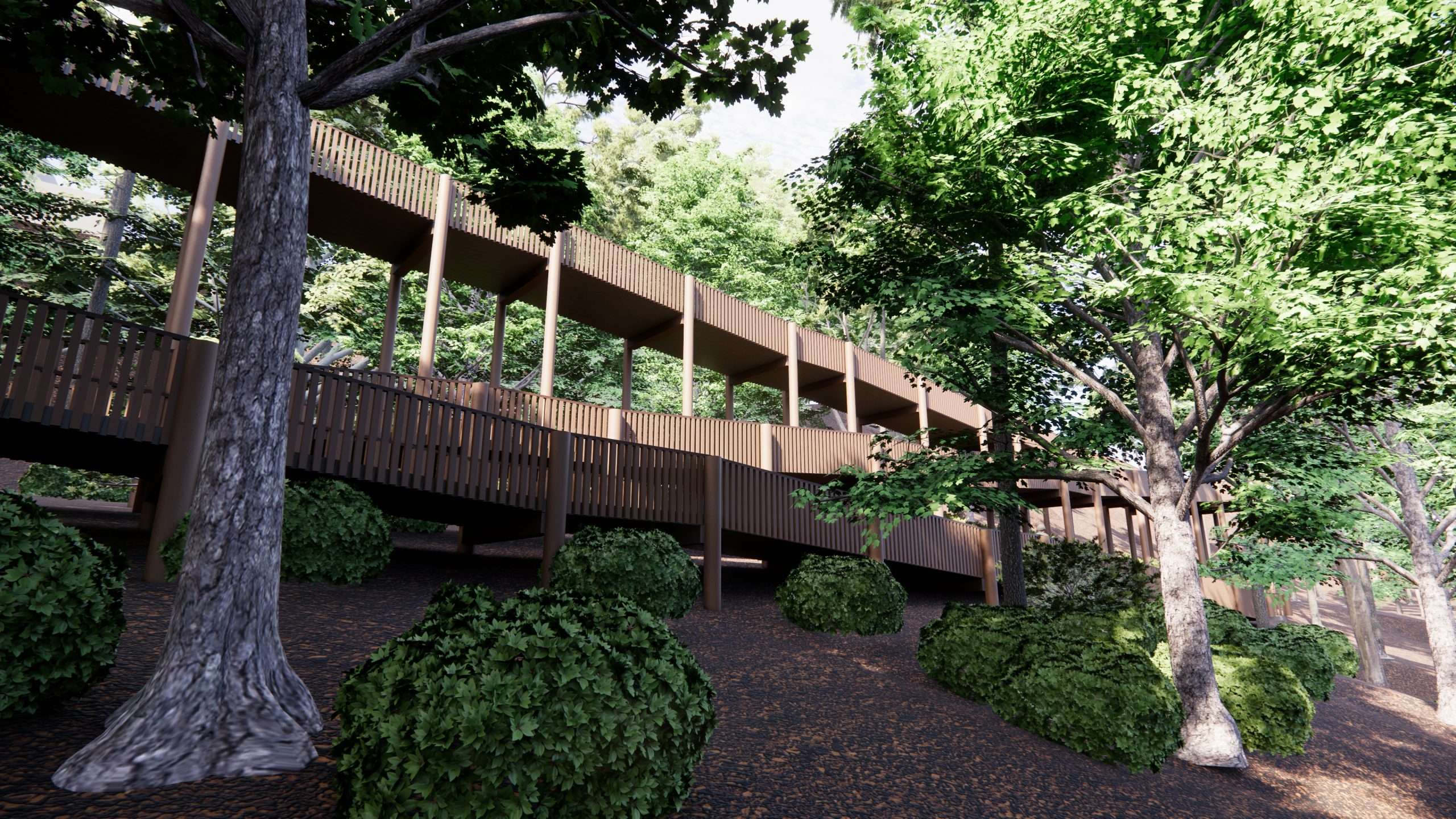
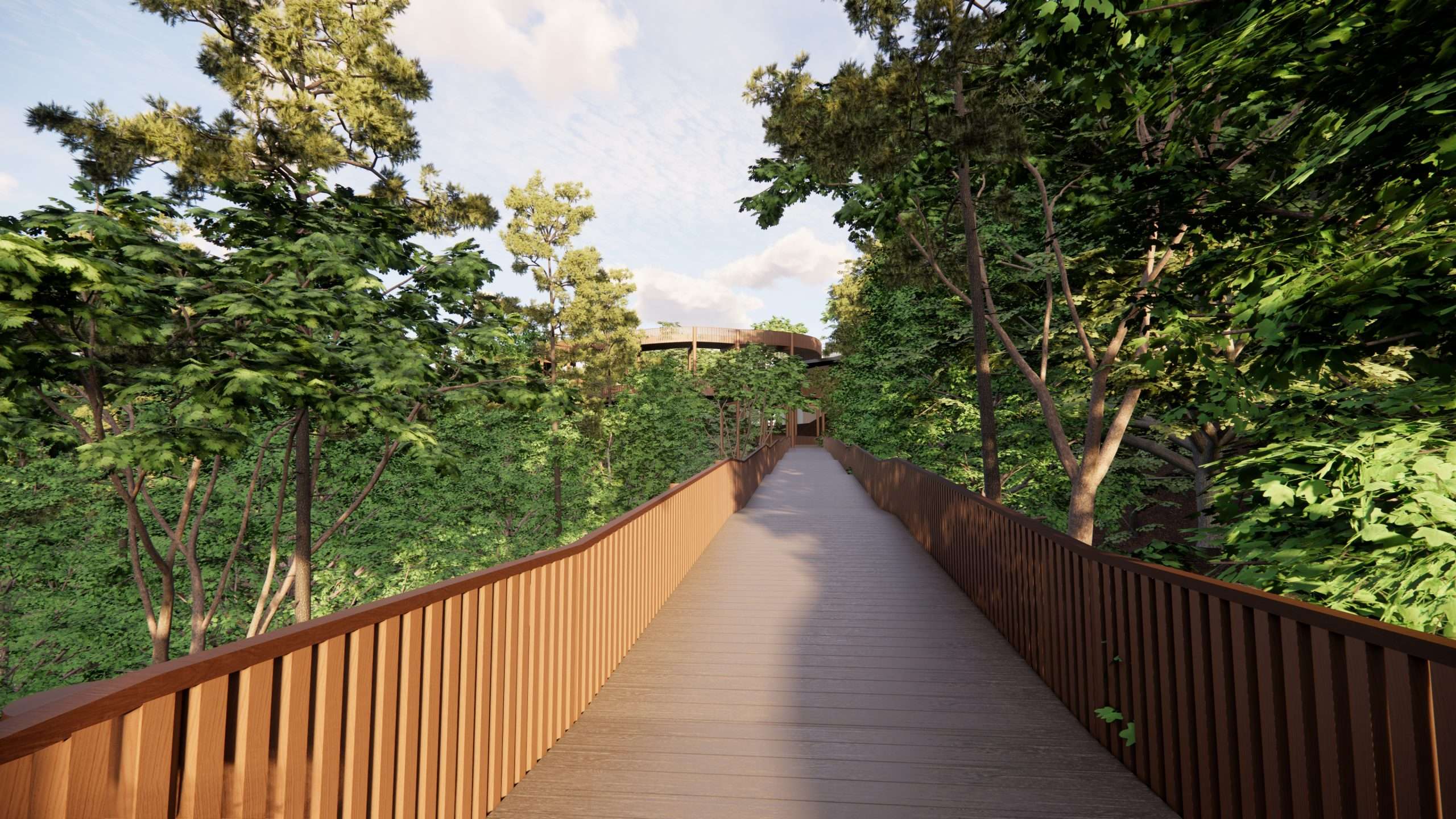
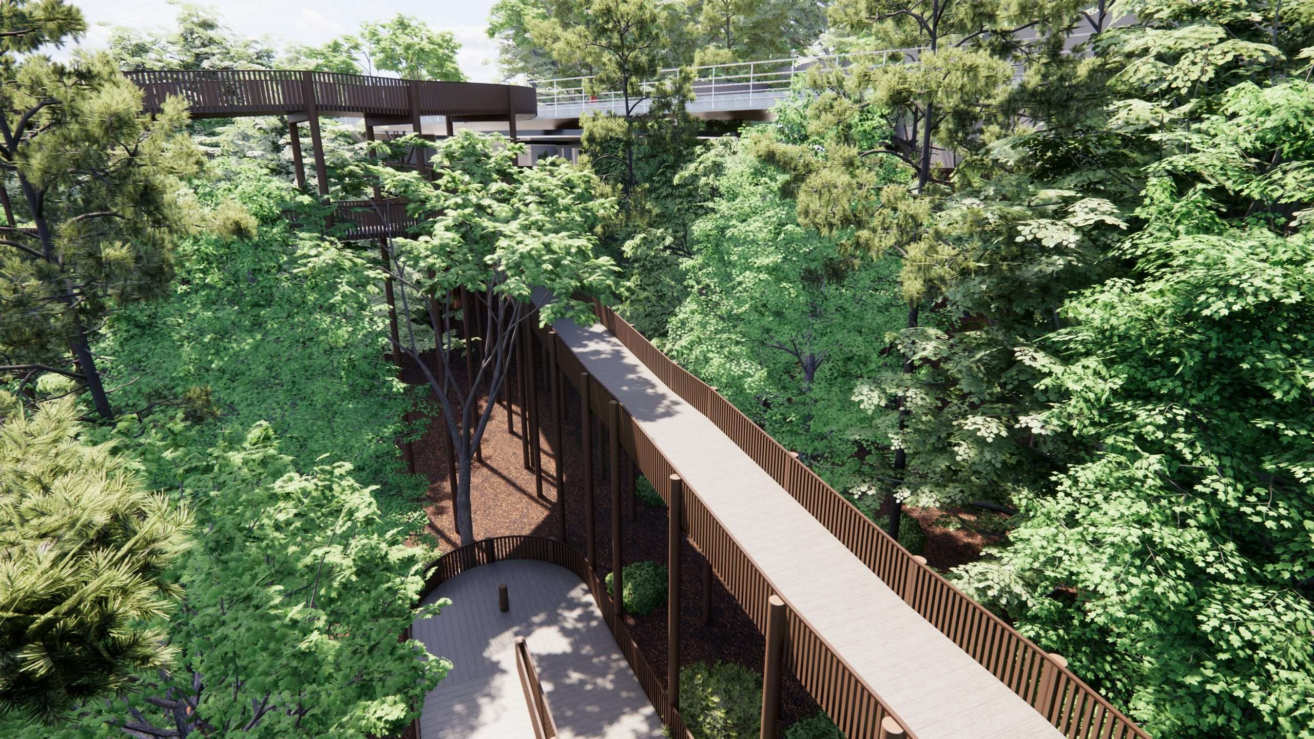
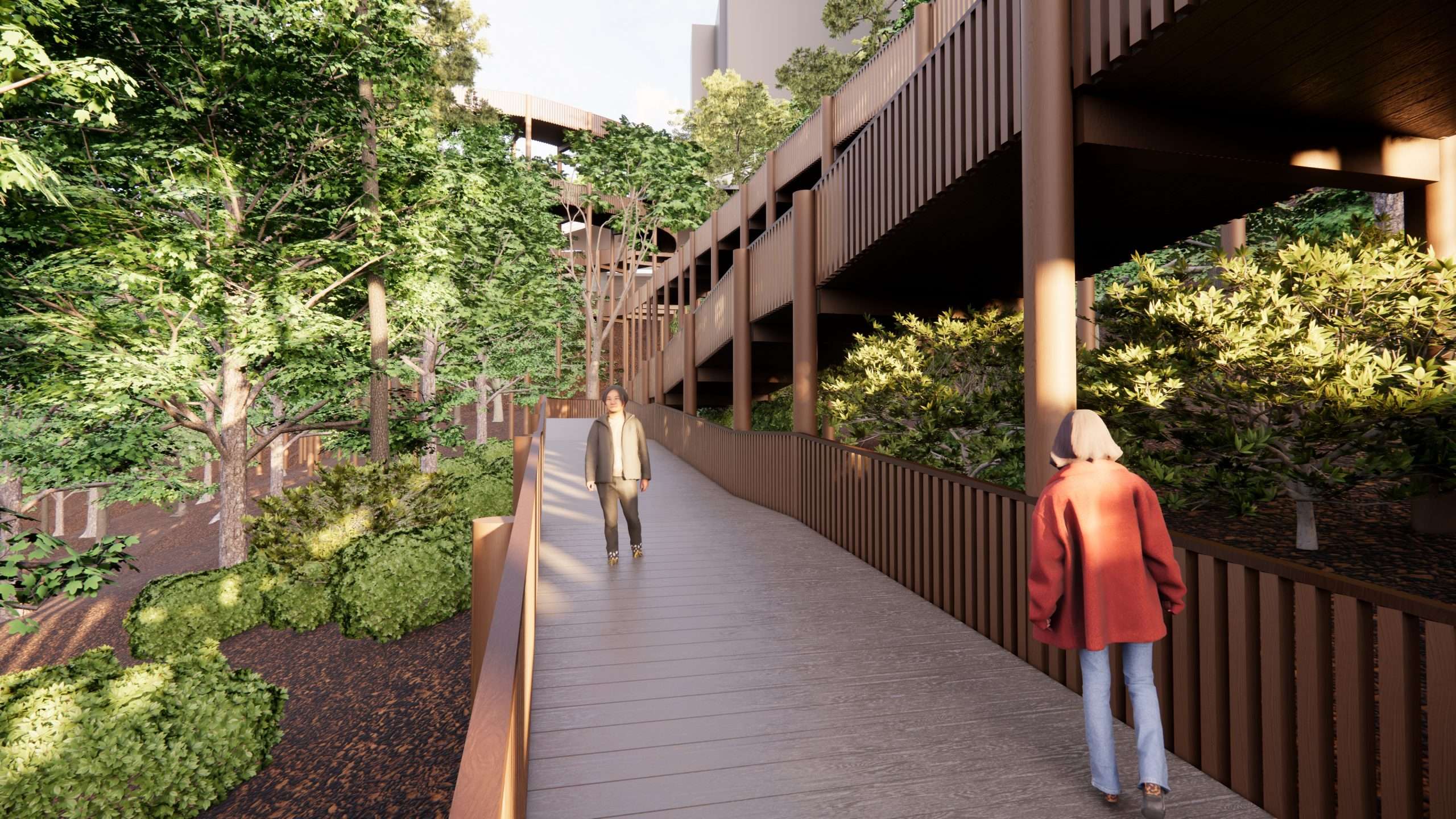
The accessible ramp has the ability to access the floor of the ravine, as well as the option to remain elevated and connect to other locations within the ravine. The accessible ramp is a wooden structure with vertical supports that blend with the existing forest of trees putting the users in a unique elevated position within the forest canopy.
POTENTIAL PATHWAY IMPROVEMENTS
A NEW BEGINNING AND STARTING POINT
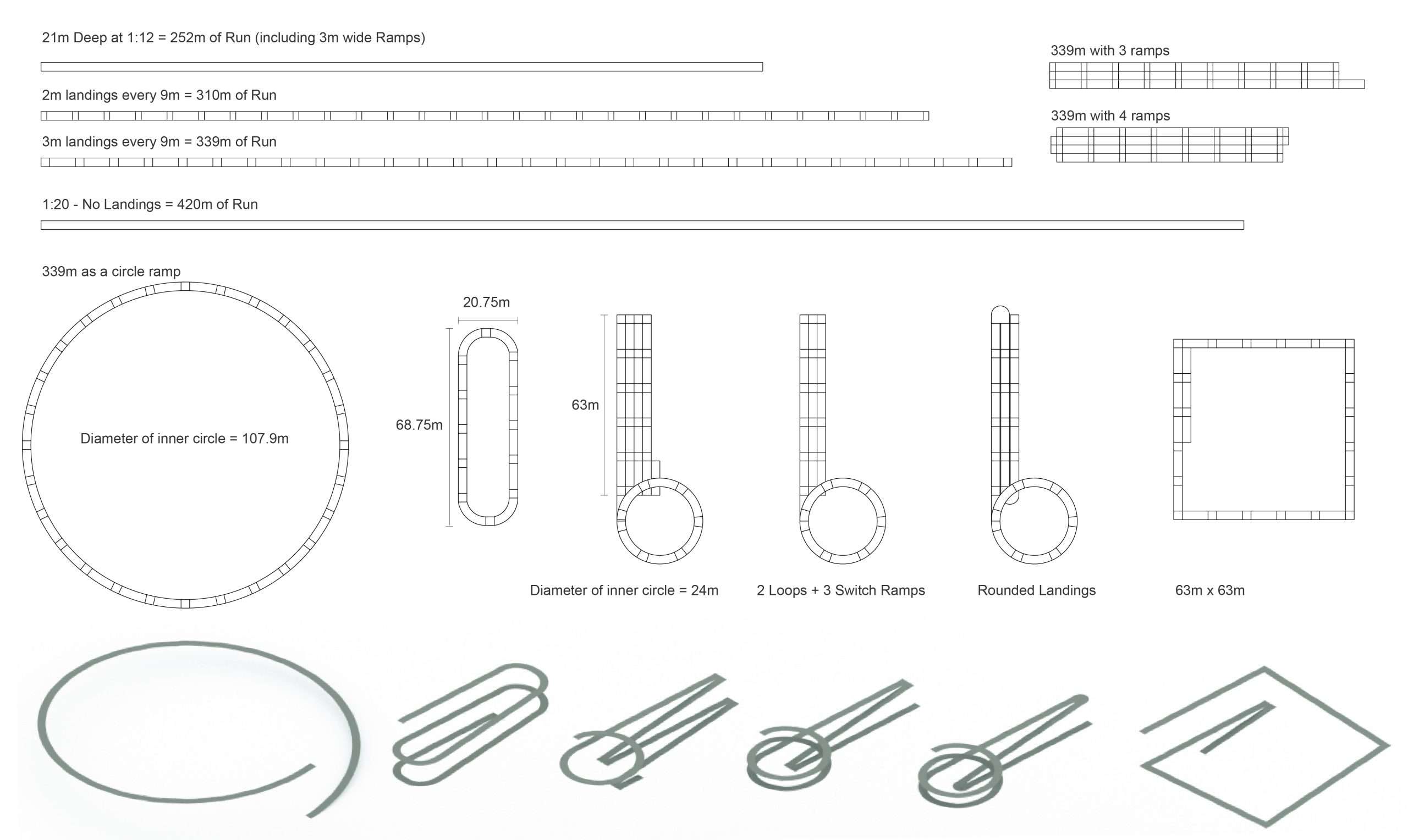
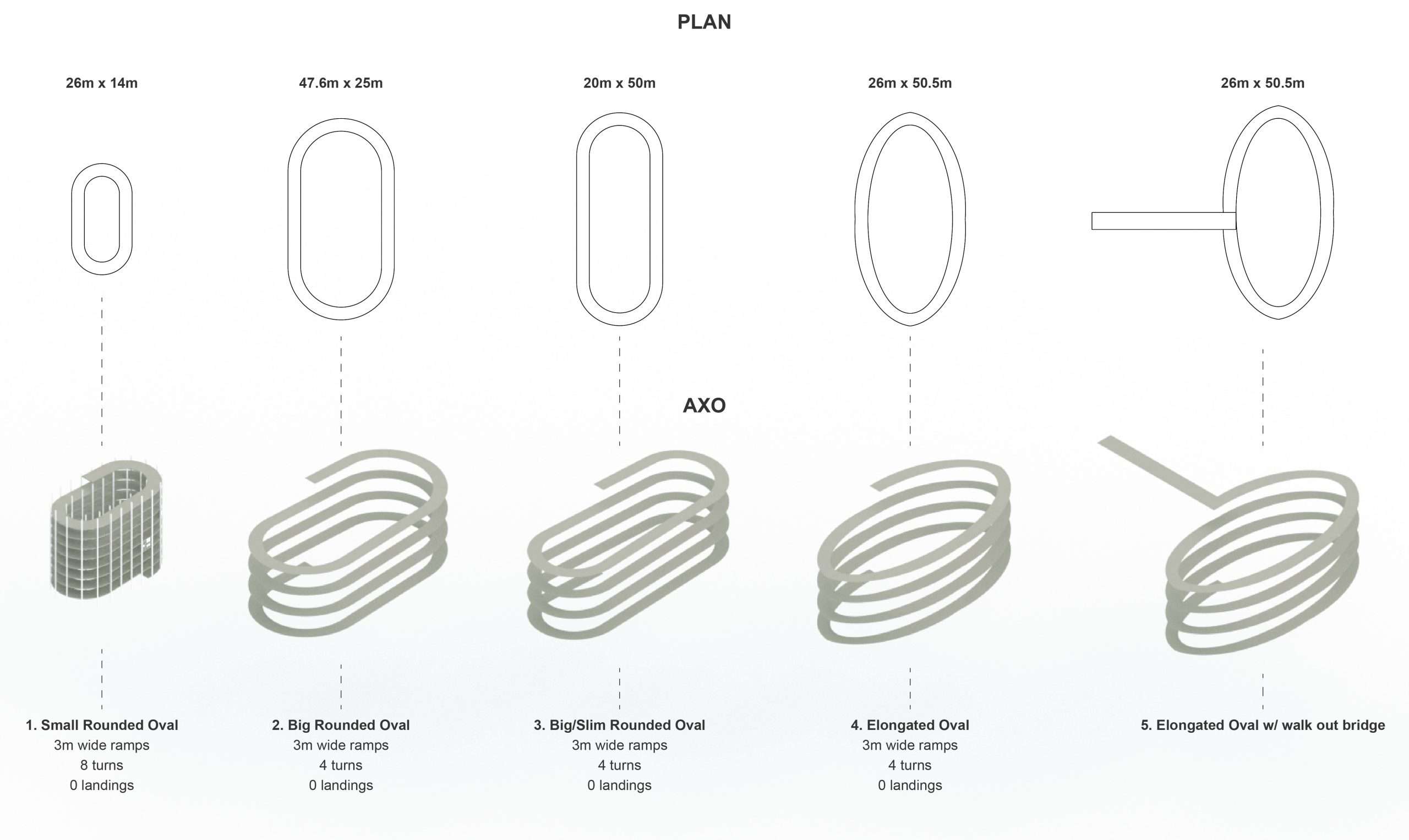
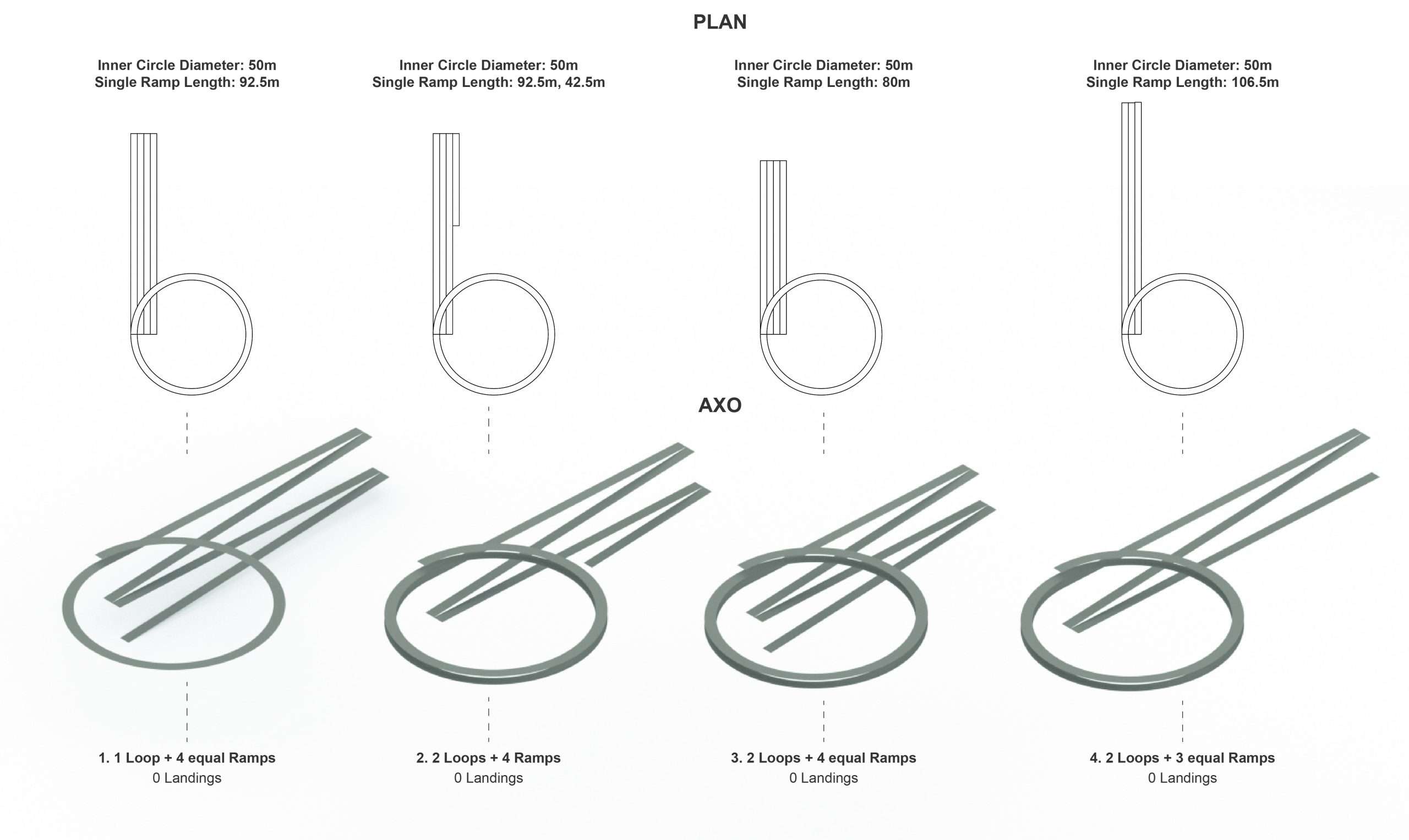
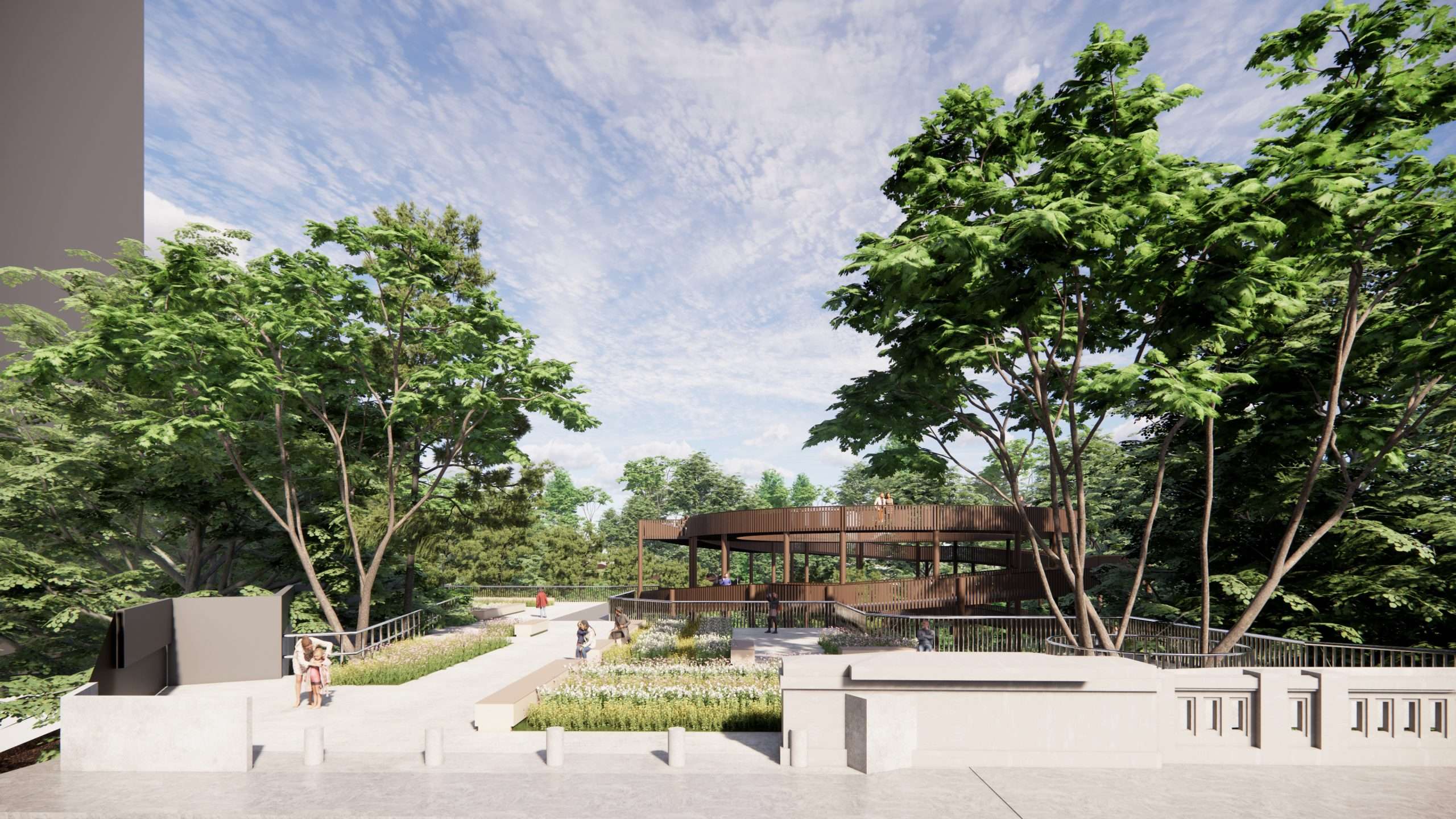
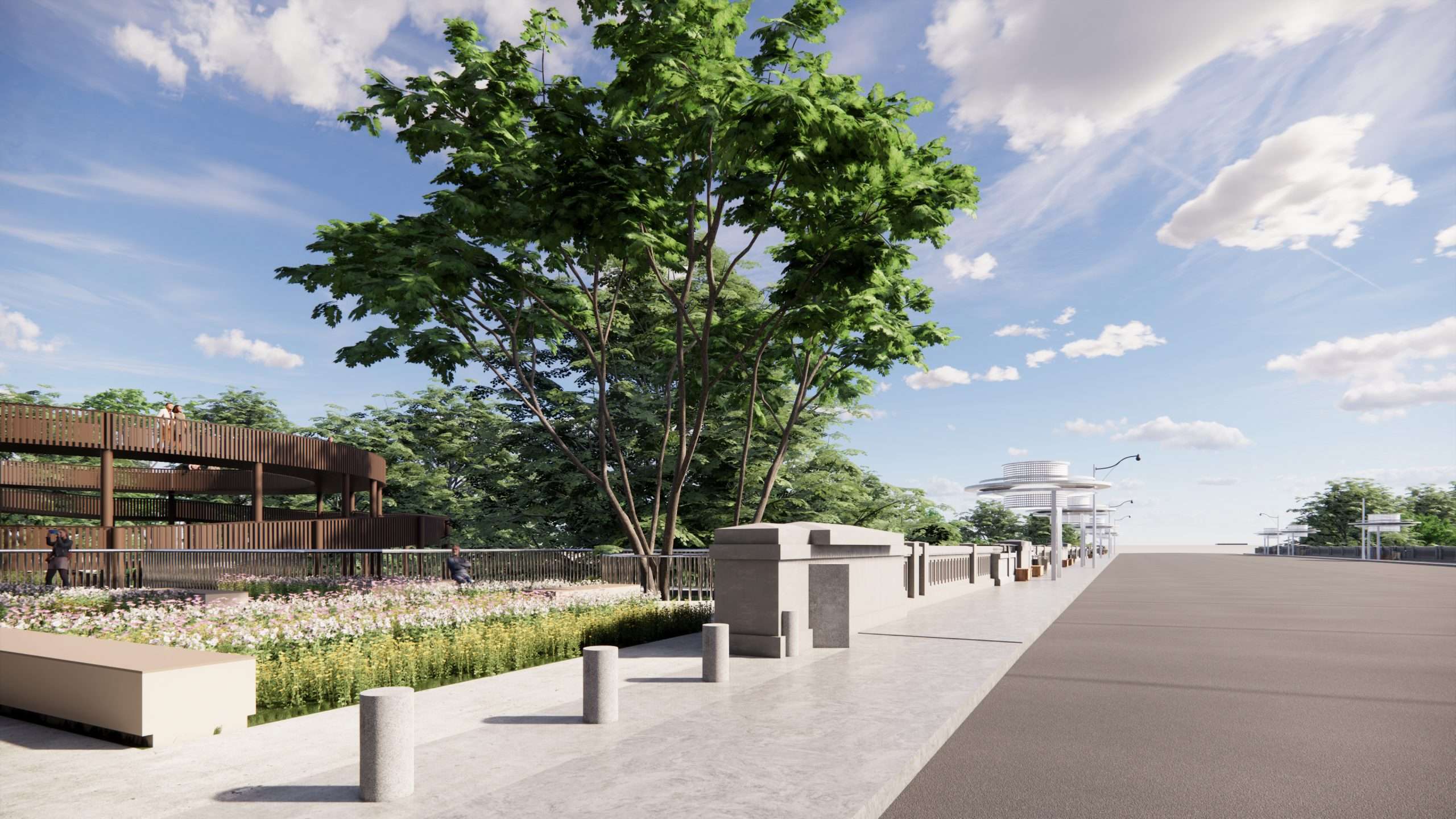
Across the multitude of elements, environments, and experiences that the Vale of Avoca makes available there is a need to maximize these elements that can heighten the experience of the Park Ravine; for instance the ‘accessible ramp’ being proposed as a speculative new element, breaks and replaces the existing run down stair case and creates a new value element, an apparatus that facilitates access into the ravine. This accessible aspect opens up more intense possibilities and creates a more refreshing access that makes it easier to move in and out of the ravine. Furthermore, the circular ramp that spirals around itself and is separated from the gradient creates and places the users in an elevated relation to the ravine and the trees, being amongst the trees the accessible ramp can stay elevated and create a unique linkage that is ramped up above the graded pathway, that can also occur under the elevated pathway.
The starting point for the accessible ramp at St. Clair is initiated by a small plaza space that acknowledges it’s urban and natural setting simultaneously. This intensified experience of entering into or alternatively exiting the ravine is given value and status in a well-designed tectonic structure, of timber and steel construction supported on vertical columns with attachments that create the elevated walkway and railings, offering panoramic views both inside and outside of the ravine/city relationship. Equally the views and perspectives towards and from the raised accessible ramp become part of the environment it forms a part of. It follows that the other elements of the larger ravine, such as staircases, pathways, public spaces, gardens and creek edges can also be designed to heighten experiences and feelings with a community of different users.
The current state of bad repair and lack of maintenance as well as sites of erosion and water flood damage need to be contrasted with new and well designed and articulated infrastructures that provide identity, orientation and safety to all visitors. This need for a more improved and speculative design approach will act as a ‘lure’ to new users looking for experiences and future possibilities for further improvements and encourages change.
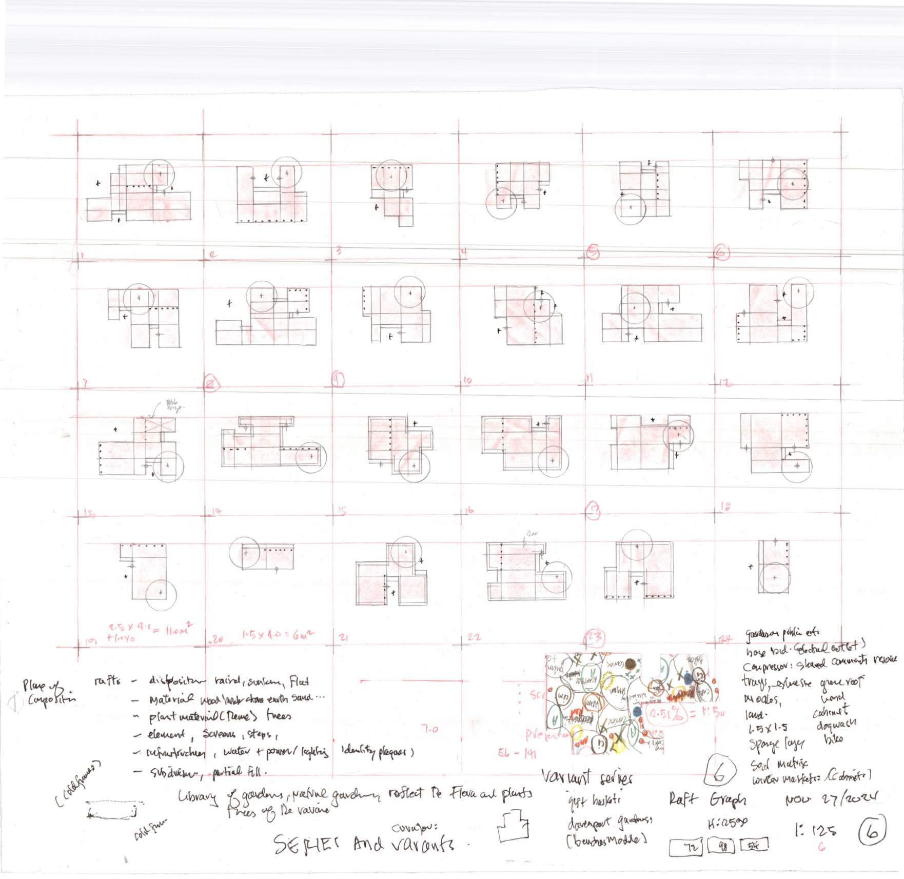
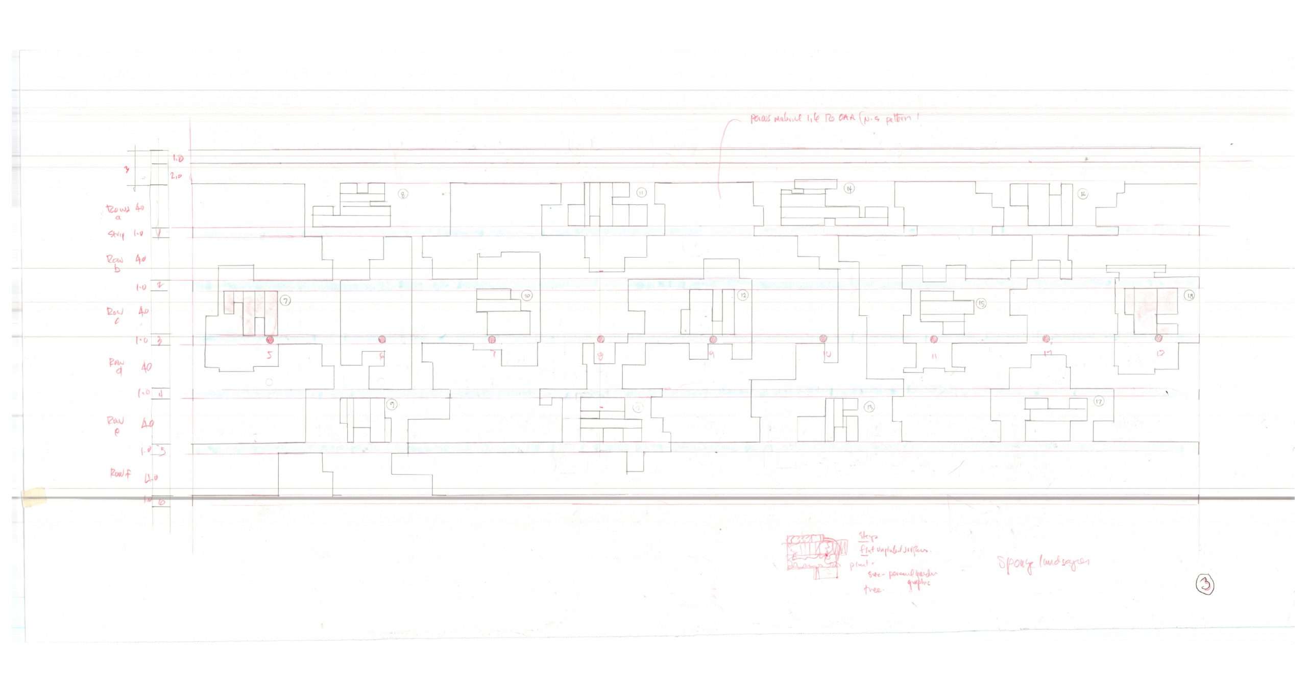
As a methodology with regard to the new design of the accessible ramp, we have studied a range of different variations for the ramp configuration, opening up the possibility for ‘hybrid alternatives’ that could fit into the existing site situation, in particular the ‘ramp’ was studied outside of its environment, and also as part of it being inserted back inside its environment, this contrasting condition allowed for a more analytic analysis and study of differentiation of effects.
The wooden structure supports for the accessible ramp become part of the landscape blending into the adjacent woodland and forest of trees in an ecological and friendly manner.
The extension of the ramp as a raised public space can extend into the park ravine creating an elevated walk and viewing architectonic experience. This raised space can have a range of different elements and events marking its place and location that could tie into existing staircases rising up and down from the upper park. Raise staircases can also connect down to grade from the upper walkway and public space.
ST. CLAIR BRIDGE AND THE TWO ENDS – THE PARK LOOKOUT AND ACCESSIBLE RAMP
As much as the St. Clair bridge has an amazing space below it, connecting with the ravine park, it also has an upper bridge space that while it is a busy passage of pedestrians and cars crossing over it; suffers in a number of ways that could be improved and intensified, as a multi model infrastructure. It’s a space of crossing as well as having marked end points that initiate the bridge and tie it into the surrounding neighbourhoods and urban conditions. To the south-east there is a triangular green space that presently remains an unmarked location; it could very well become an accessible park and even include a lookout cantilevering into the ravine. In contrast, the north-west corner of the St. Clair bridge is the location for a new and exciting public access ramp and forecourt plaza. Both locations are at street intersections and are needed public spaces and proposed lures that are perched above the ravine looking for an opportunity and new propositions for new public amenities. The south-west location has adjacent apartment buildings, commercial shopping and adjacent access to bus transportation a short walk to Yonge Street, a pair of illuminated marquee structures link these two spaces to the bridge and St. Clair providing potential new bus stop waiting areas.
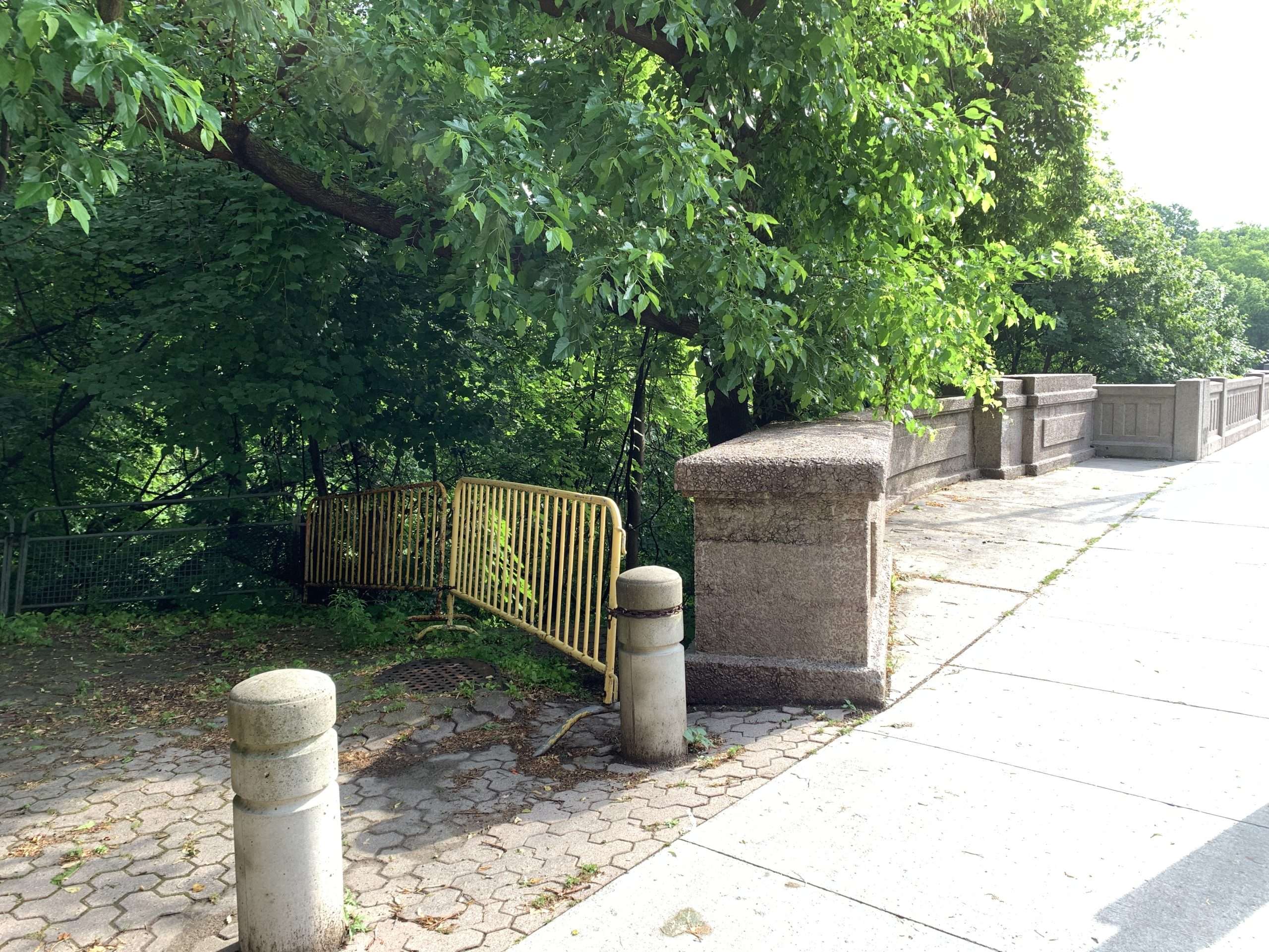
The general surface of the bridge as well as the high concrete lookouts and lighting street poles need cleaning and painting. The existing balustrades have filled in the occupied gaps or openings in the balustrade that would have created views or light openings into the ravine. We are proposing that the current lookouts be replaced with circular designs with seating, glass and the opportunity to look into the park ravine. These new additions would further animate the surface of the bridge and accent a new publicness and intensity of experience for both pedestrian cyclists and motorist. As well a historical moment can also capture the history of the bridge and its predecessor as a tribute moment/monument
As well the general curb alignment of the bridge could be returned to match the street section to the western end of the bridge. Currently there is a shift, an increased public sidewalk width could as well match a bike lane on both sides of the road to include cyclists. The bridge would return to it’s earlier role as a public space while accommodating the needs of car traffic in a more balanced fashion. The two new public spaces at either end of the bridge strengthen their importance and the bridges expanded new capacities and responsibilities, they would also establish an important pair of new viewpoints between the city, the bridge and the ravine park.
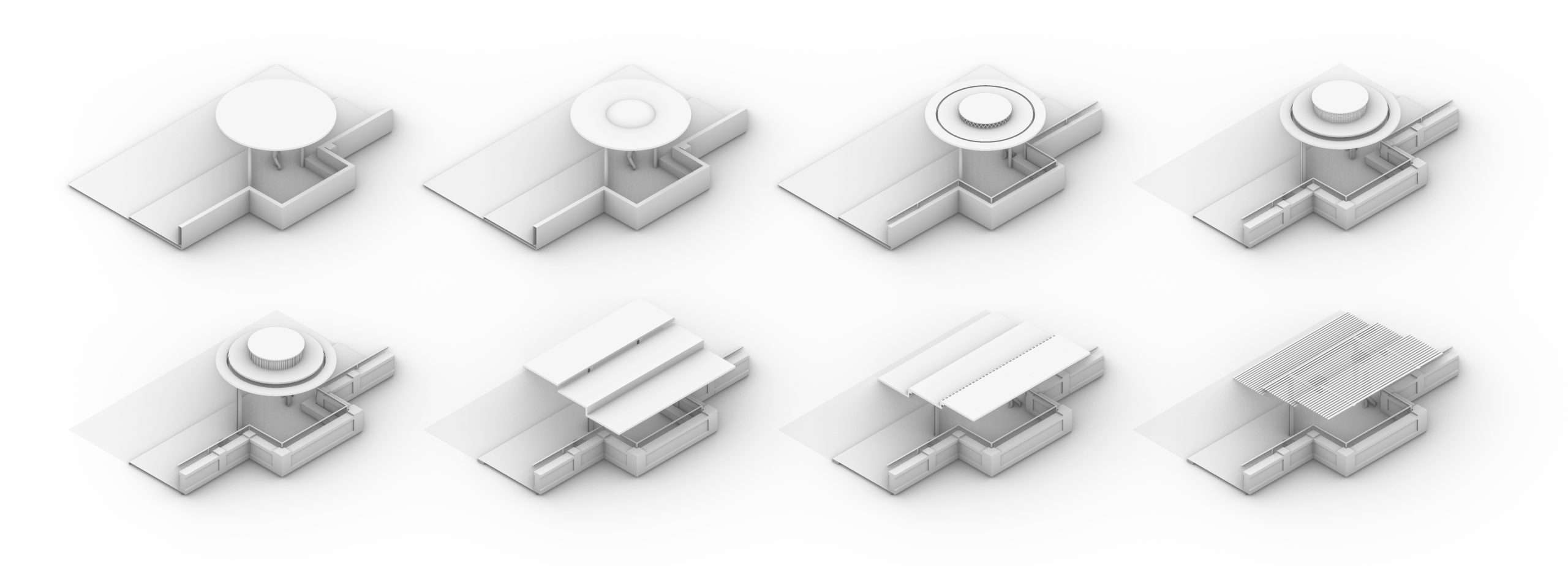
POTENTIAL EXPANSION – THE AVOCA MONSTER
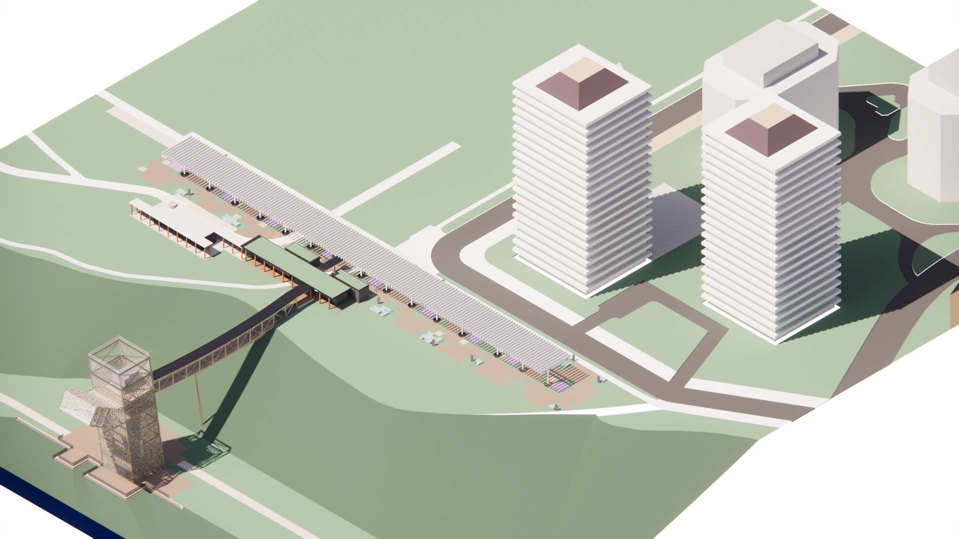
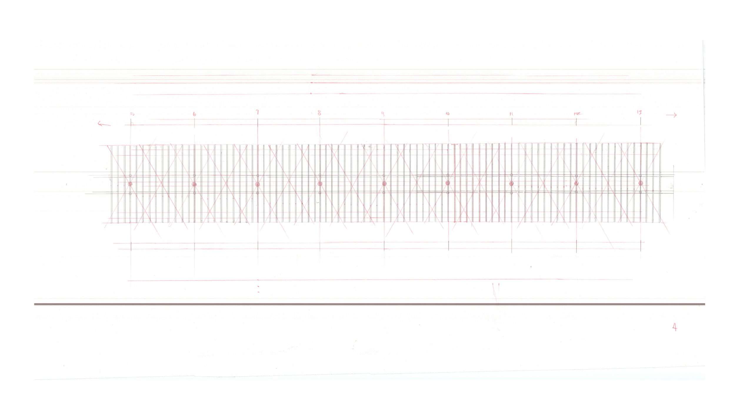
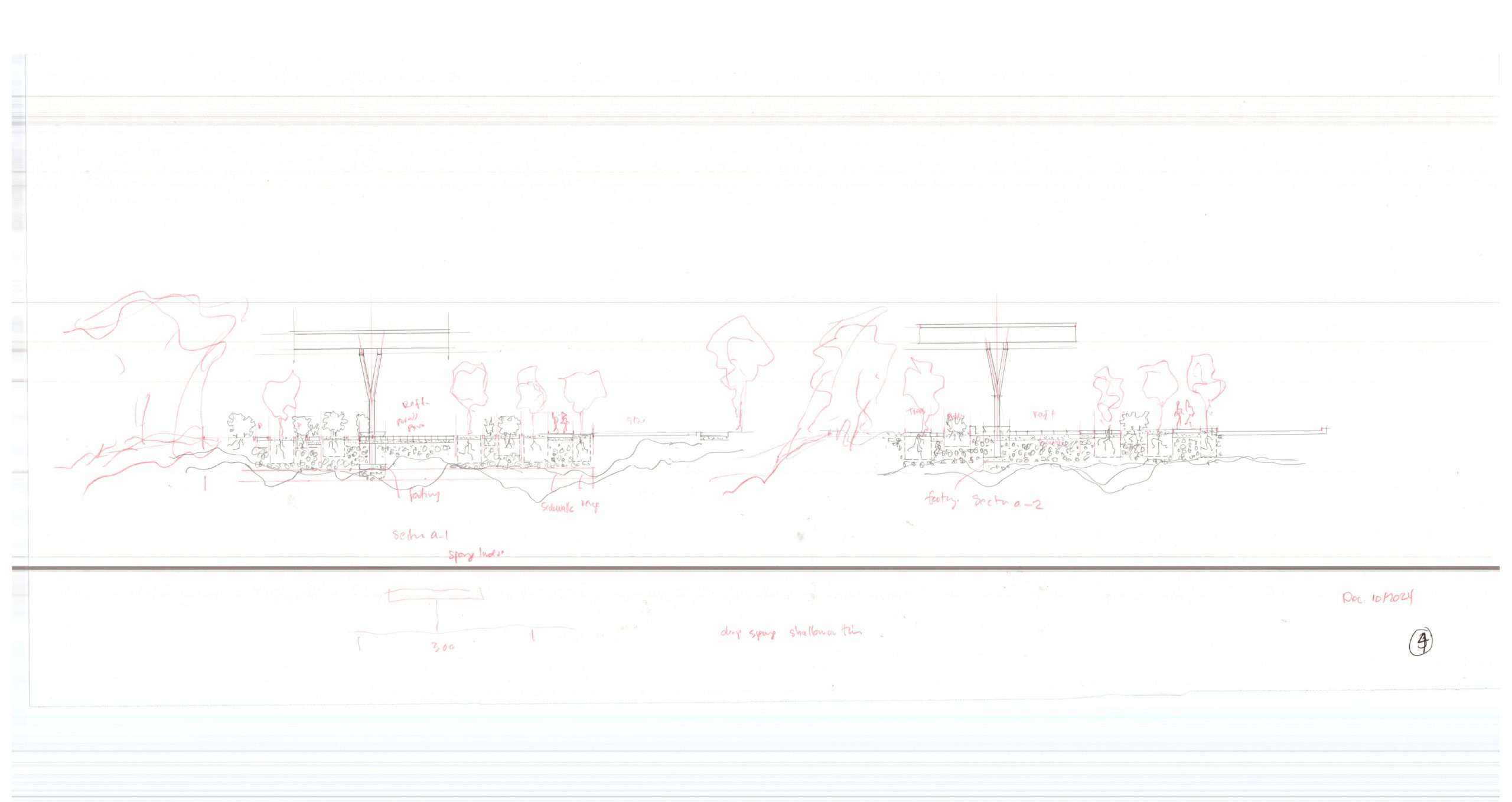
BRIDGE TOWER AND SHADE CANOPY AS A PROPAGATING STRUCTURE
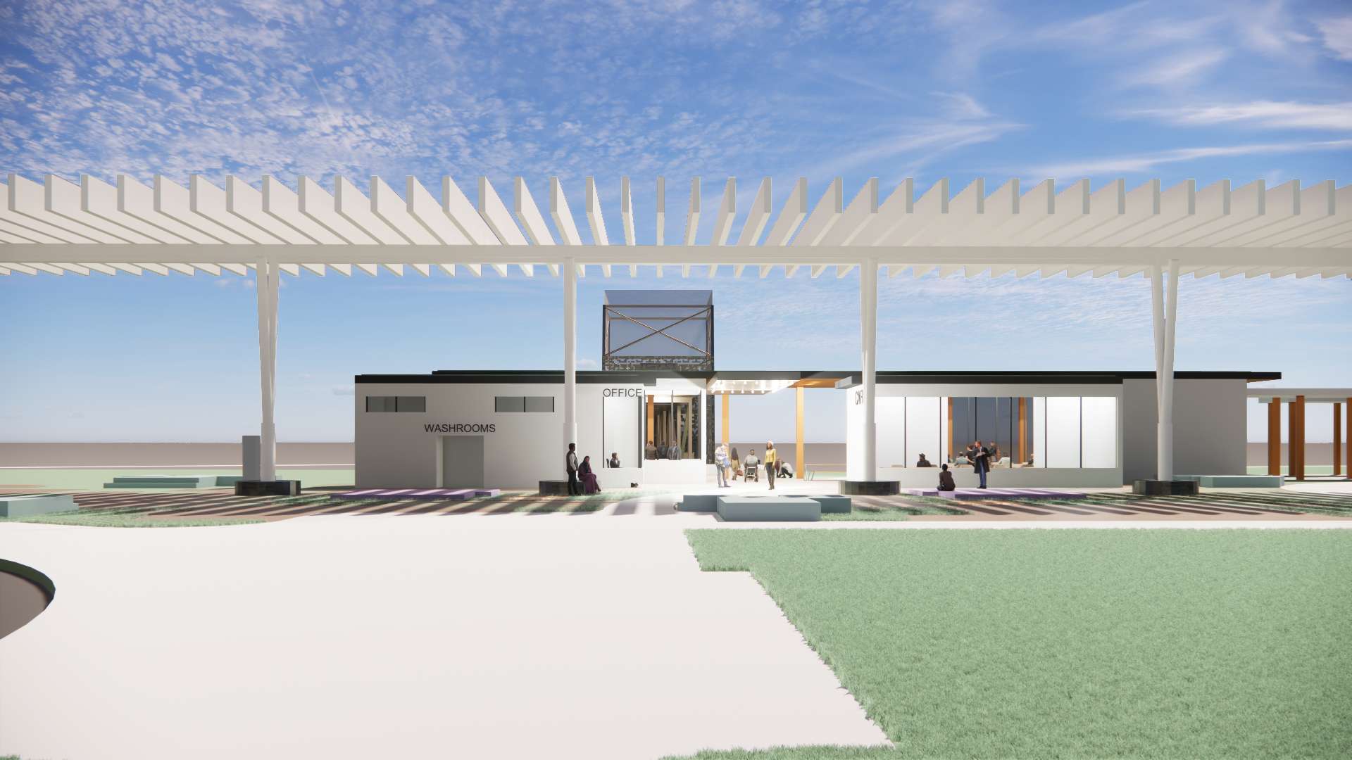
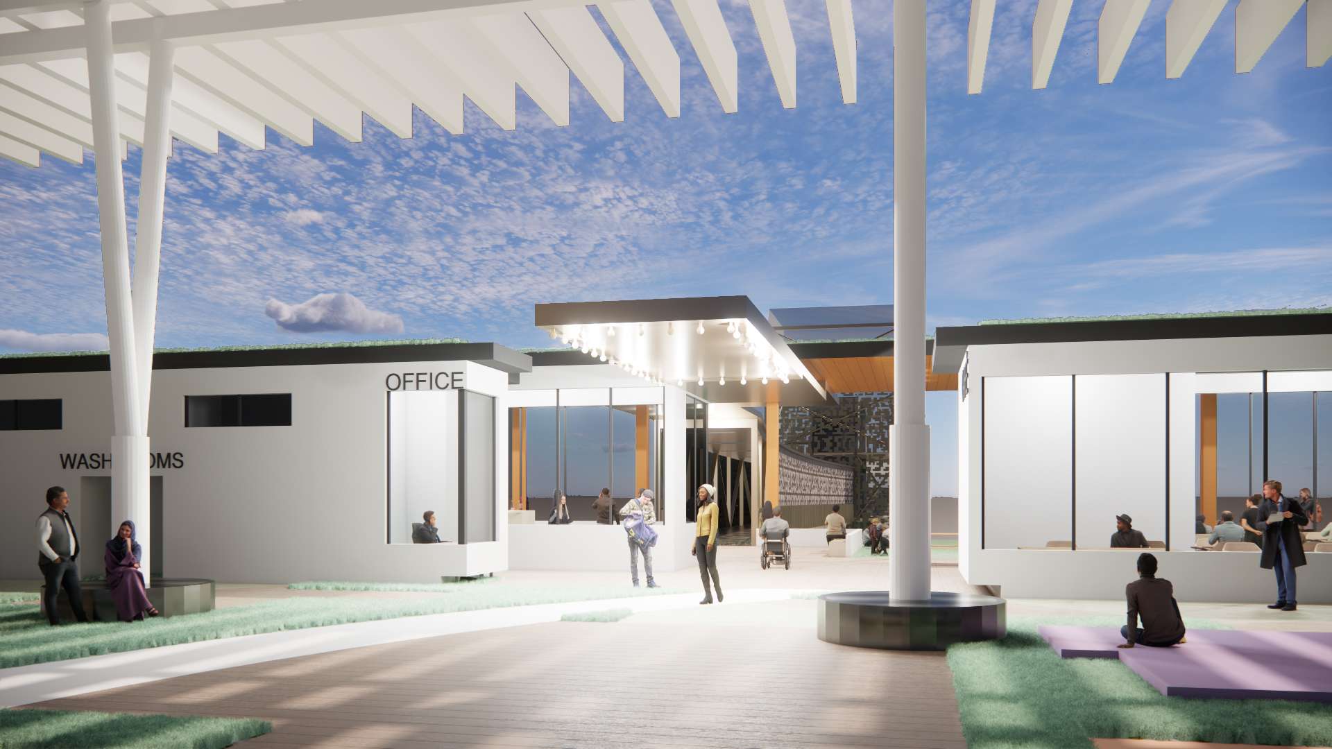
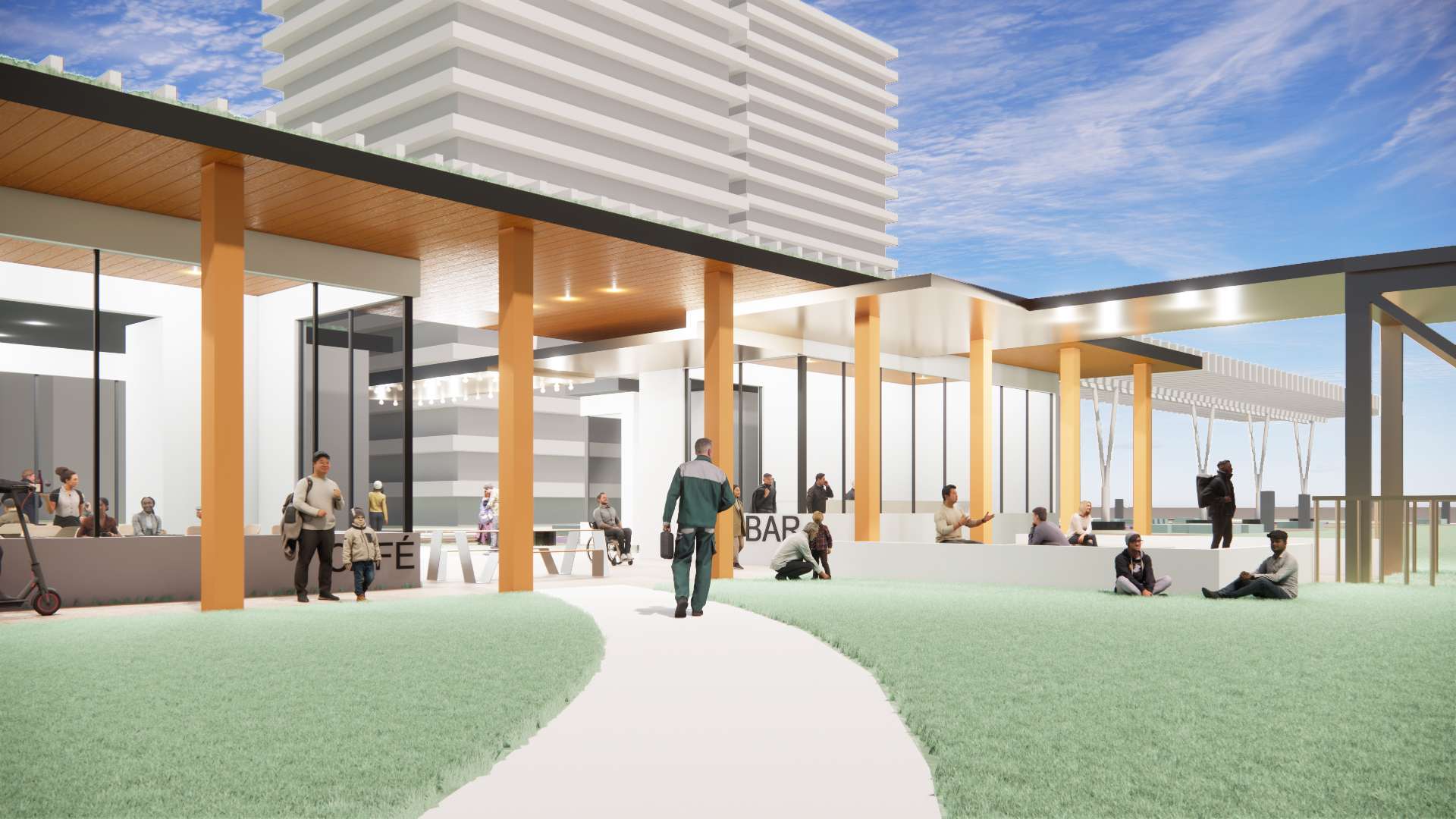
The combination of the Bridge, Tower, and Shade structure as an idea is structured and functionally determined by the need to create a publicly accessible access into the ravine at the precise situation. The shade canopy physically asserts itself into the larger site context; its formal architectural structure of vertical supports extends across the separated park strip it occupies and extends itself in relation to and in position with the large public/city lawn, creating an elevated perspective and new visual presence. This long and open new horizon for the park collages the existing park washroom pavilion and the extensive tree forest/freed green edge of the ravine, in which it produces a new framing structure of light and shadow.
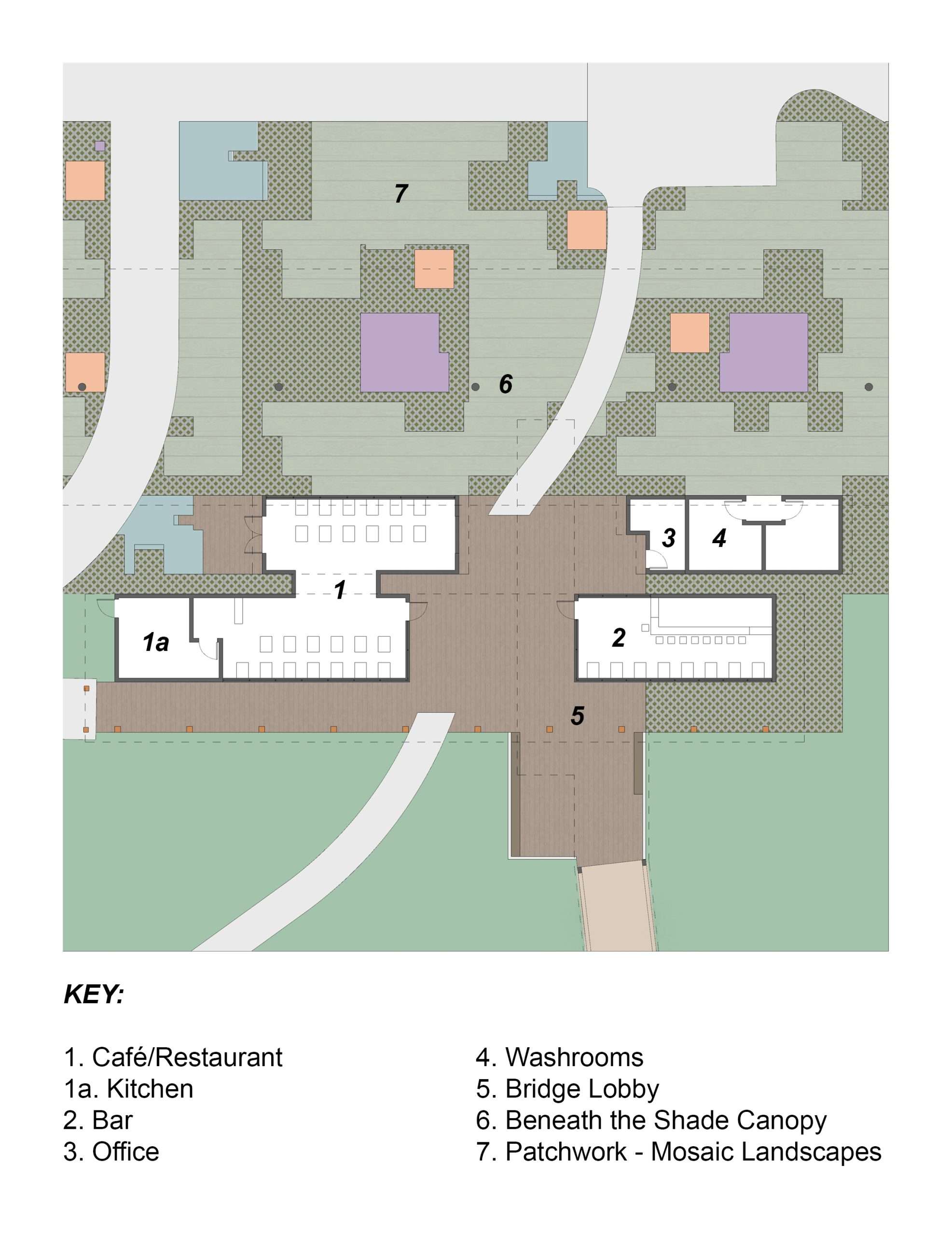
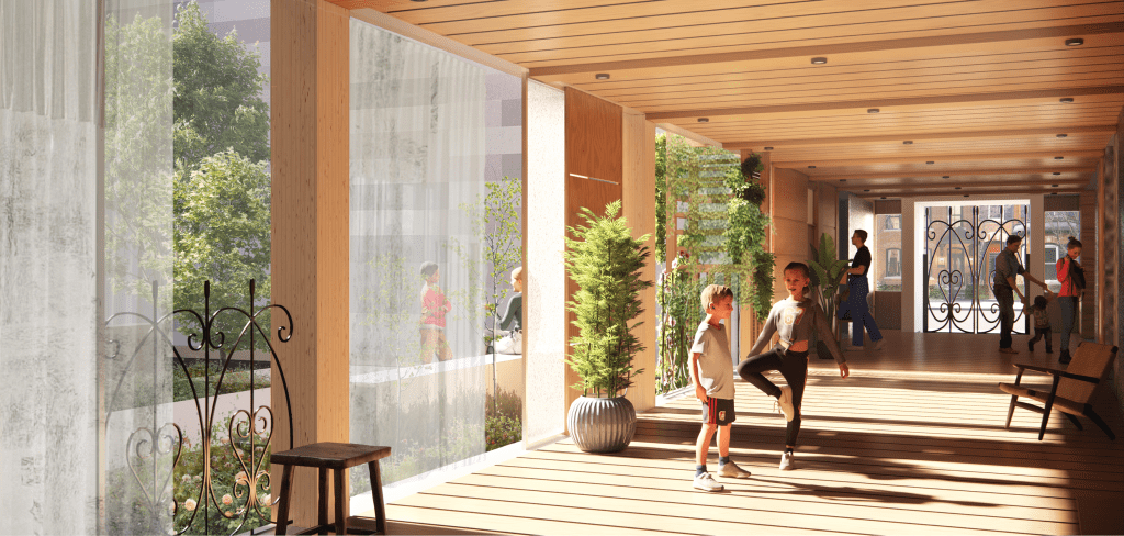
The steep ravine and threshold transition is an important part of the idea such that when you combine a café amenity space with the access challenge, what becomes evident is that there is a need for a public space that is capable of ‘accommodating’ and ‘making’ an ‘aggregate location’ in which these elements can compositionally interrelate with each other. The precedent examples we have illustrated show an assortment of buildings and landscapes that form a ‘front event space’ to the aggregate bridge and tower infrastructures. The shade canopy achieves its primary task as a climate modifier utilizing an open structure of columns and upper rafter structure with a ground surface mosaic of landscapes that become a resource and place of importance for the larger David Balfour Park and Rosehill Reservoir. As a structure the shade canopy is open with a perimeter threshold and edge that interacts with its adjacent environment both in a natural and urban mixture. In particular the public space at the juncture of the start of the bridge, the café/restaurant and its juncture meeting space create an exciting event space, as an analogous space. The underside of the St. Clair bridge creates a lively interplay of bridge, arches, and supports that give the experience of moving through the natural ravine, a ‘dramatic tone’, that the upper level of the public bridge doesn’t deliver. The shade canopy is a spatial intensifier with multiple surfaces, articulations, and landscapes for the public to use and interact with. In-the-making leave open other possibilities and potential for the shade canopy as a ‘propagating’ structure of open potentials. The bridge extends into the canopy structure creating an inviting theatre-like marquee invitation.

BRIDGE TOWER AND SHADE CANOPY AS A RESPONSIVE CLIMATE MODIFIER AND SOCIAL CONDENSER
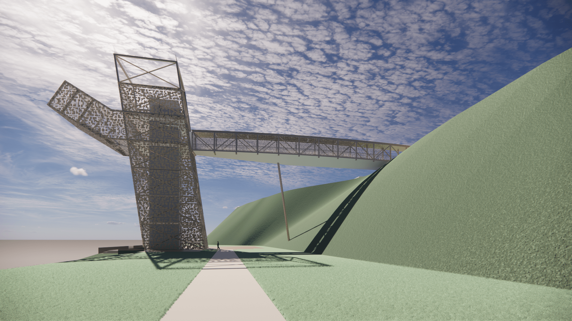
The alignment of the bridge + tower are in alignment with Rosehill Avenue, the upper tower mechanical space is seen from a distance and acts as a marker for the bridge seen from Rosehill Avenue. The Bridge + Tower combination springs from the edge of David Balfour Park in the piece of park currently occupied mostly by the parks two buildings, the shared park space/strip of land runs parallel to Avoca Avenue. A series of smaller amenity structures, a café, restaurant and perhaps office initiate the extension and threshold that transfers to the bridge. The bridge structure is supported by a ‘brace’ into the inclined ravine slope otherwise there are no other supports. The Tower is slightly inclined into the ravine, with a textured screen as skin. The elevator cab is enclosed with glass and connects to the floor of the ravine, adjacent the creek with a raised plinth that forms the base of the tower and connects to an adjacent pathway and small public space. The tower and bridge and in a way analogous to a tree and tree branch that emphasizes the Y. Joint, the accompanying image takes a naturalistic them as motivation for the technology of the bridge + tower. The tower breathes, and its perforations create affects of light and shadow analogous to a fractal leaf pattern. Expected, is green growth from the base of the tower, which will further tie the tower to its environment. The tower has a projecting lookout and public space that extends into the space of the ravine.
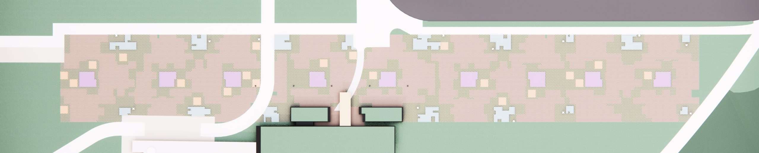
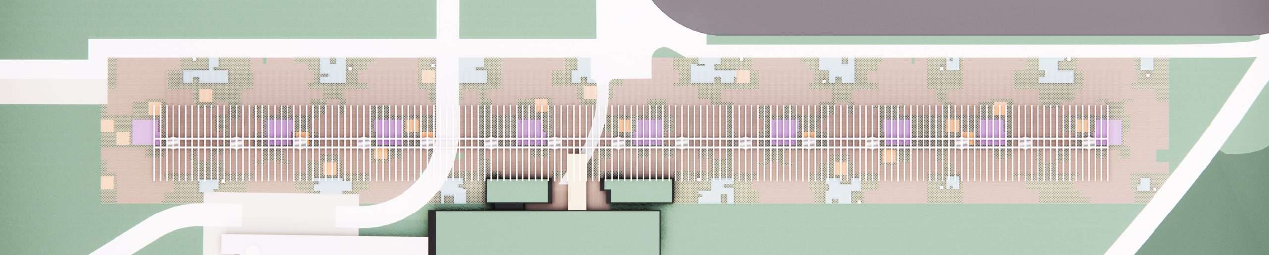
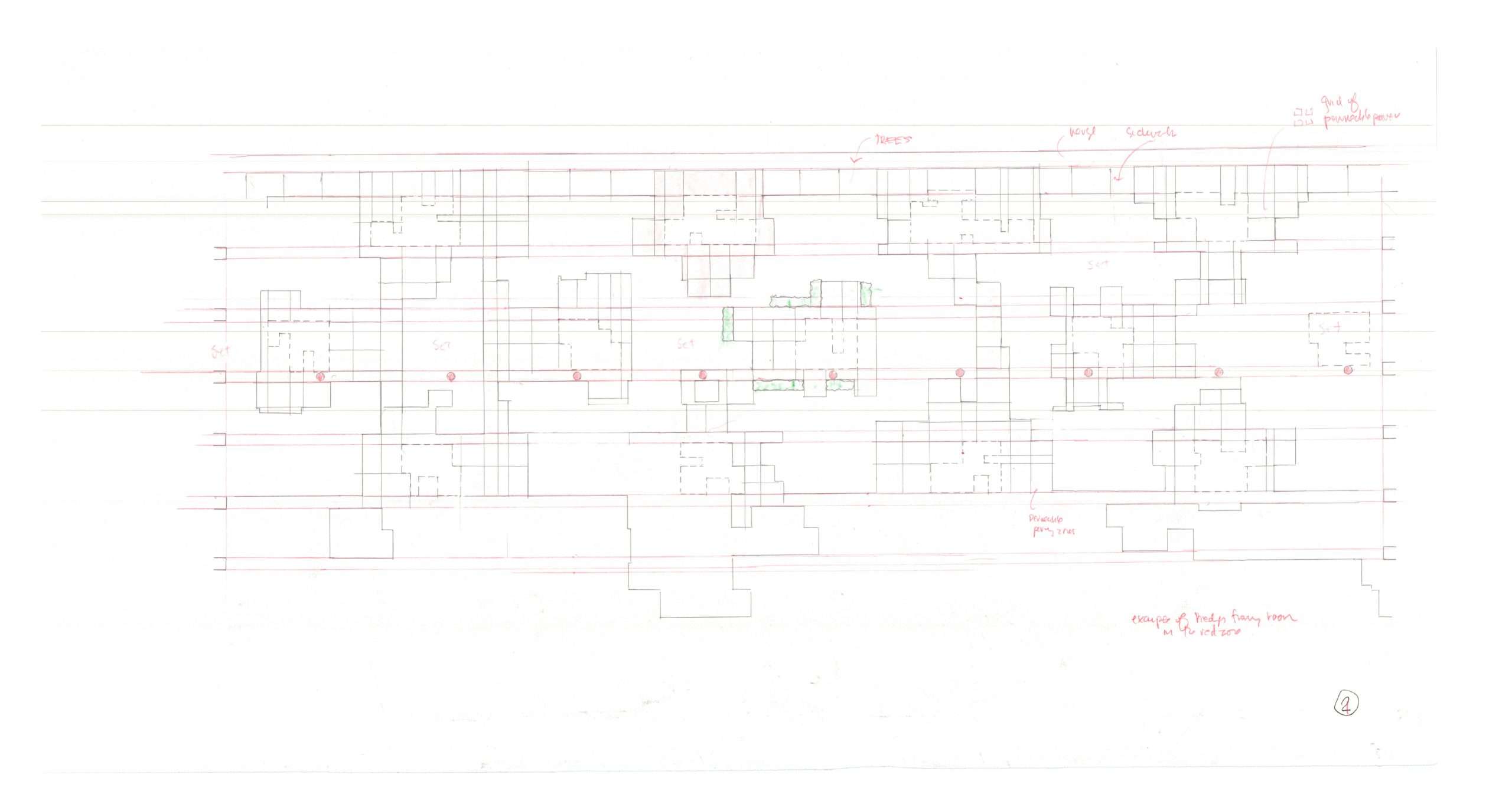
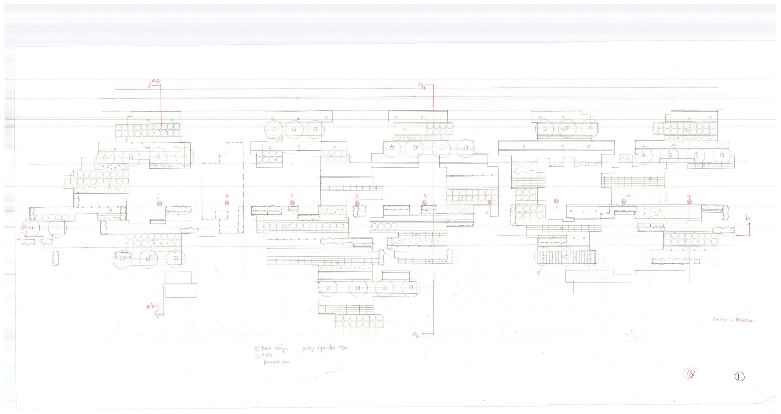
GARDENS, SOILS, AND SPACES
The idea is to present these ‘rafts’, ‘plinths’, etc. as ‘gardens’ in particular because of their size they could reflect a typical residential scale of the backyard or front yard garden. This is where the real revolution of climate change would occur; as a didactic illustration of individual gardens. These sites could then be seen as a ‘library’ with ‘signage’ and have an educational value. Again, apartment dwellers, house owners can look at these for inspiration given they have a relational scale to them. Materially they could be set up from the ground and demarcated perhaps even a set of small steps, ornate fencing, partial enclosures, and seating edges. They are identified and form a series in and around the canopy. They are supplied by water from the strips running north to south, they could also be gardens that certain groups or individuals could appropriate.
They range in size from approximately 4×4 m in area. They could also include lower walls; for plants to climb onto or screens, or even small trellises. They would also be filled with a water source, maintenance, could also find a location within the larger matrix. They become analogous islands, analogous mosaics.
They are defined partially by a hard porous surface zone around them are hedges and benches linked in a series of partial rooms. Maybe these sites could generate some income, or be able to be rented out. They would clearly be an attraction and a place to visit. As well they could also be locations for public art located and indented and inset. They would also have wall lighting around their base.
As an attraction the restaurant café works well with the multiple library of gardens. Again the gardens individualities and the fact that they are arranged in a multiplicity under and around the shade canopy, makes them attractive as a place to visit, walk and move between and to experience their various different characters. The small garden and restaurant café are a natural fit to enjoy as places; arrange serially they can form part of a ritual walk through the larger Rosehill Reservoir Park which is often an attraction to local residents and new apartment dwellers.
AVOCA MONSTER FULL BOOKLET:
BSA – Avoca Monster Booklet
POTENTIAL EXPANSION – ST. CLAIR BRIDGE LOOKOUT CANOPIES
URBAN DESIGN IMPACT/IMPROVEMENTS
The ascending descending accessible ramp into context of the St. Clair bridge becomes a visible artifact, seen sequentially as you cross the bridge from east to west, as well as other viewpoints that link the Balfour public shade trellis (both apparatuses) are connected visually and architecturally along Avoca Avenue.
- The shade canopy/trellis, reconnects an otherwise isolated and separated piece of David Balfour Park and brings it into focus
- It becomes a new element to the eastern boundary of D.B. Park
- It creates a strong N-S linkage along Avoca Avenue into the large park
- It creates a side to Avoca Avenue, creates alignments and a frontage to what is a ‘stiff corner’ connecting Avoca + Rosehill Avenue
- It creates a parallel organization that joins to the washroom pavilion + canopy
- It becomes a major new element viewed from multiple points across the raised reservoir surface
- As a connecting element + infrastructure it sets up a sequence of elements to connect to the accessible ramp and St. Clair utilizes a reduced Avoca Avenue + point on St. Clair it’s visible
- It acts as an ‘intensifier’ into the David Balfour Park
PROJECT PRECEDENTS
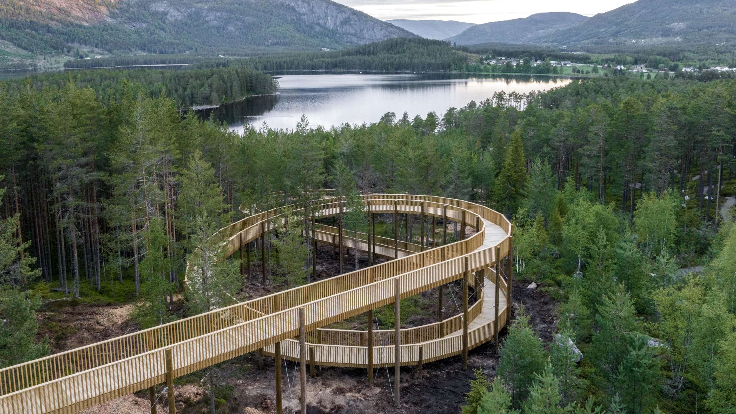
RAMP PRECEDENTS FULL BOOKLET:
VoA – Ramp Precedents
We have included a number of well-known tower + bridge examples, as well as other smaller examples. In all cases, the space proceeding the transition onto the bridge is quite often substantial and in some cases, this is a significant building grouping as well as having a park and public space. This new infrastructure will have a significant impact and attract an eager large public to experience the entrance into the ravine. Consequently, we have proposed a long shade canopy that runs parallel to Avoca Avenue, providing an underneath patchwork landscape of surfaces, consisting of landscapes, event spaces, giving the structure a sense of an ‘open availability for public events’, leisure and multiple surfaces used for seating areas. A partial arrangement of structural hedges form partial room enclosures, for collective groups to appropriate and utilize for both spontaneous and planned events. The openness of the shade canopy means it has no exterior but just a upper wood structure in a pattern generating a shadowed affect. The wood and steel construction of the shade structure create a ‘propagating’ organization that allows for opportunities and new potential to evolve and transform the space given the needs and values of the surrounding community of users. The supporting columns as well are analogous to tree configuration. The shade structure we are showing could also be shown or not shown in relationship to the tower and bridge restaurant amenity assemblage.
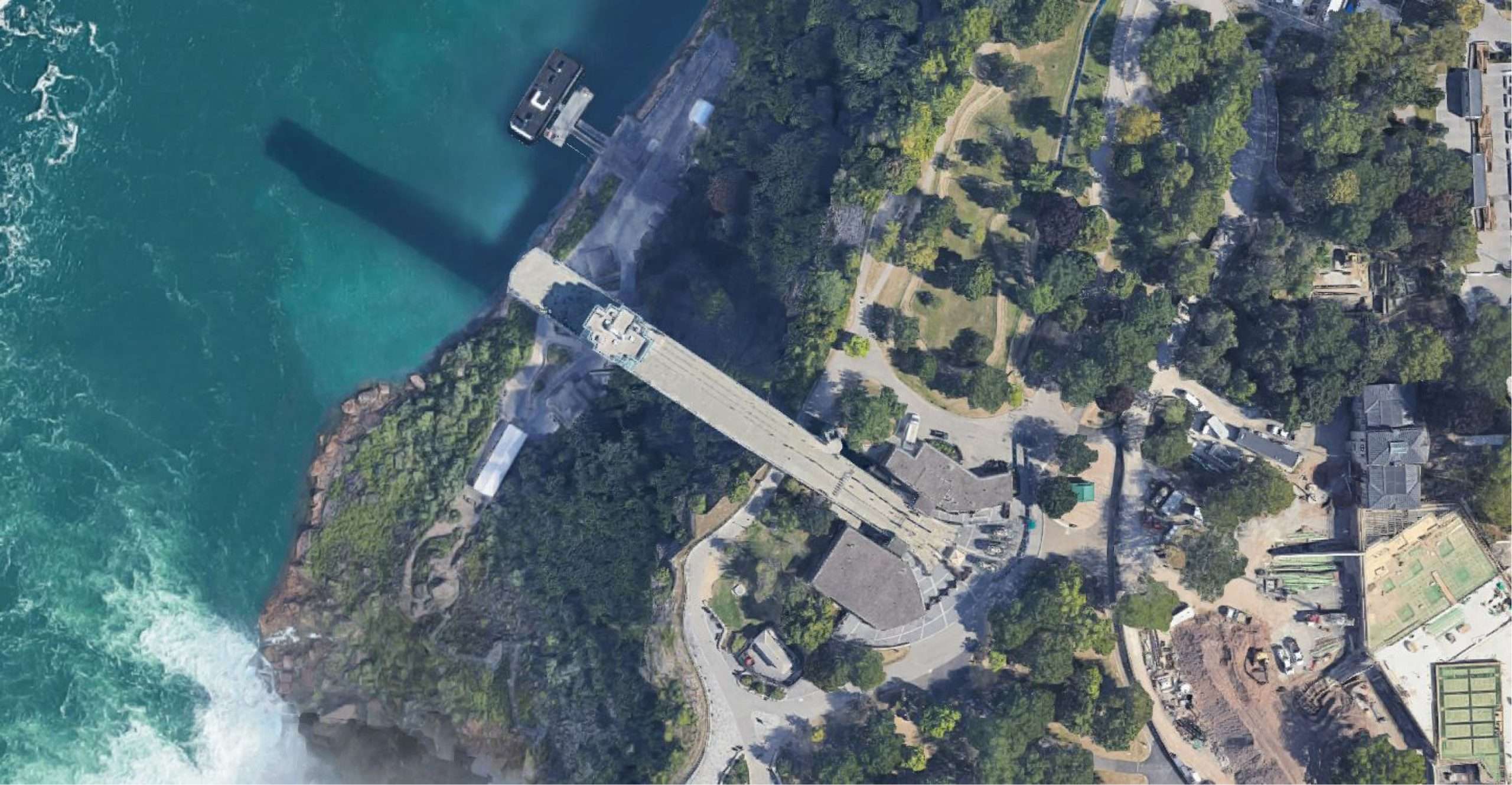
AVOCA MONSTER PRECEDENTS FULL BOOKLET:
VoA Bridge + Elevator + Canopy Precedents
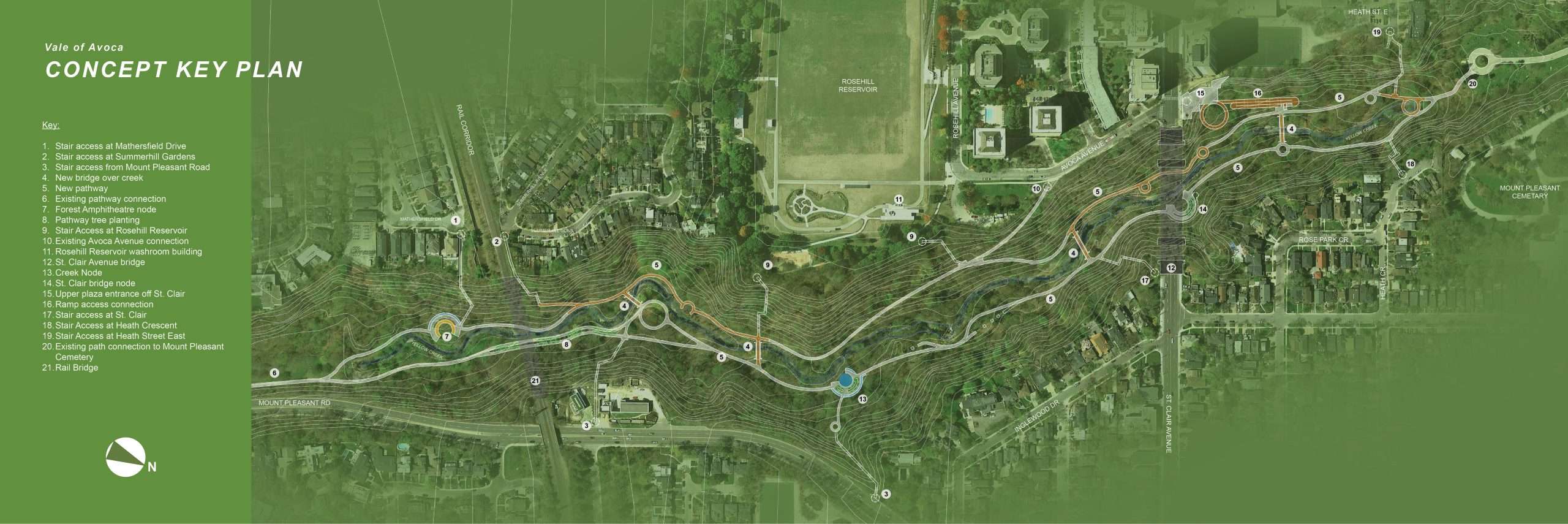
CONCEPT KEY PLAN