
The New Golden Mile
The gradual dissolution of the Golden Mile as the fabled automotive golden moment along a stretch of Eglinton Avenue in Scarborough, Ontario is the latest in a number of its evolutionary stages. The compressed rapid succession of these stages – from wilderness to concession driven farm land to vast asphalt plaza – has had consequences both negative and positive. Each stage has nearly erased all characteristics of the preceding, so that only the faintest traces of the wilderness can be detected in the remnants of Massey Creek, and only the concession grid remains of the agricultural regime. What the Golden Mile has been given as a legacy is its singularity, an autonomous sector of the larger metropolis, that stands apart from the other miles of plazas that have sprung up across the amalgamated city and GTA.
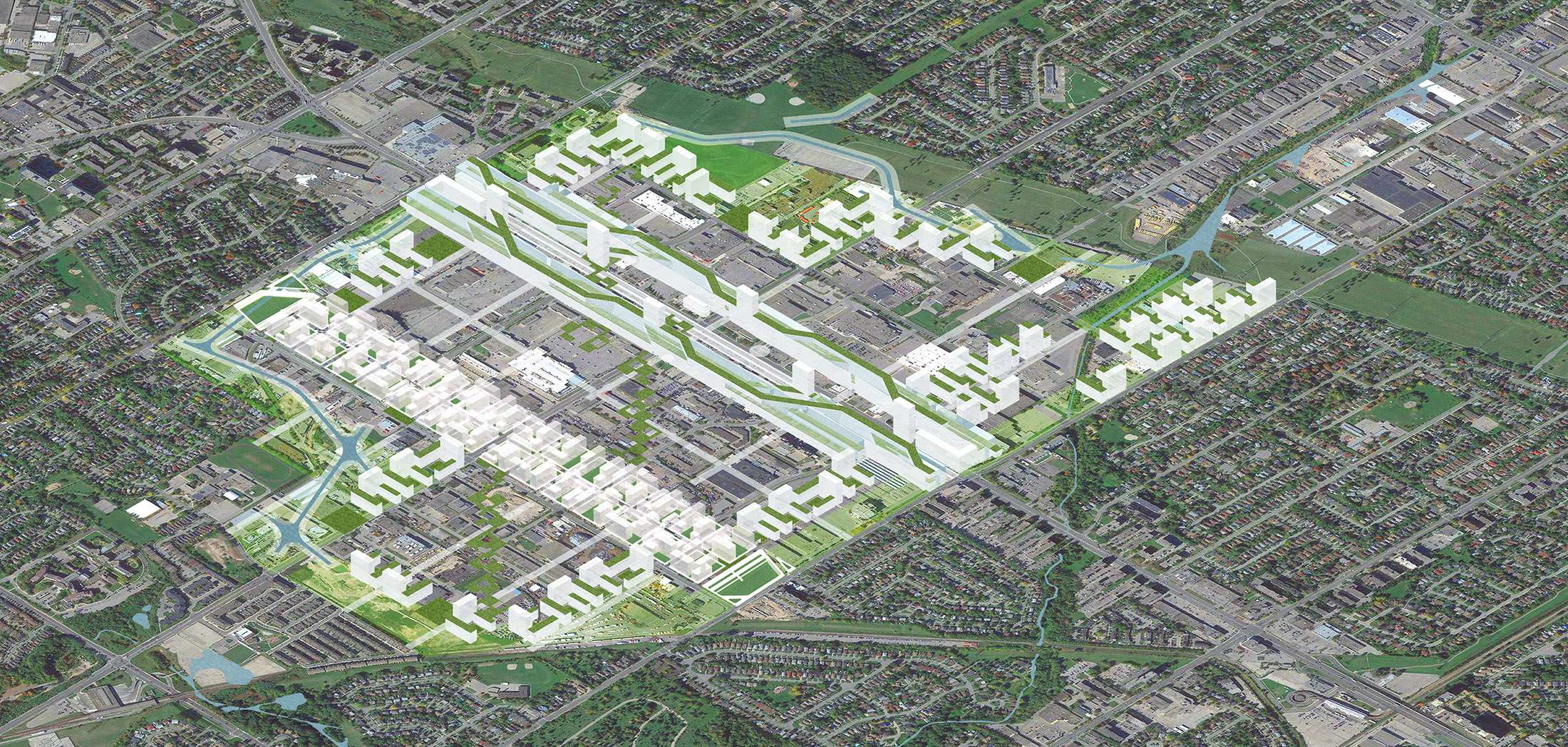
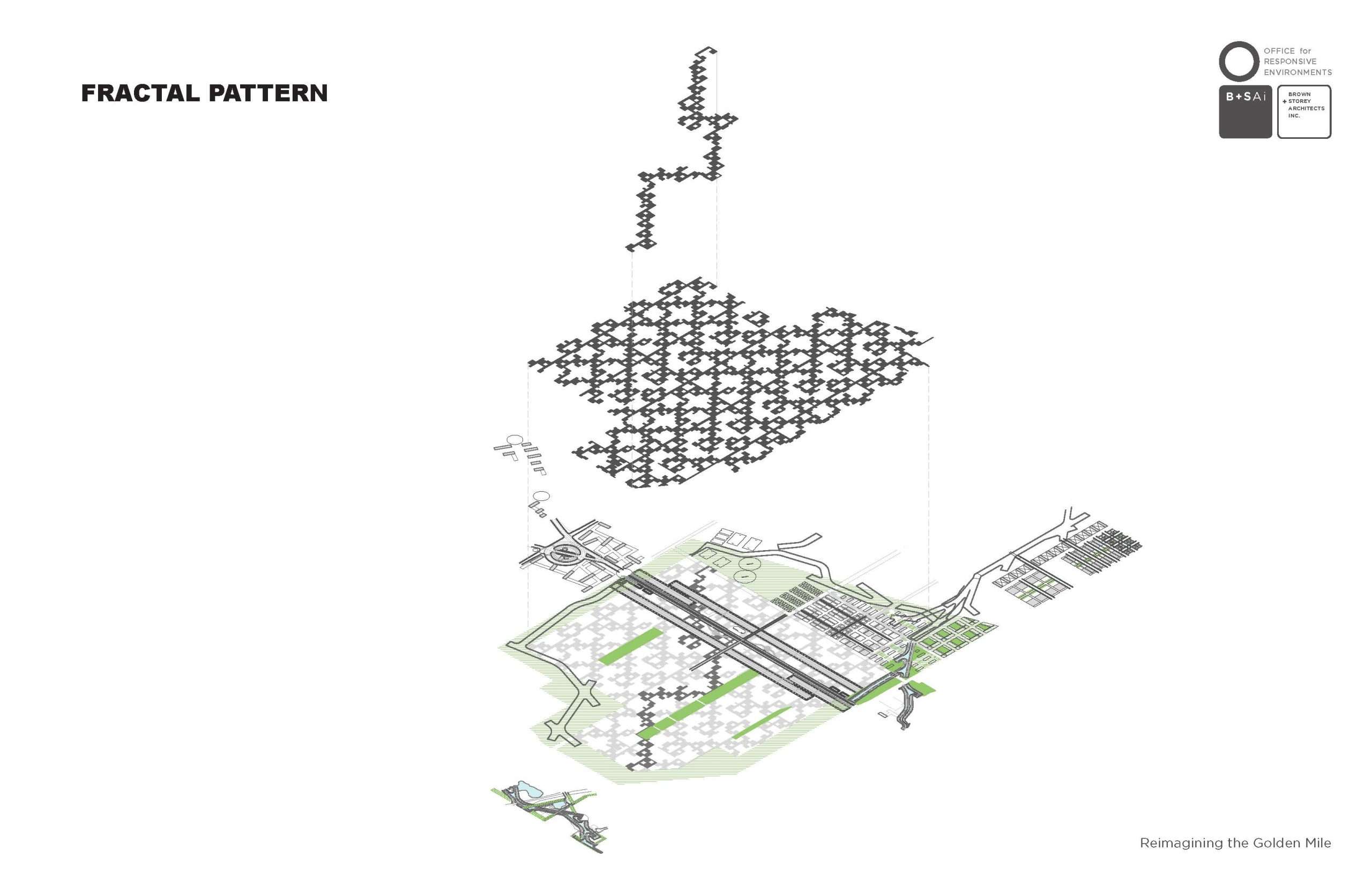
This project for a new Golden Mile pulls out to a larger territory, exploring a scenario where the natural landscape plays a formative and expanded role integrated with the original concession network, while creating a continuous green frieze / public common, its periphery containing an intensification that recalls the earliest settlement model first posited by Lord Dorchester for the Town of York.
While a lot can be said about the unplanned suburban form, there is nevertheless an overwhelming need for a larger view of greater precincts that can respond to our current mandates for climatic issues, housing intensification, maintenance and enhancement of employment lands, and healthy retail environments while making meaningful public open space commons. The new Golden Mile project is a pattern and method for revisited settlement that can be applied to other sites across the suburban landscape of the GTA and beyond.
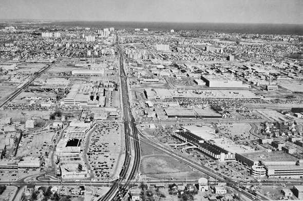
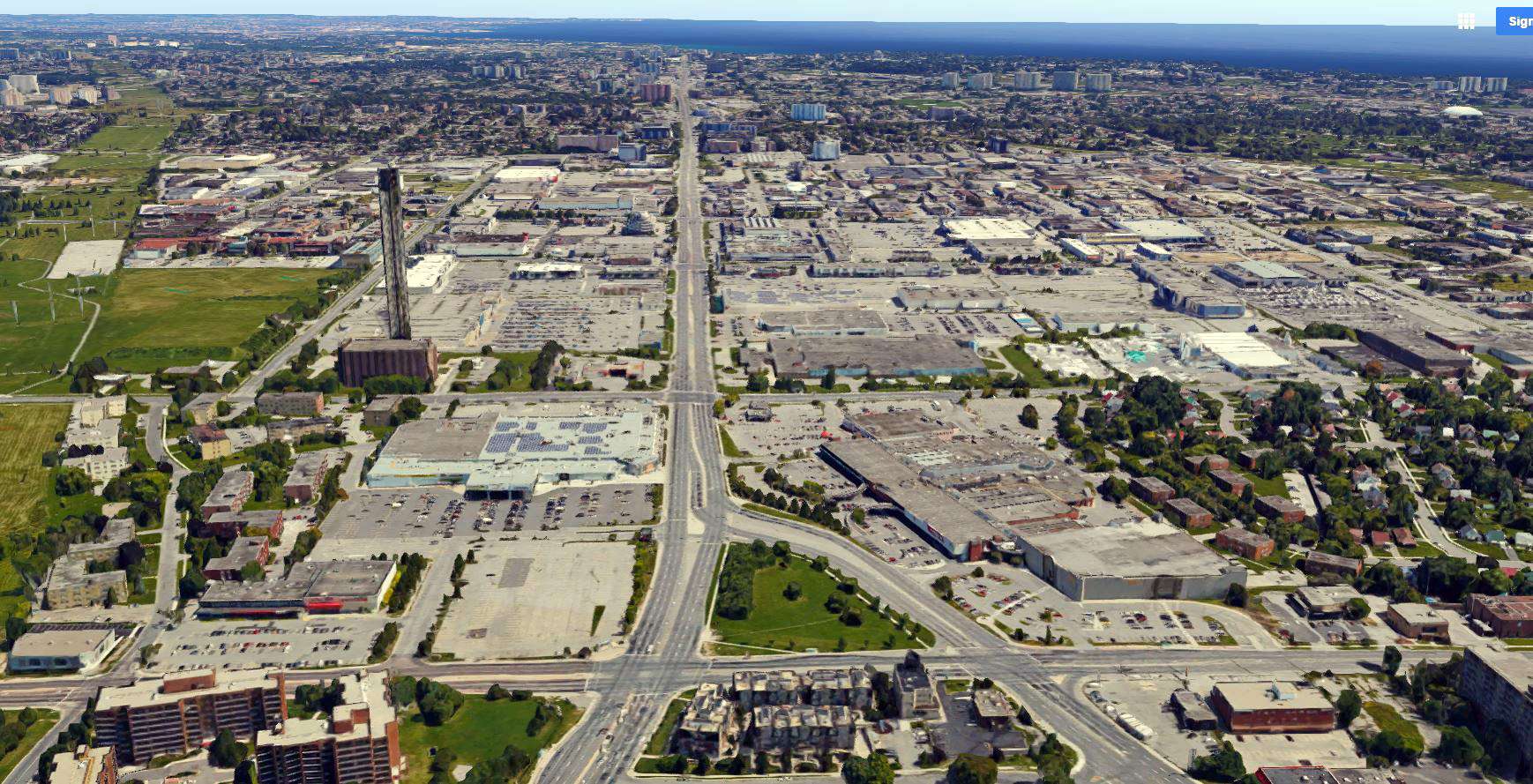
Centered along Eglinton Avenue East between Pharmacy Avenue and Birchmount Road, Toronto’s Golden Mile was one of Canada’s first model industrial parks, hosting munitions plants for involvement in World War II, and factories producing consumer and automotive goods during the following decades. Today, Eglinton is commercialized with big-box retail uses, and the upcoming Crosstown LRT is stimulating demand for developmental change. Looking to the future of the Golden Mile, we envision its possibilities through ongoing research that integrates civic infrastructure, transit systems, mixed-use density, and enhanced public space.
Elements of the New Golden Mile
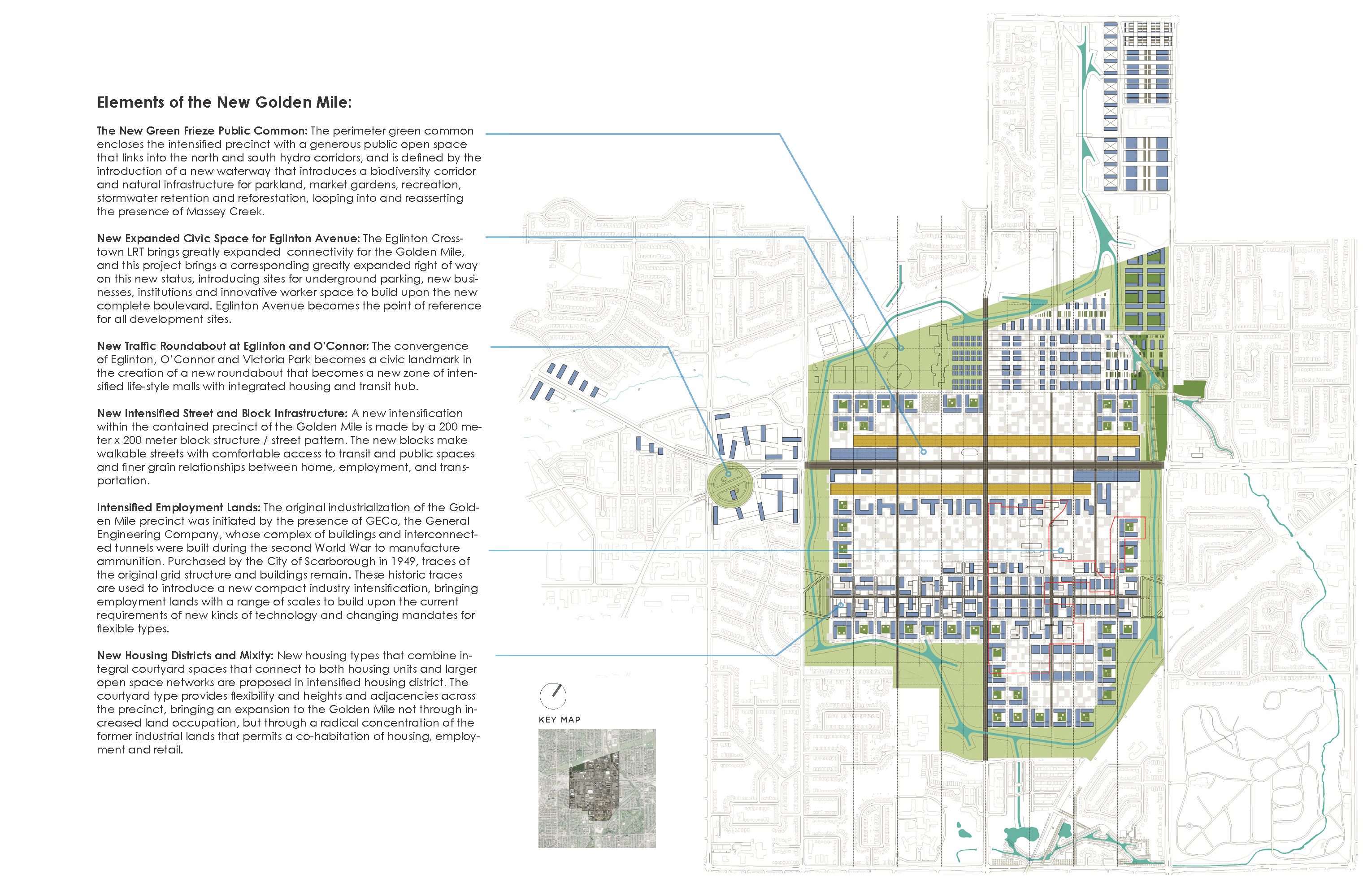
The New Green Frieze Public Common: The perimeter green common encloses the intensified precinct with a generous public open space that links into the north and south hydro corridors, and is defined by the introduction of a new waterway that introduces a biodiversity corridor and natural infrastructure for parkland, market gardens, recreation, stormwater retention and reforestation, looping into and reasserting the presence of Massey Creek.

New Expanded Civic Space for Eglinton Avenue: The Eglinton Crosstown LRT brings greatly expanded connectivity for the Golden Mile, and this project brings a corresponding greatly expanded right of way on this new status, introducing sites for underground parking, new businesses, institutions and innovative worker space to build upon the new complete boulevard. Eglinton Avenue becomes the point of reference for all development sites.
New Traffic Roundabout at Eglinton and O’Connor: The convergence of Eglinton, O’Connor and Victoria Park becomes a civic landmark in the creation of a new roundabout that becomes a new zone of intensified life-style malls with integrated housing and transit hub.
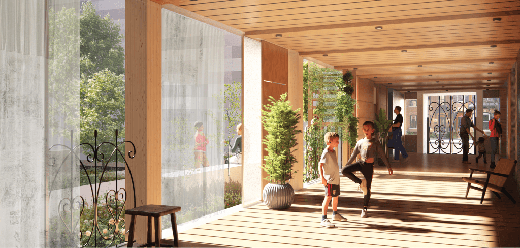
New Intensified Street and Block Infrastructure: A new intensification within the contained precinct of the Golden Mile is made by a 200 meter x 200 meter block structure / street pattern. The new blocks make walkable streets with comfortable access to transit and public spaces and finer grain relationships between home, employment, and transportation.
Intensified Employment Lands: The original industrialization of the Golden Mile precinct was initiated by the presence of GECo, the General Engineering Company, whose complex of buildings and interconnected tunnels were built during the second World War to manufacture ammunition. Purchased by the City of Scarborough in 1949, traces of the original grid structure and buildings remain. These historic traces are used to introduce a new compact industry intensification, bringing employment lands with a range of scales to build upon the current requirements of new kinds of technology and changing mandates for flexible types.
New Housing Districts and Mixity: New housing types that combine integral courtyard spaces that connect to both housing units and larger open space networks are proposed in intensified housing district. The courtyard type provides flexibility and heights and adjacencies across the precinct, bringing an expansion to the Golden Mile not through increased land occupation, but through a radical concentration of the former industrial lands that permits a co-habitation of housing, employment and retail.
View the full presentation: Golden Mile Schematic Presentation