
Lower Don Lands International Competition
Client:
Waterfront Toronto
Team:
Brown + Storey Architects
ZAS Architects
Nina-Marie Lister
Brookner Studio
Kidd Consulting
Applied Ecological Services
Moffatt + Nichol
Arup
Pine + Swallow Associates
Nitsch Engineering
ConsultEcon
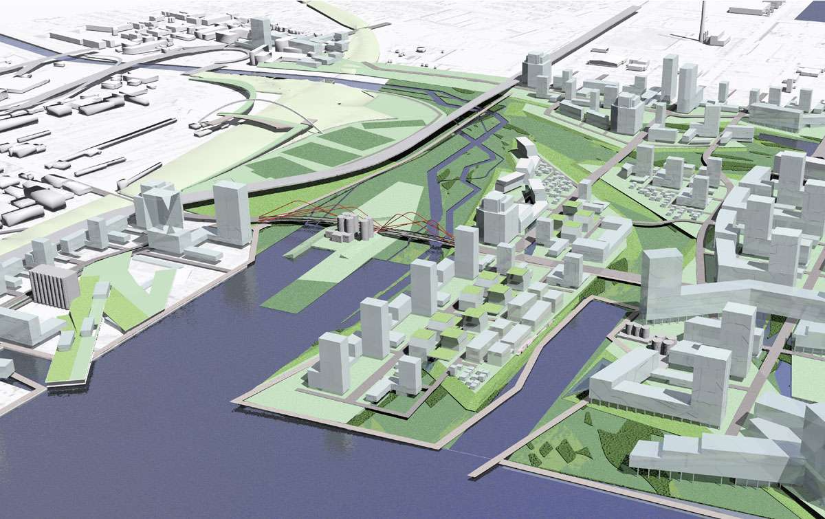
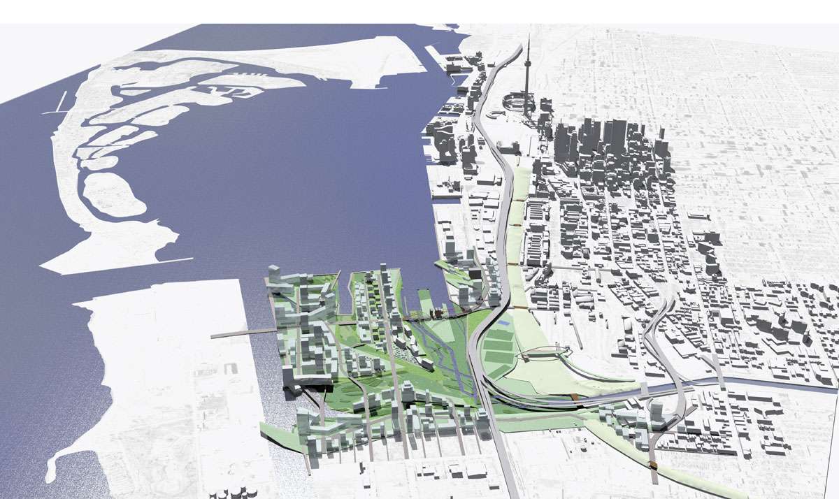
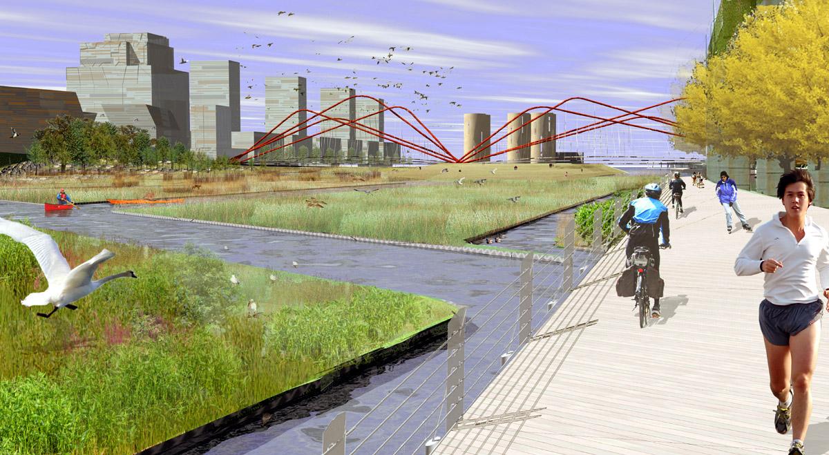
The mouth of the Don River is both a spectacular and sensitive locale with many responsibilities to the general public. Its special nature will be embedded in the unique disposition of its new neighbourhoods to a public realm that will be far more intensely used than is the norm on Toronto’s residential streets.
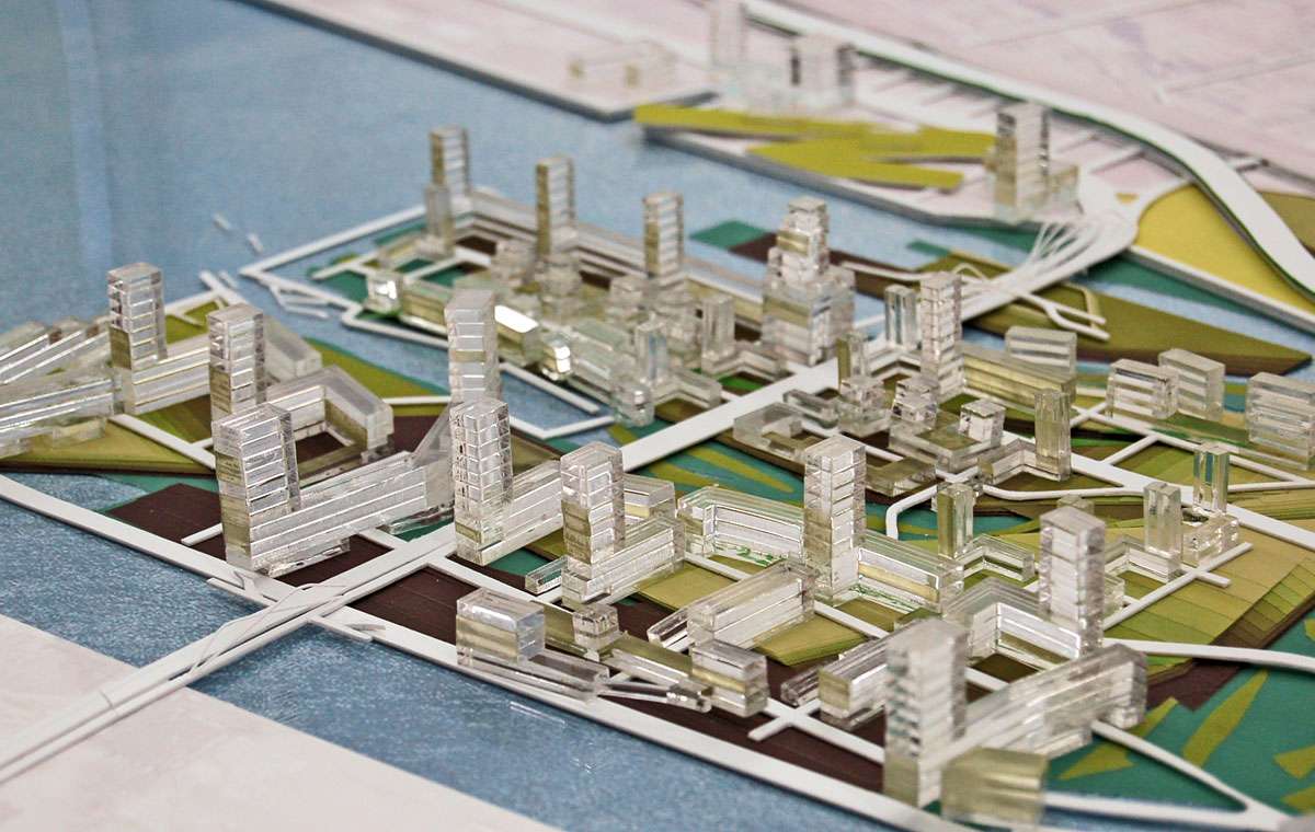
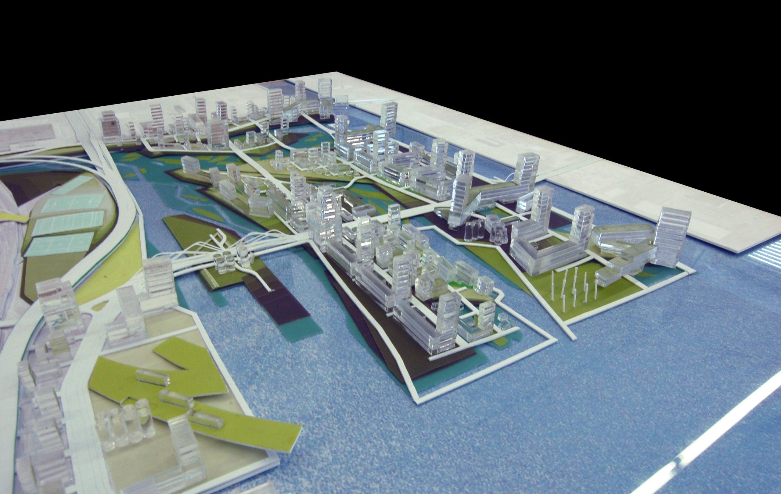
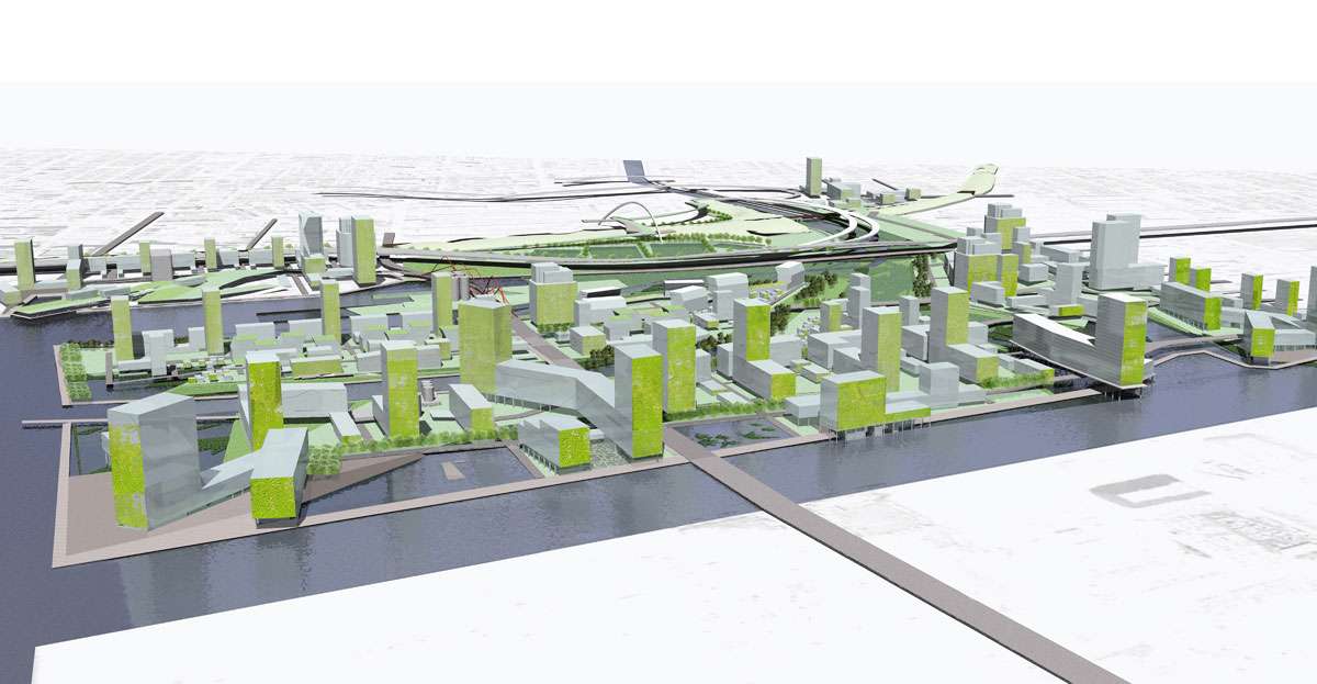
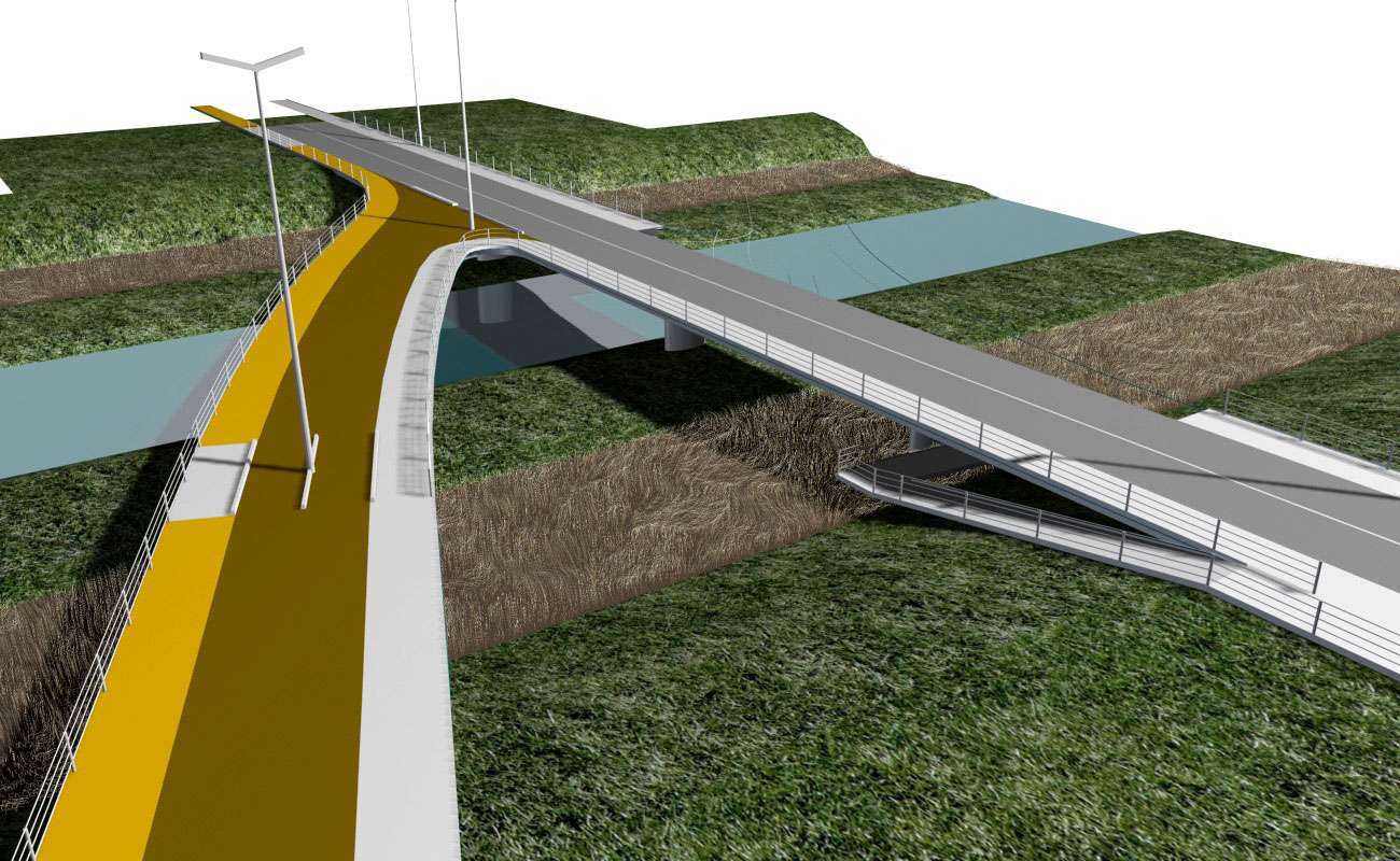
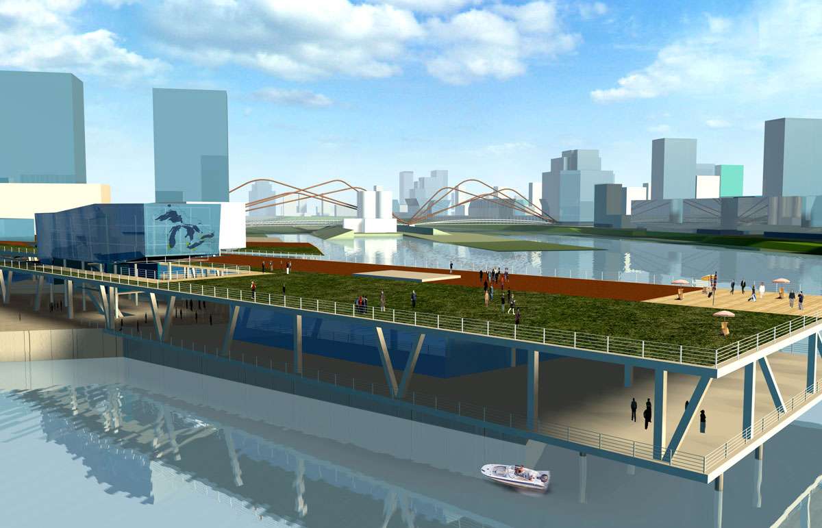
The new neighbourhoods of the Don River have been composed as part of the rich mix of striated islands and spits, marshes, parkland and water – from the cultivated to the wild. The position of the spits and islands within this new open realm creates a robust relationship between the new Don River landscape, Lake Ontario and the streets and homes of five new neighbourhoods – Victory Flats, Commissioners’ Island, the Channel, Don Island, and Don Point. At a broad scale, the spit landscapes allow for the long view through the length of the neighbourhoods east to west; from north to south the neighbourhoods have a compact section with immediate access to the landscape swaths of marsh, water and park.
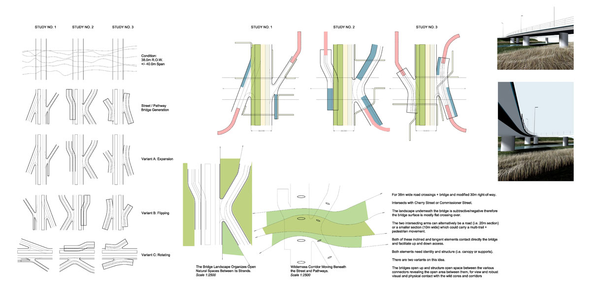
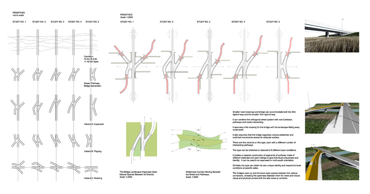
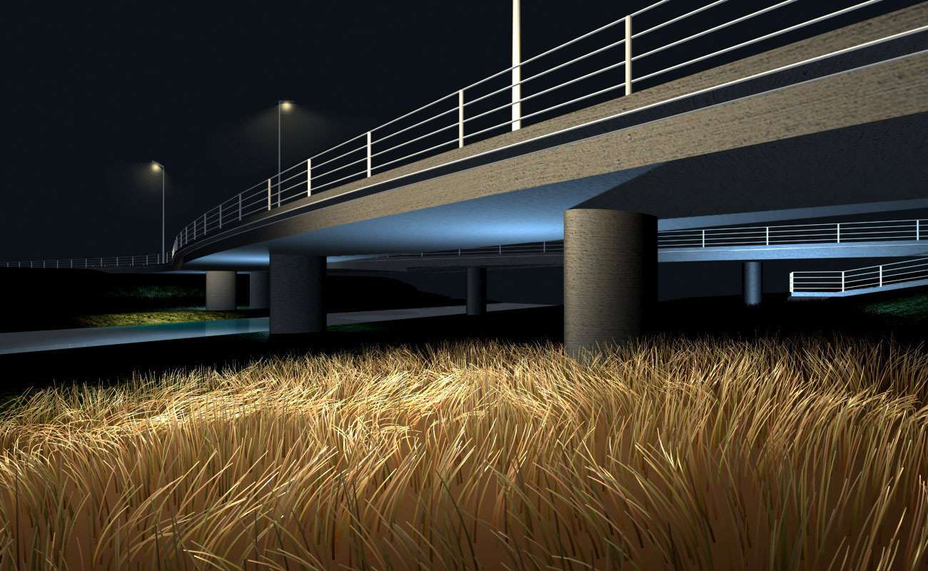
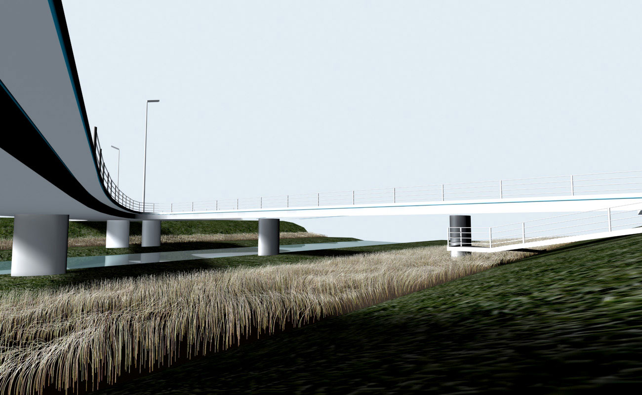
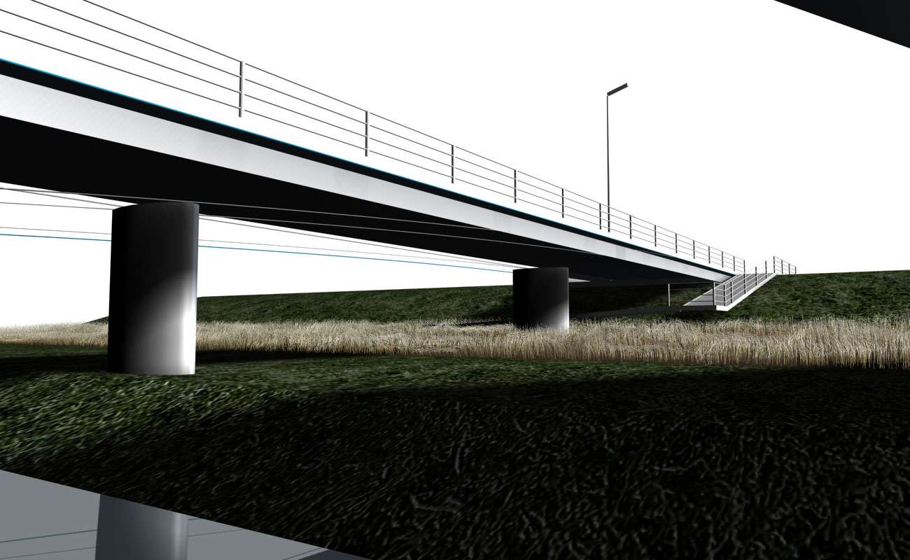
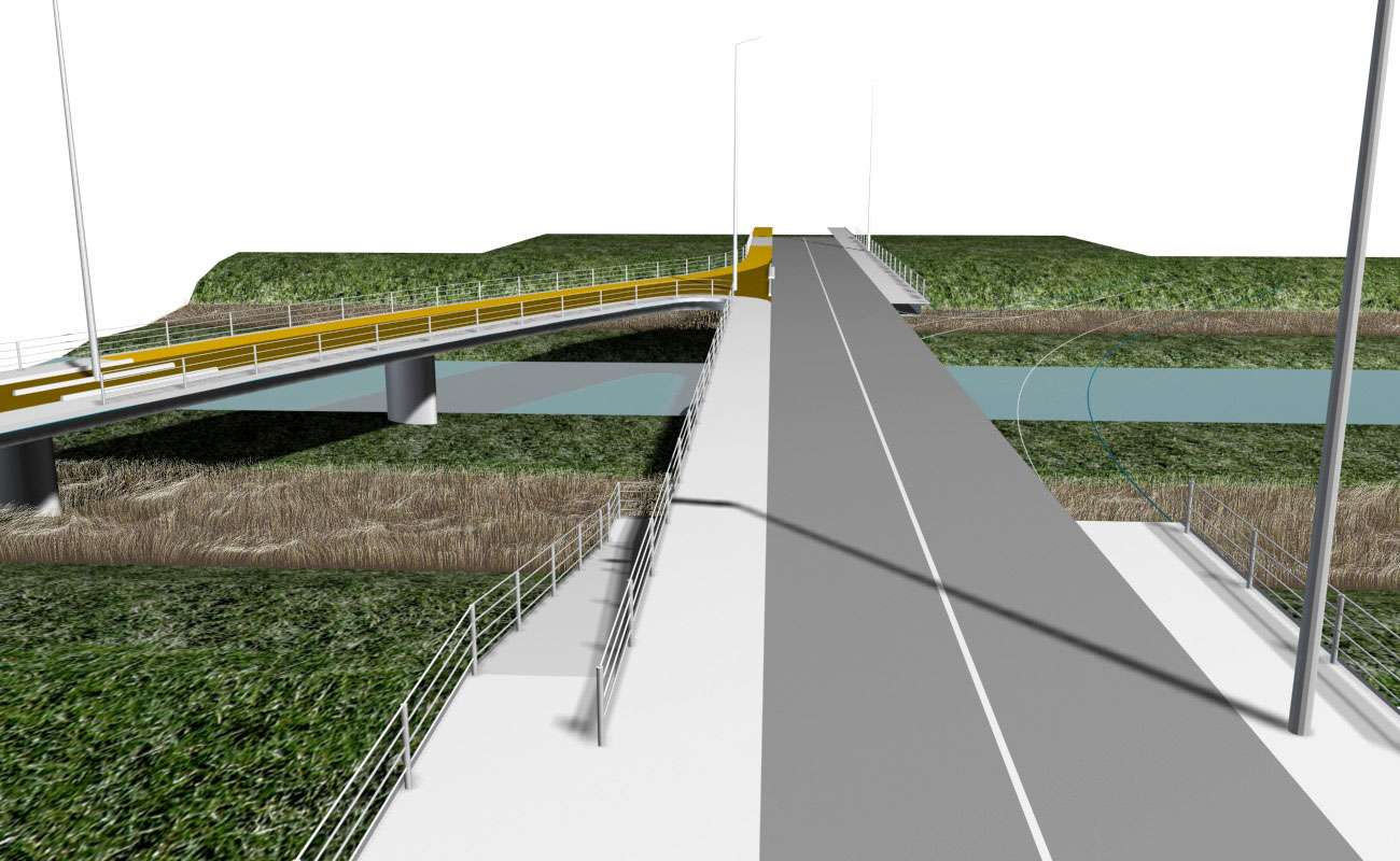
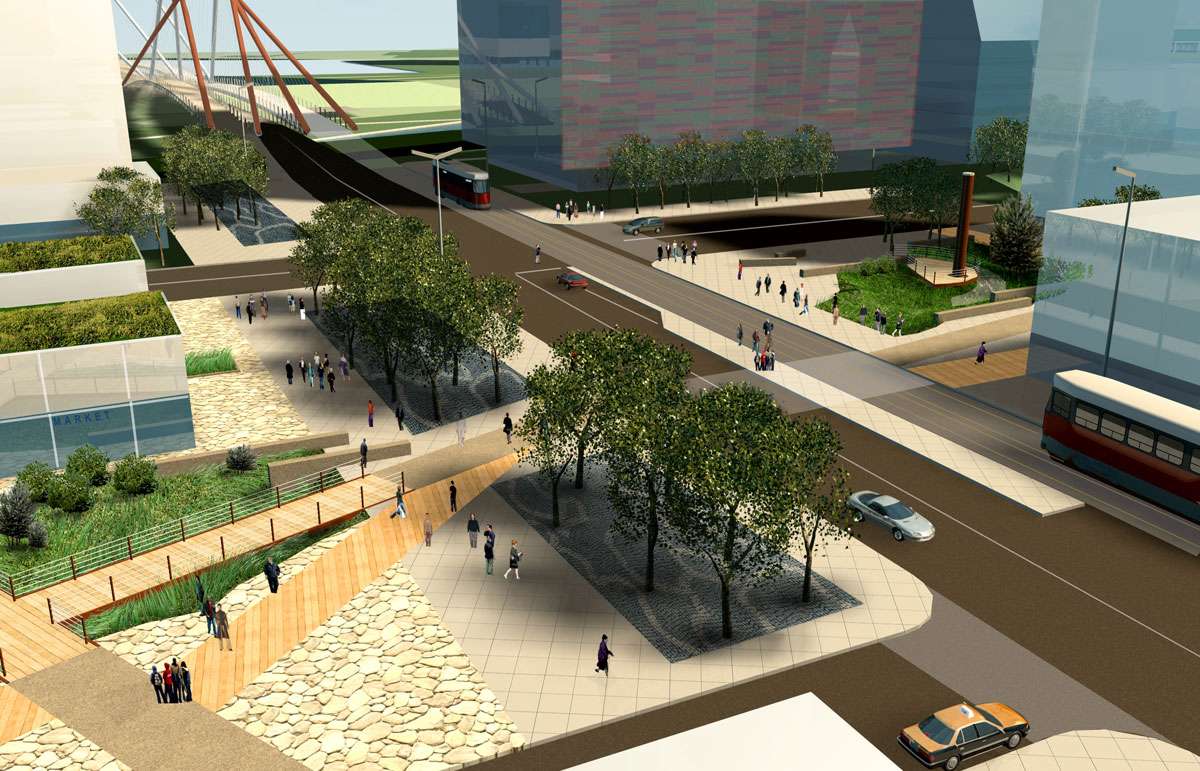
The infrastructure of streets and bridges interconnect the neighbourhoods in a studied mix of pedestrian, cycling, public transit and vehicular systems in street compositions scaled incrementally to the relationship of courtyards, esplanades and promontories. Within each neighbourhood, a mix of built form types are drawn from eleven different built form typologies, that have been developed to provide opportunities for mixed uses of residential programmes, institutional and retail, and in particular, all carefully conceived with integrated systems of open space. A set of balanced relationships – between a generous open-ness and the ‘critical mass’ needed to economically sustain the neighbourhood, between fine grain relationships of the private residence to the public realm and the special role for a public realm that serves the whole city, and the original co-evolving balance between the natural landscape and urban form – together create the milieu for these five new robust neighbourhoods.
The many successful communities in Toronto have depended on a gradual evolution of elements of streetscape, landscape, and urban form, through successive waves of residents, to give a neighbourhood depth and comfort. One of the characteristics that sets up an organizational infrastructure that gives distinctness to these neighbourhoods – like Corktown, like Yorkville, like Little Italy – is an underlying lattice pattern of blocks, which in many situations is a result of a balance (or truce) between the original landscape and the early surveyors. As the initiation of providing linkages to the historical communities surrounding the Lower Don precinct, and a diverse set of patterns to provoke the development of responsive new built form typologies, we have adopted three scales – Corktown (46 meters by 46 meters), the original Old Town ten blocks (80 meters by 80 meters), and the St. Lawrence neighbourhood (125 meters by 125 meters).

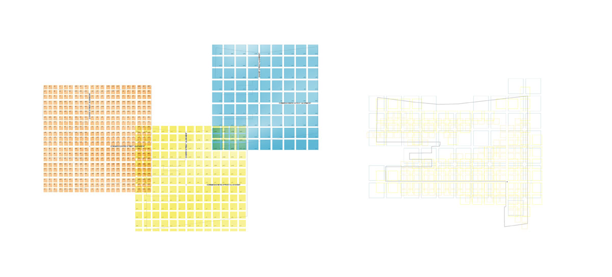
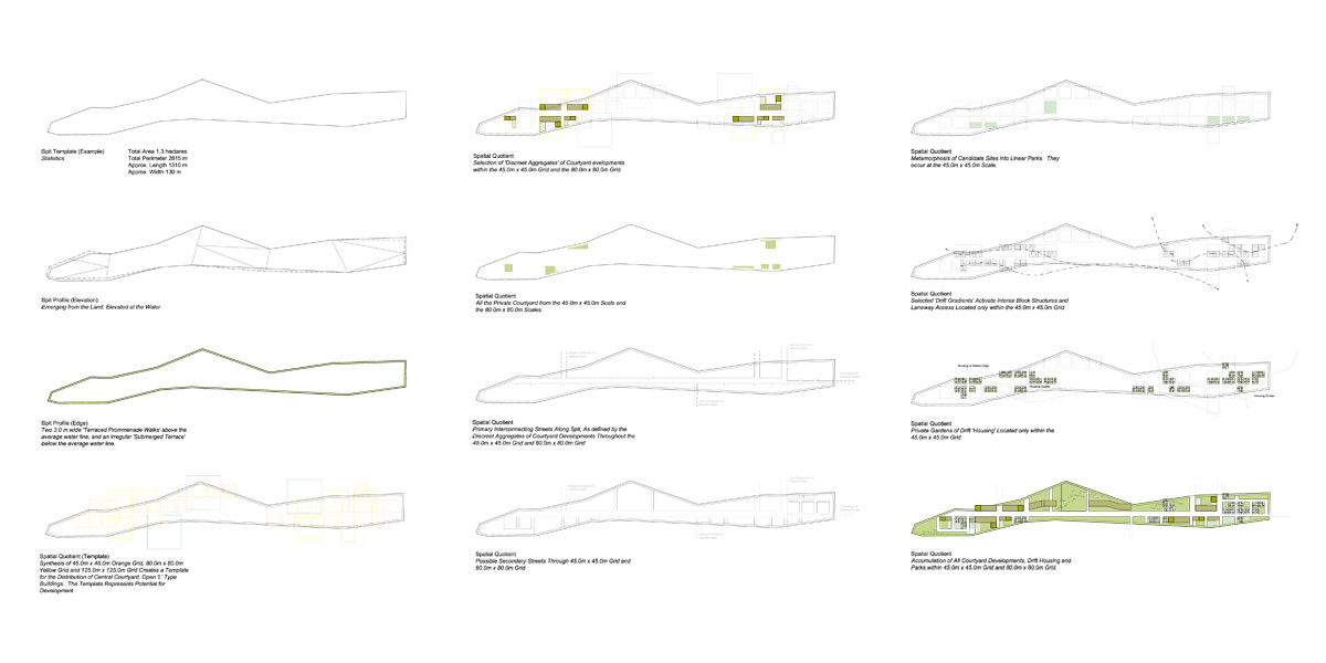
These three scales of lattice patchwork are juxtaposed and overlaid on the site area to create a constructed set of variations – of openness, of clusters, of different scales of built form and open space. The lattice is strongly affected by the striated spits and islands and the dynamic of the Don River and its floodway. The lattice pieces can be deleted to create openness and connections. They can take aspects of the grid to create systems for distribution of services. The adjacencies of the three scales of the pattern create distinct contrasts between sizing of streets, pedestrian ways, edges to the cultivated and wild landscapes.
The patchwork provides an invisible coherence across all areas of the site, creating sized relationships to surrounding districts, while setting up a range of conditions for the development of the eleven built form typologies. The relational nature of this striated patchwork works like a layered gameboard in which the background is open and flexible – hand-tailored to a specific site or conditions, unlike the overly generic grid where one size fits all.
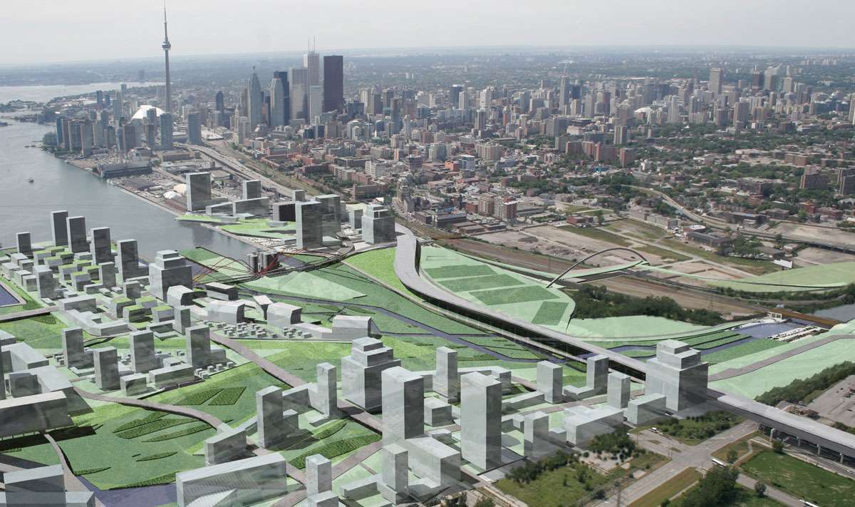
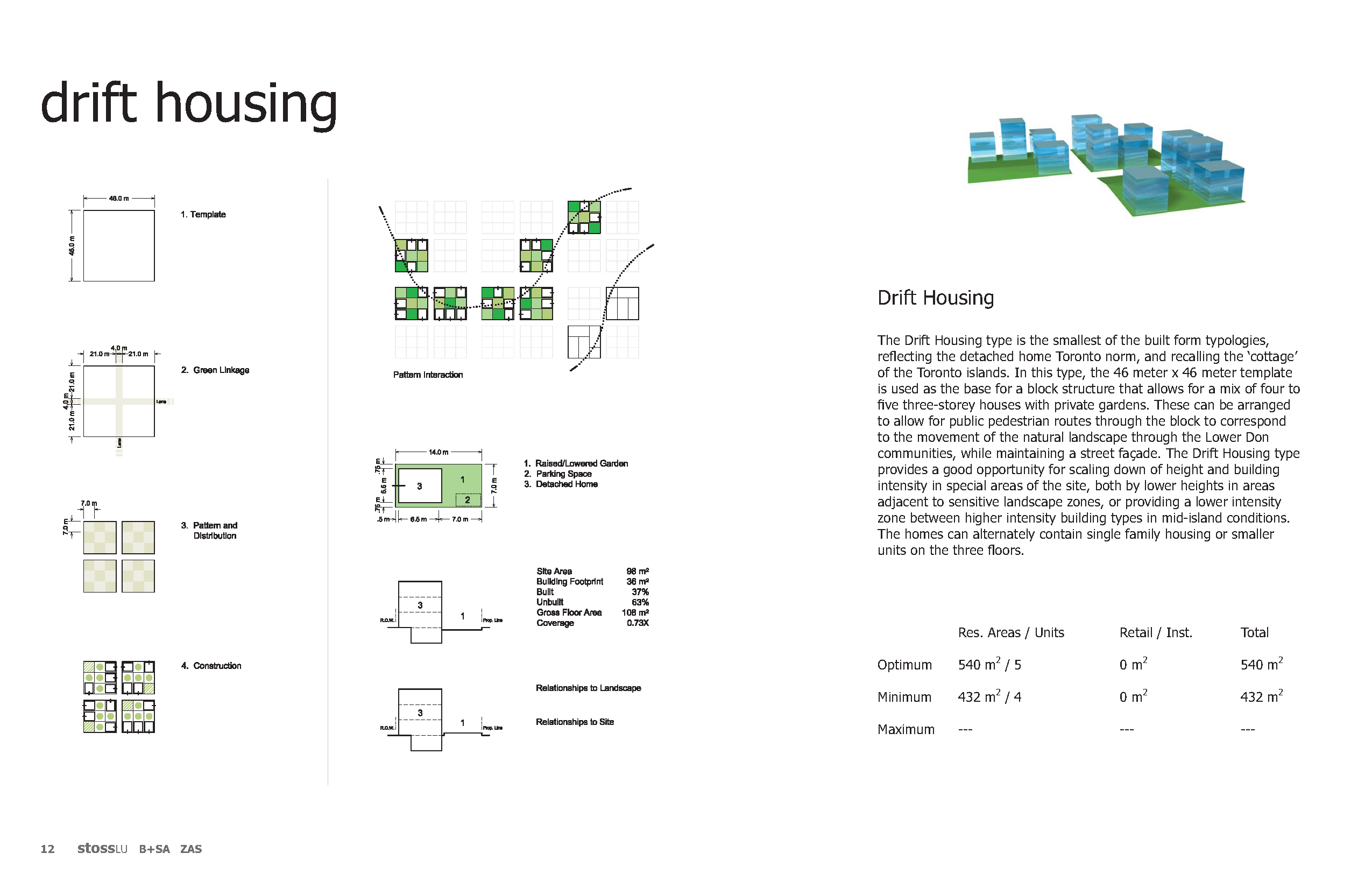
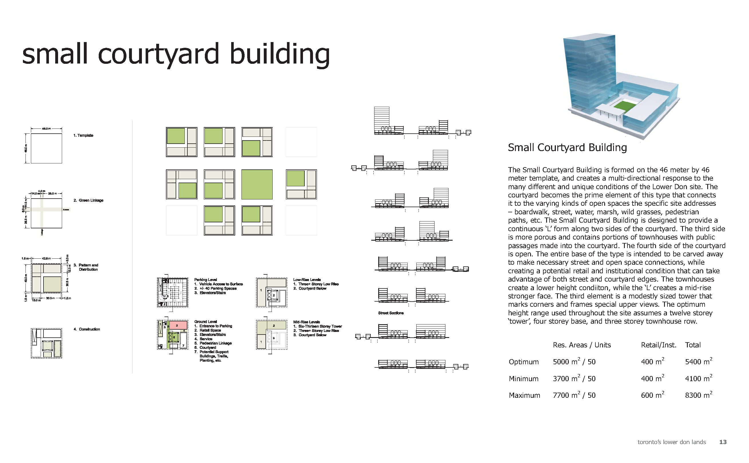
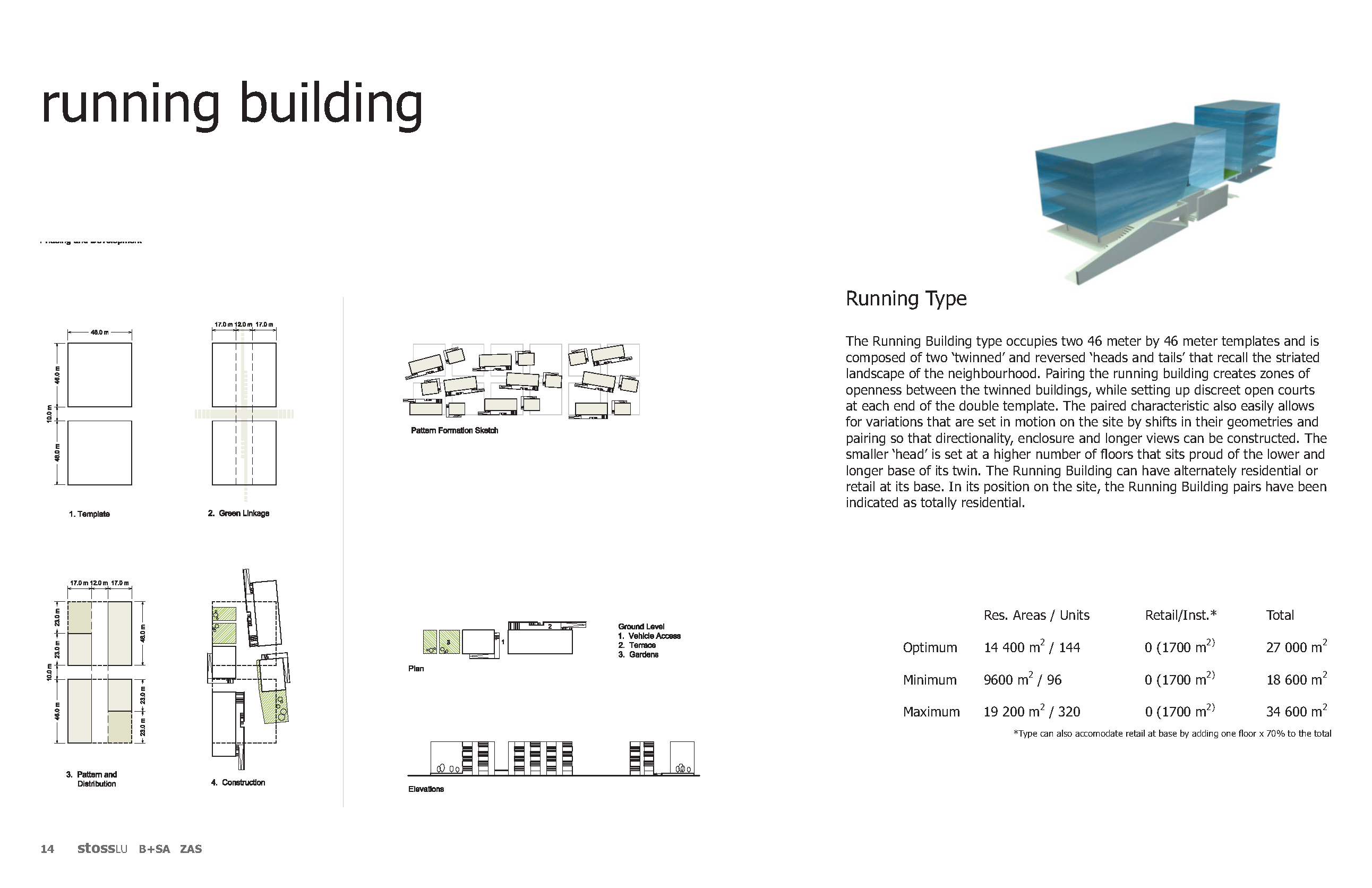
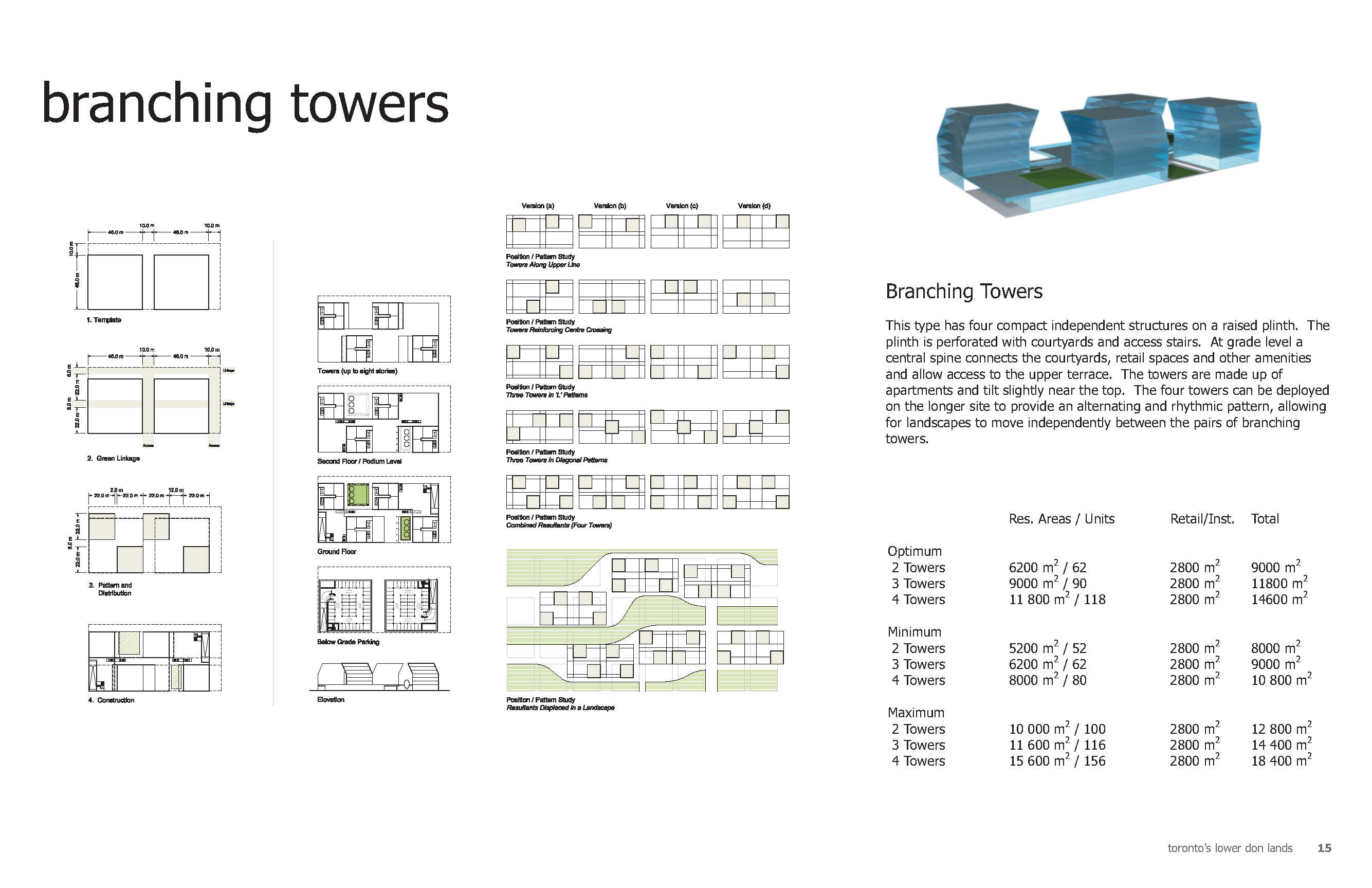
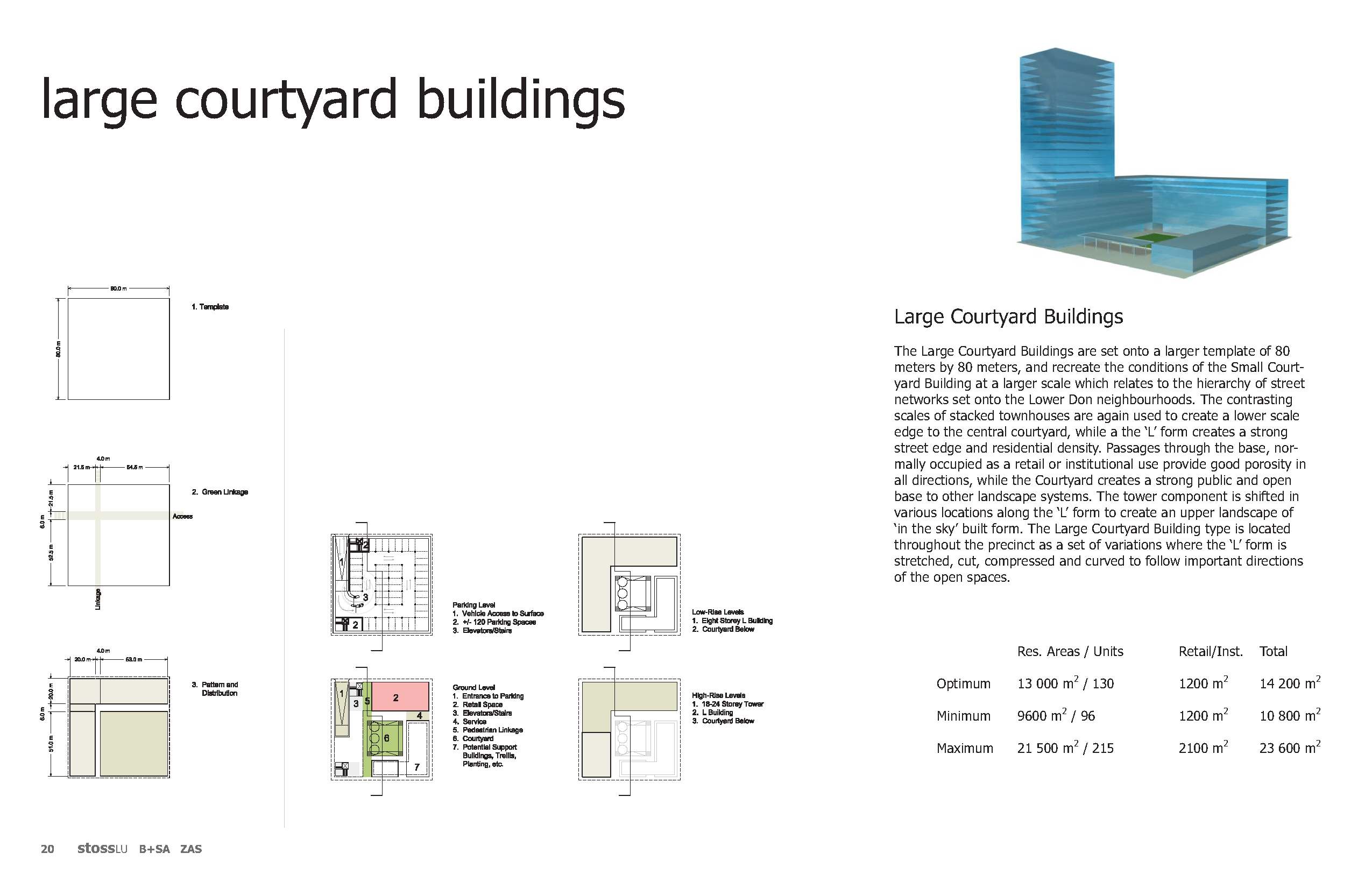
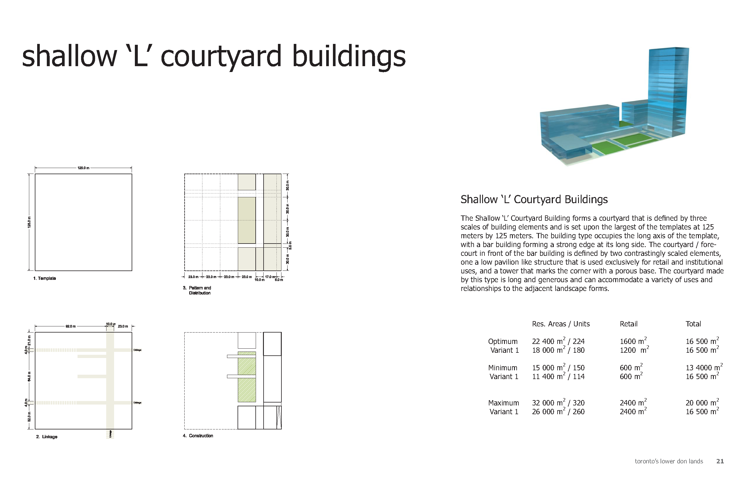
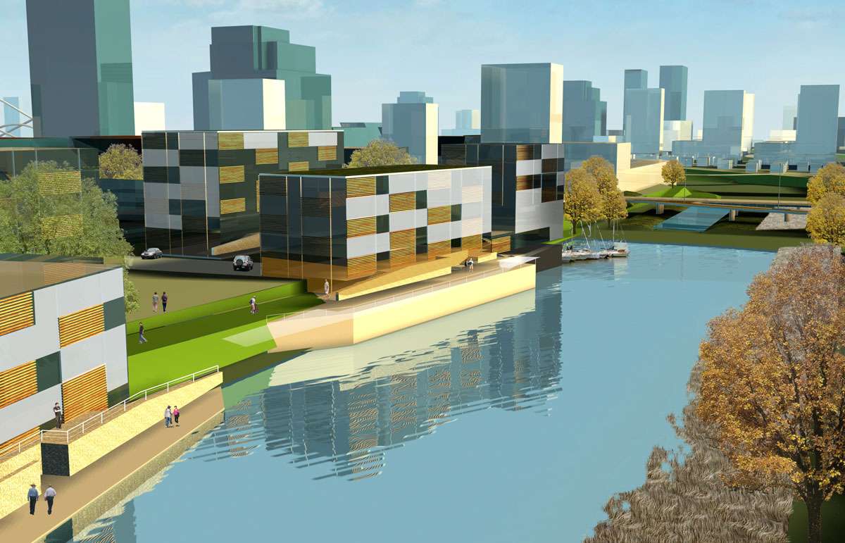
The new communities of the Lower Don will need to establish a newly modified set of building typologies that are uniquely defined by their relationship to both the public realm and the new naturalized landscape. It will not be enough to transplant several successful housing types to these new neighbourhoods. The uniqueness of the new Lower Don landscape should be reflected in a newly configured set of building types that draw upon our known traditional and excellent residential building stock in the city, while introducing new features drawn from analysis, research and innovation that are special to Toronto’s regenerated connection to the mouth of the Don River and to the waterfront as a whole.
Building Types
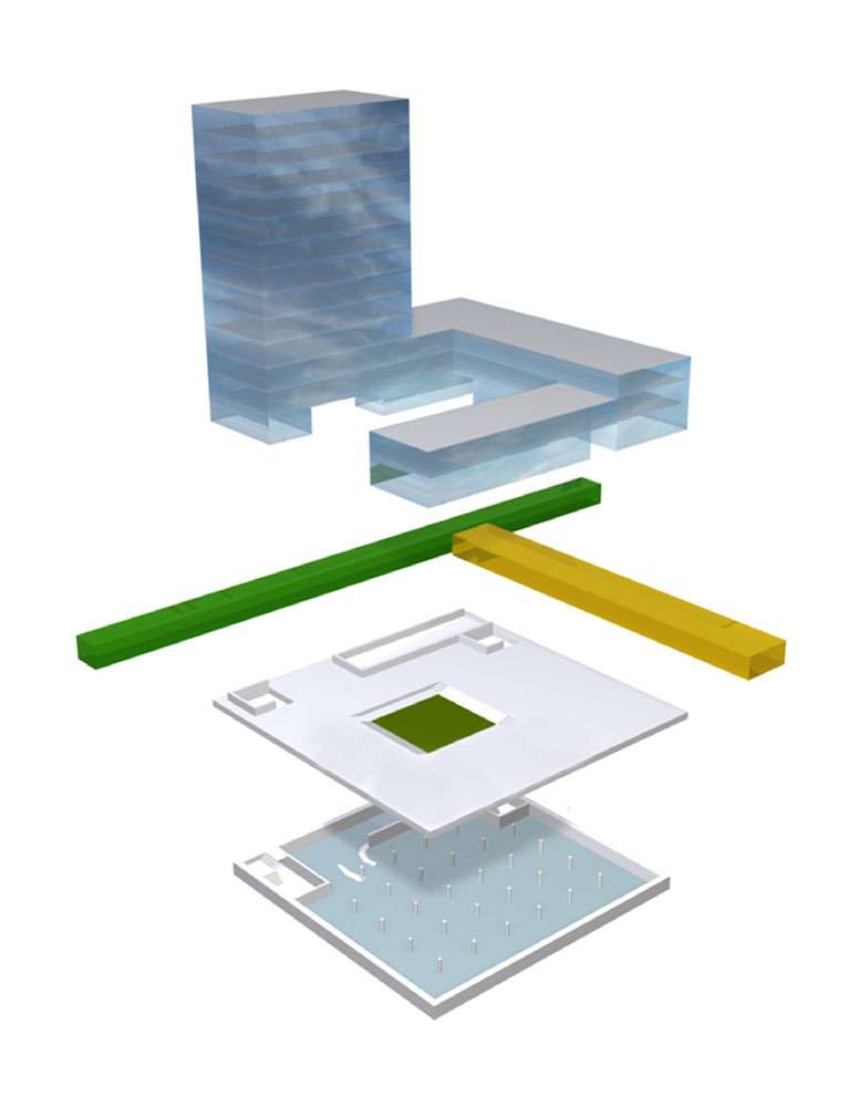
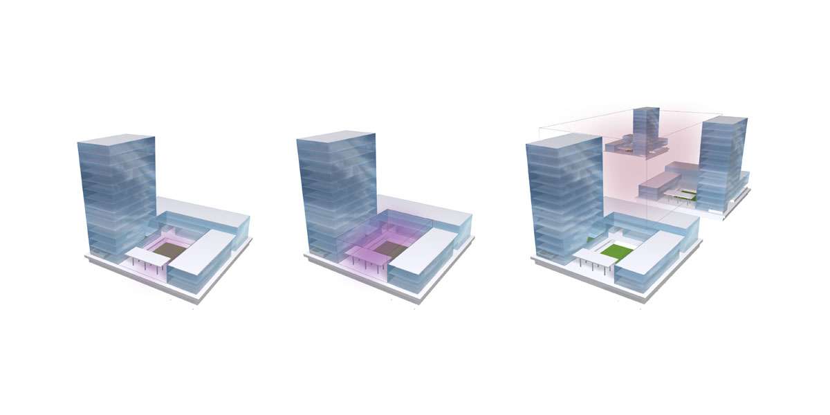
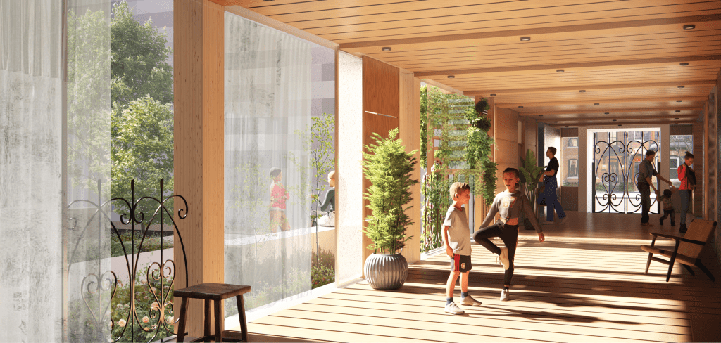
The three lattice patterns have initiated a process of differentiation in scale and sizing of the new building types as they create adjacencies, contrasts and continuities. Their uniqueness will be generated by the cross-movement flow of the landscape across and around the spits and islands. Each building type needs to have flexibility to allow it to stretch, to be compressed or to be truncated to address both cultivated and wild landscapes, esplanades, water’s edges and banks, to be positively affected and interpreted by a sometimes dominant freer geometry of the landscape. This strong effect of the naturalized landscape sets up a new open-ness in the building typologies, where the open volume created by the built type is of over-riding importance – how systems of open-ness across the spits are created north/south and how the long view is framed in the east/west direction. At the immediate scale, the framing of new public spaces and the new landscape must be accompanied by an idea of ‘interpenetrability’ – the movement of the landscape into the building, creating a lively space of dialogue between inside and outside, making that middle realm of public space through the blurring of edges.
The need for the ‘master plan’ means a strong direction towards the ‘organized’, and to a certain extent, this is important. How one determines area of intensity for buildings that correspondingly organize lower intensities, open-ness and a strong intentionality of the re-established landscape. At the same time, it is equally important to be ‘on the ground’, to explore how the detailed and fine grain relationship of the typologies – both built and open – can be created to be ‘self-organized’ so that the richness of the city can be allowed to envelop the infrastructure laid down by the larger plan, creating over time that uniqueness to neighbourhoods and places that have characterized the best of Toronto’s communities.
The built landscape of the new five neighbourhoods have been composed to be affected by the landscape, and to set up conditions where ‘on the ground’ fine grain relationships can flourish. At the same time, the typologies also include discreet placements of higher towers within lower building bases that create an ‘in the sky’ relationship of the entire Lower Don precinct between the communities and to the larger city context.
The rules that have been used in the development of the eleven built form typologies are:
– Variety of scales in heights and patterns to create contrasts, similarities, adjacencies;
– Flexibility of form to allow for special relationships to river banks, open space swaths, and harbourfronts.
– Flexibility of the ground plane to develop mixed use programming of institutional (schools, community centres, attractions), commercial (retail, offices, live-work, studios), and residential as their placement in the larger plan suggests.
– A full range of residential mixes that include townhouses, apartments, houses and lofts that can accommodate families, couples, singles, etc.
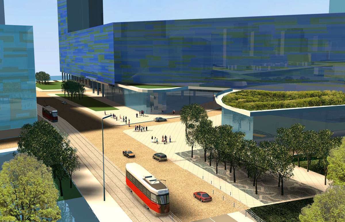
The traditional relationship of the public realm of the street to the private spaces of the house – the thoroughfare, the verge, the front steps, the lawn, the porch steps, porch, foyer, etc. – all constitute a grammar of urban form that needs to be re-thought and re-configured for the new models of multi-residential housing. The challenges of re-establishing that grammar in the new context of the new Lower Don communities is not just for the benefit of the resident – the entire public realm depends on its interconnection with parks, with the natural landscape, with streets, with transit, and with the built form.
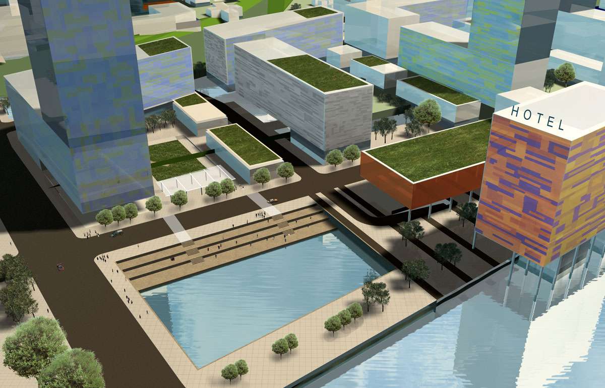

Each of the built form typologies includes an integrated open space type that is a variation of the urban courtyard. The urban courtyard is seen as a strong connector of the ‘medium’ public realm, acting between the public realm of the street / the park / the boardwalk and the residential areas. In this zone, the fine grain interpretation of the lawn, the step, the threshold is created. The courtyard space adjusts its character for its position and adjacency to both open space and programmed types. For retail uses at grade, the courtyard becomes more public and open. For residential uses at grade, careful delineation between semi-public and private routes are made. At institutional uses, the courtyard becomes public square where any number of public activities can be generated. The courtyard itself has been interpreted through the site design as vegetal, hard surface, and water, where special activities like skating, fountains, water play can be developed.
The courtyard also forms an important connection point and threshold to the wilder landscapes of marsh and riverfront. The connective tissue of pedestrian pathways, strings of streets and special planting move through and adjacent to the courtyards as part of an overlaid and ‘simultaneous’ system of greenways through the precinct.
Type Sheets