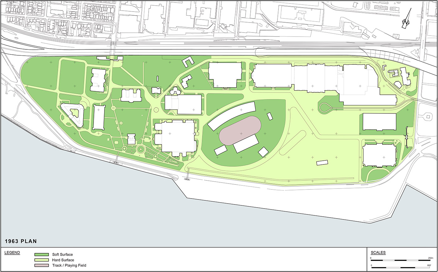
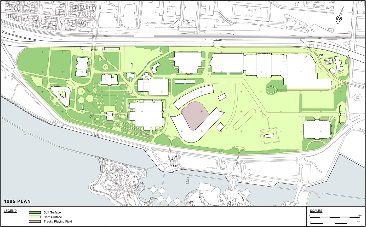
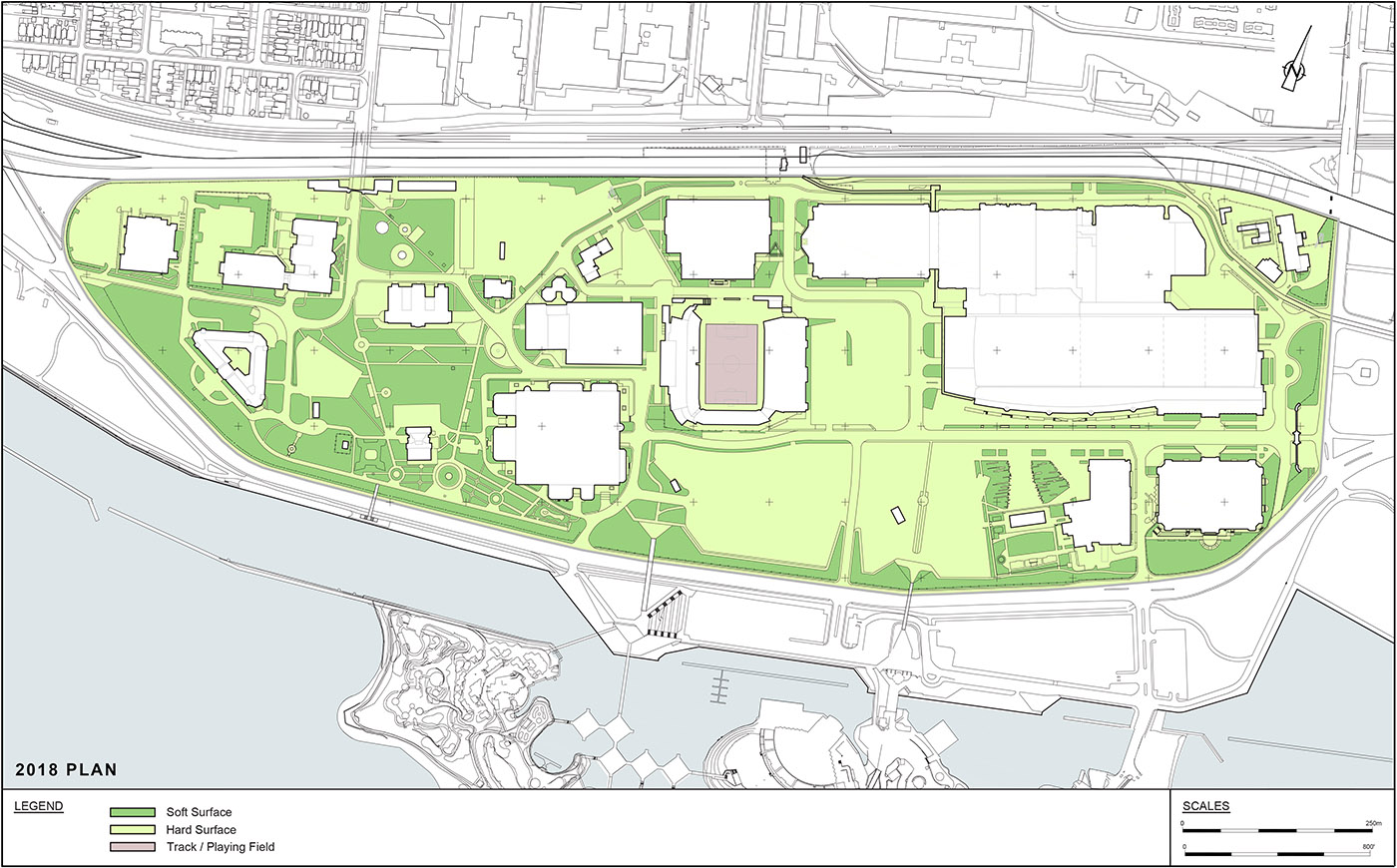
The Exhibition Place Mapping series contains 24 different maps illustrating the Exhibition Place grounds. These maps illustrate a range of site conditions, including spatial and compositional organization, building and landscape types, and historical transformation. These maps were developed as a part of the Exhibition Place Cultural Heritage Landscape Assessment, a 2019 report prepared for the City of Toronto. Brown + Storey Architects Inc. worked as part of a team hired ASI.
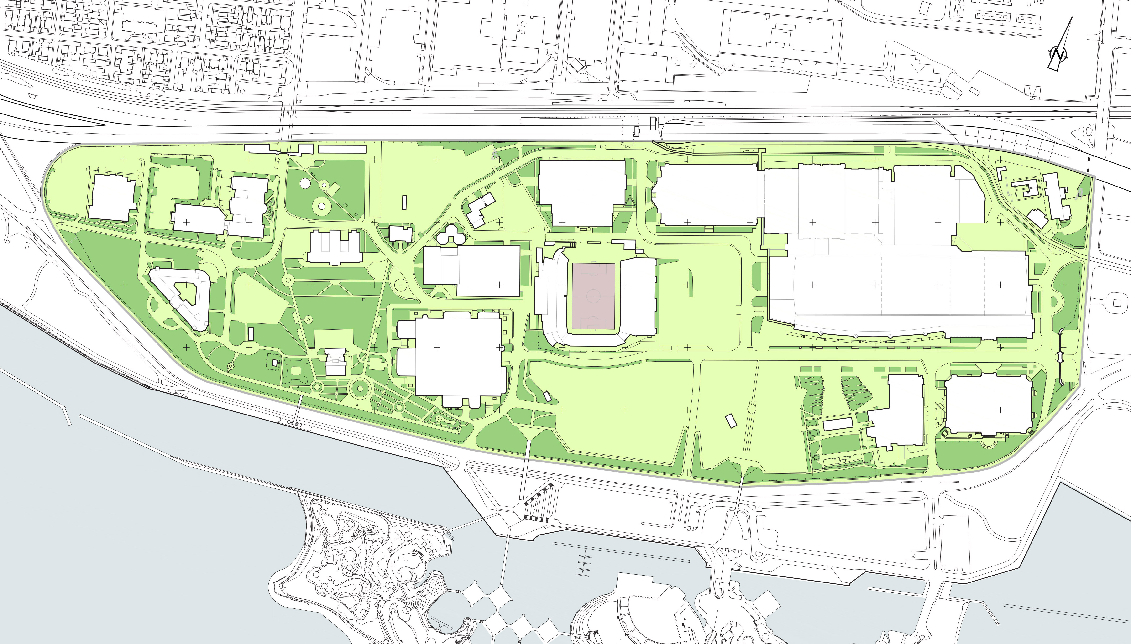
Exhibition Place Plan
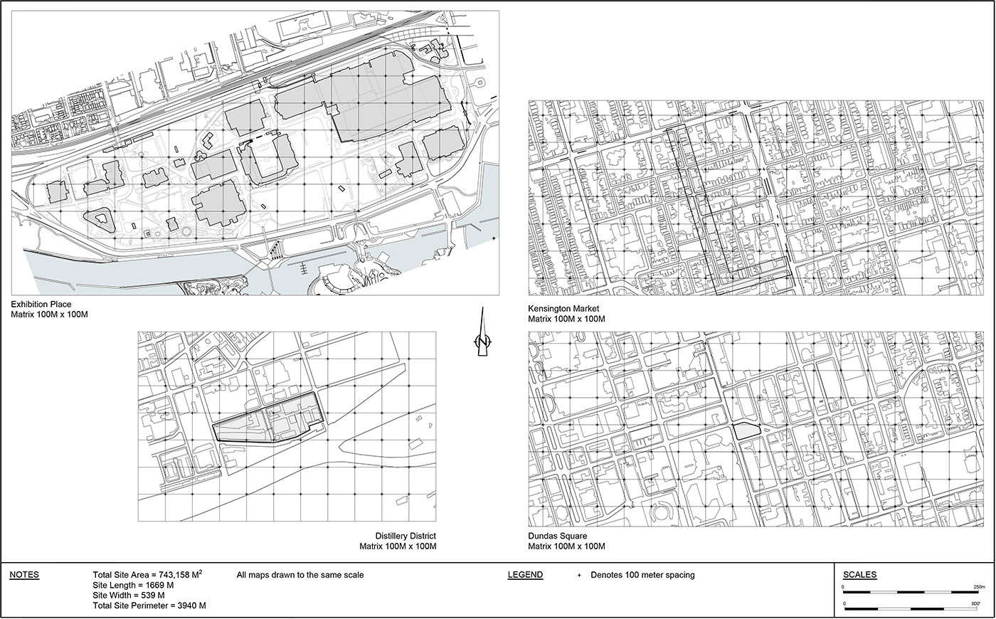
Comparative Mapping
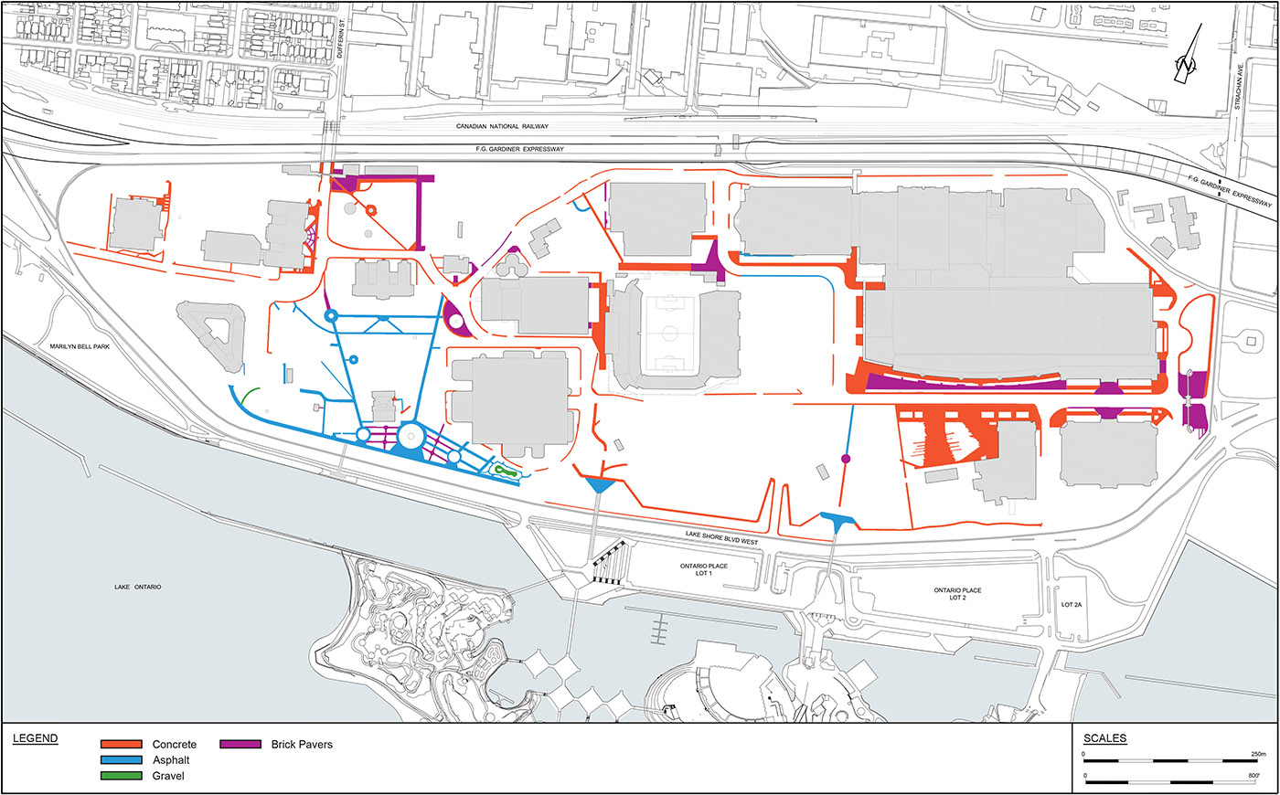
Surface Type
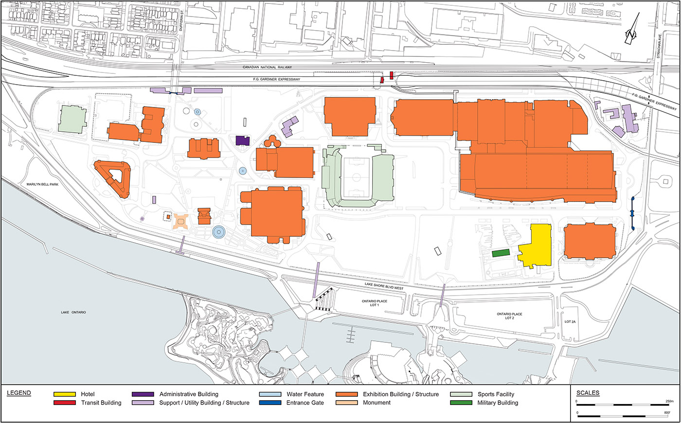
Building Types
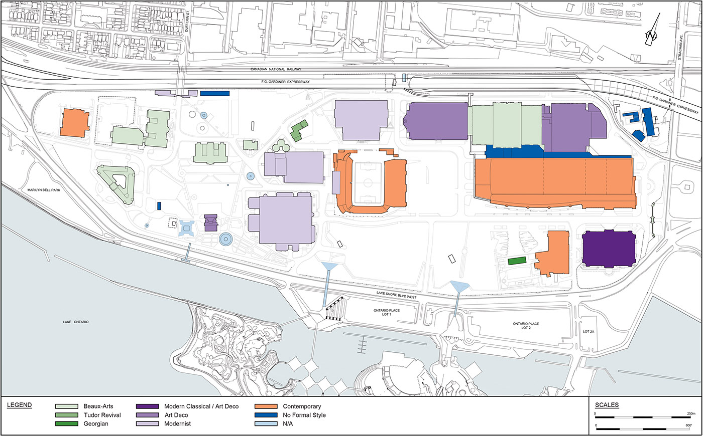
Architectural Styles
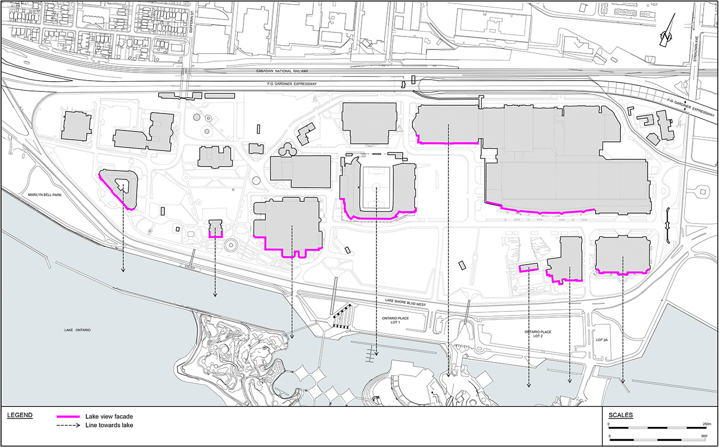
Lake View Buildings
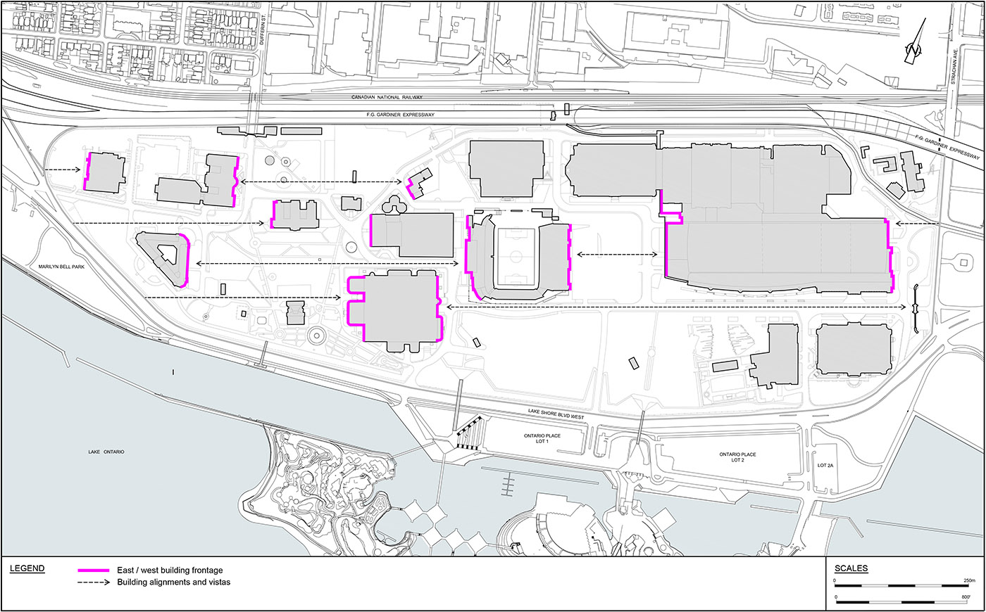
East West Building Frontages
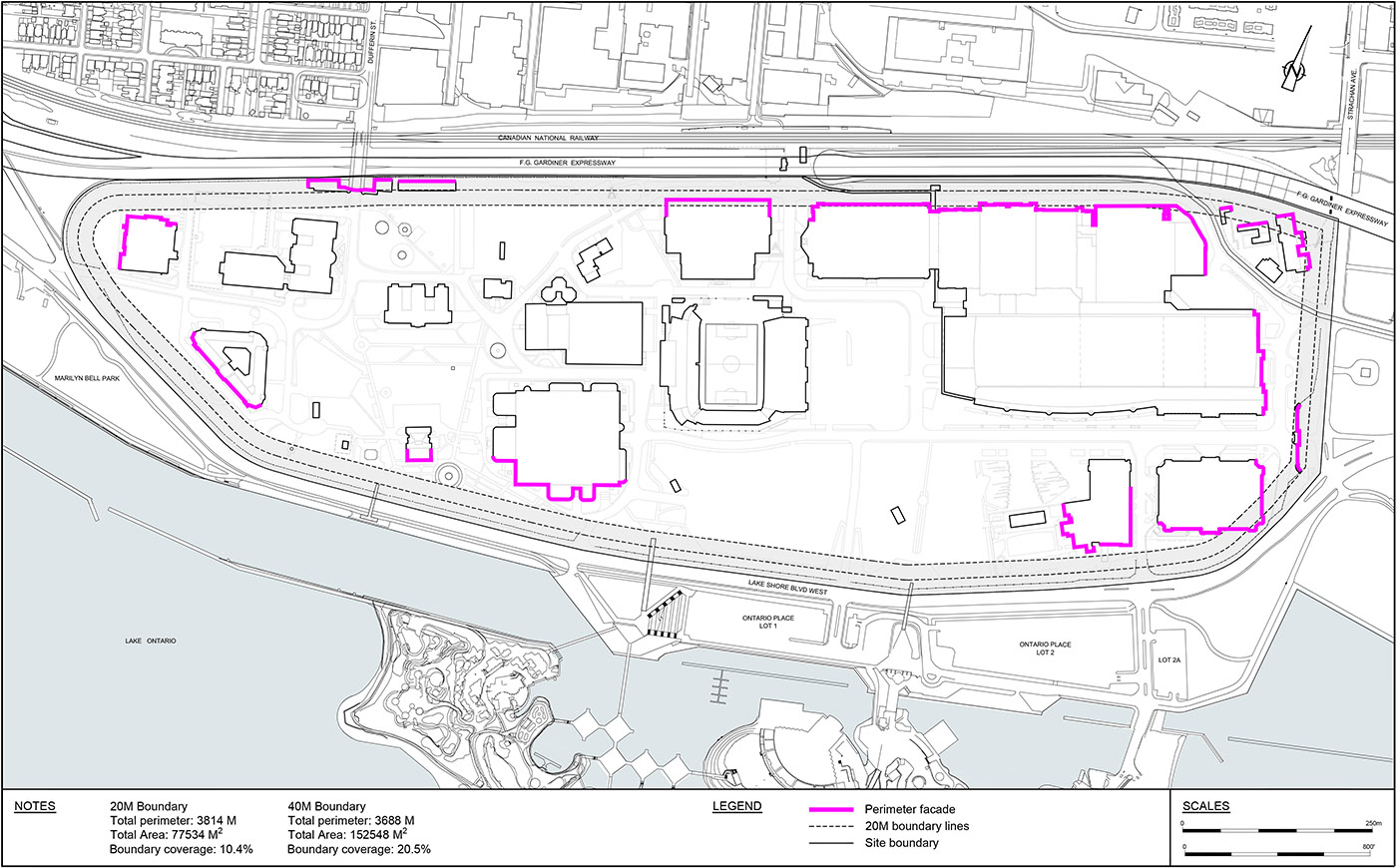
Site Perimeter
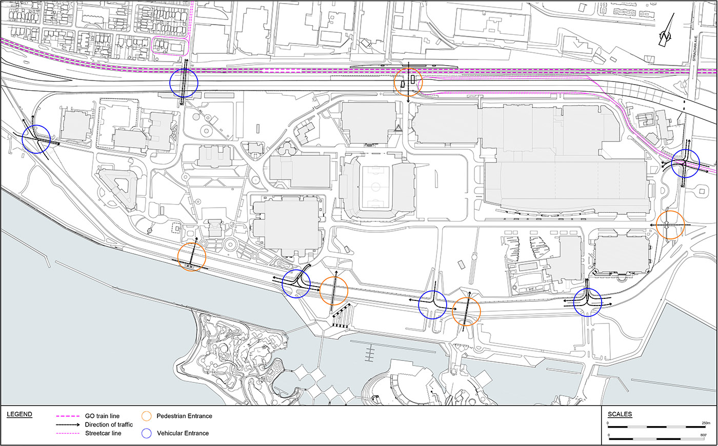
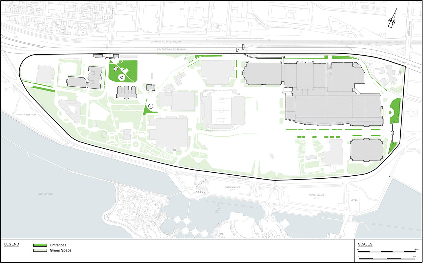
Site Entrances
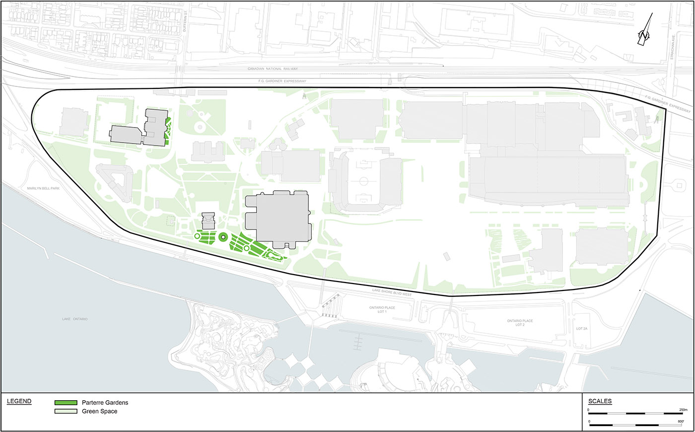
Parterre Gardens
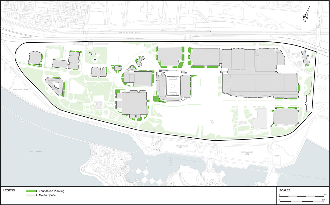
Foundation Plantings
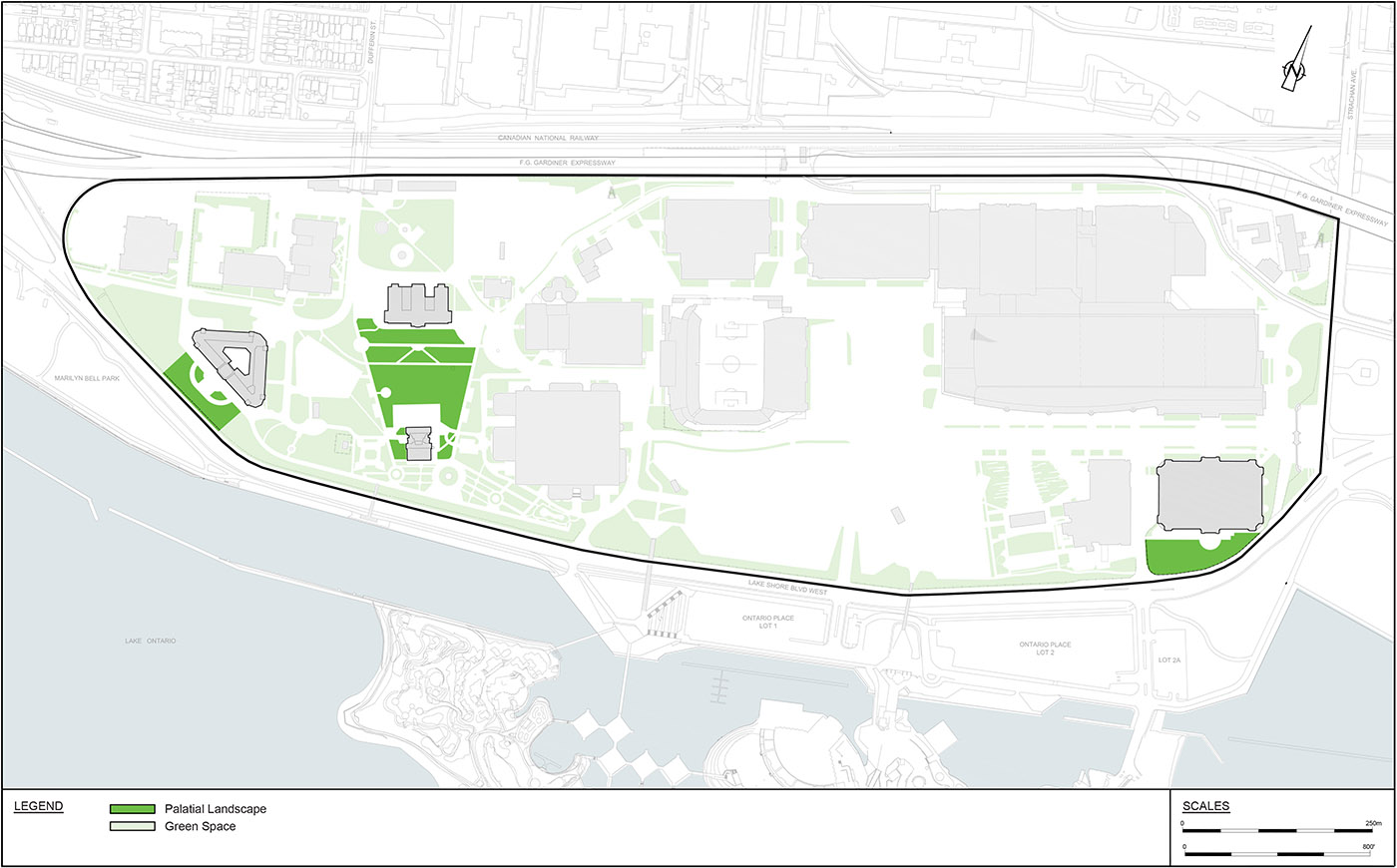
Palatial Landscapes
Entrance Gardens
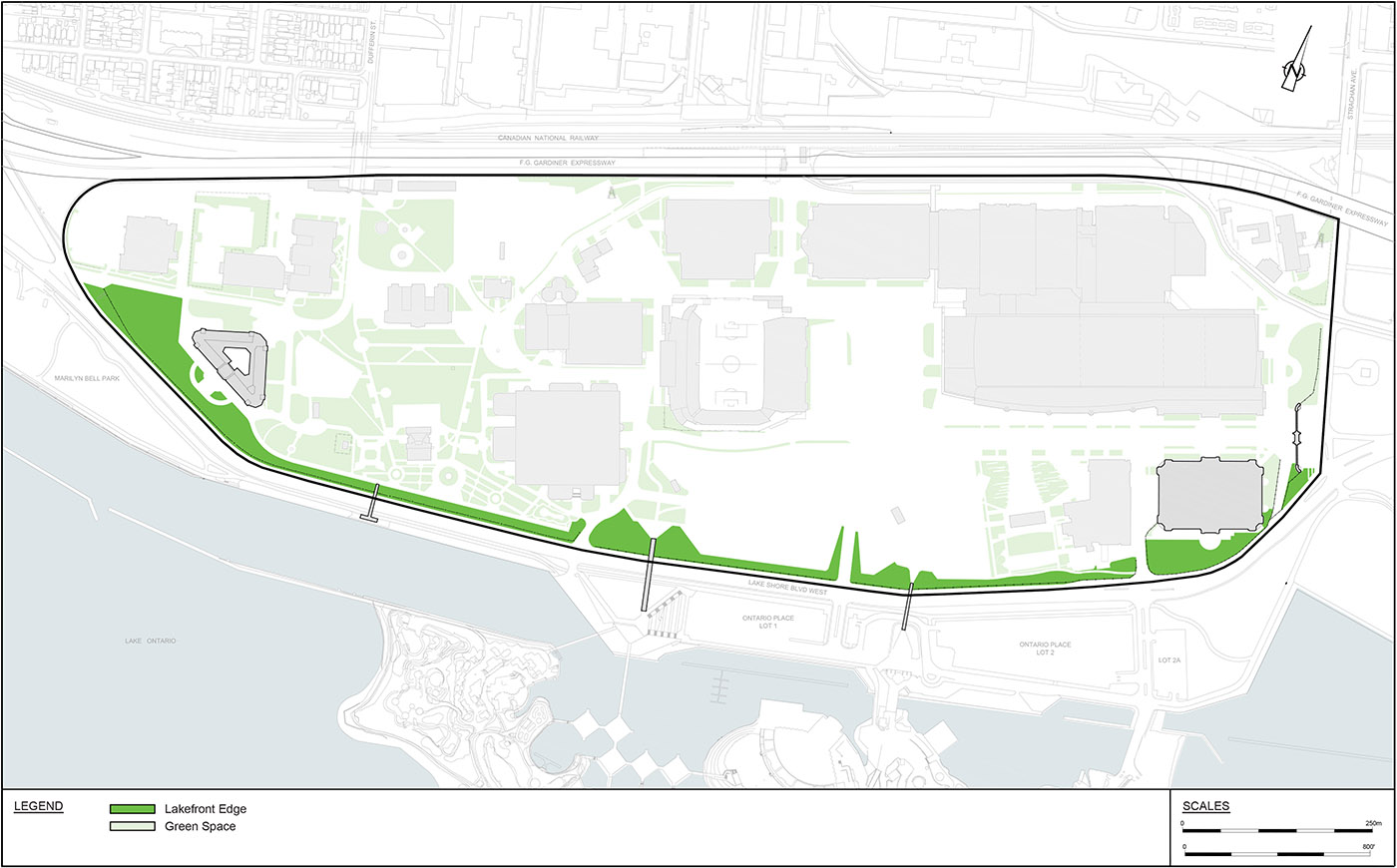
Lakefront Edge
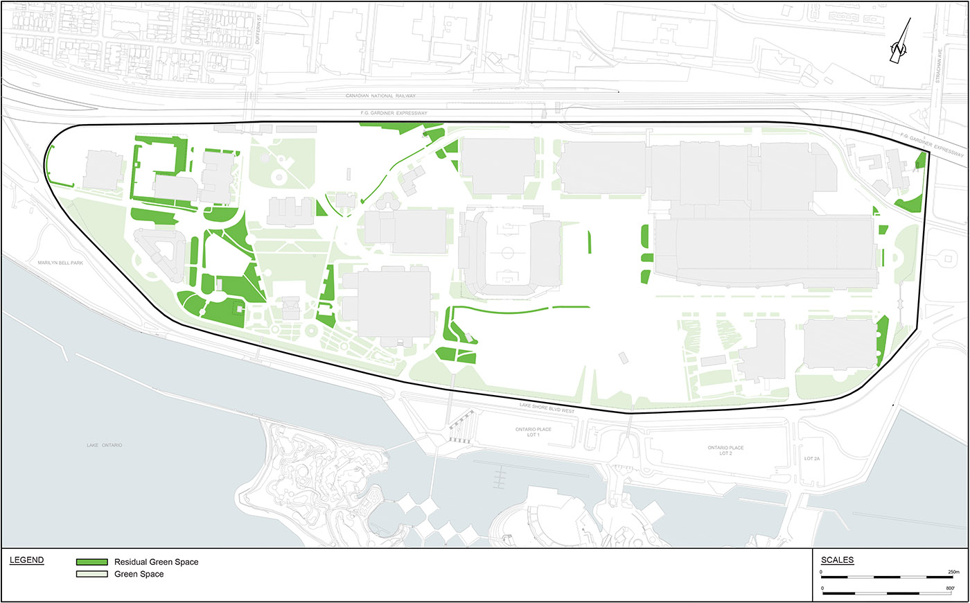
Residual Green Space
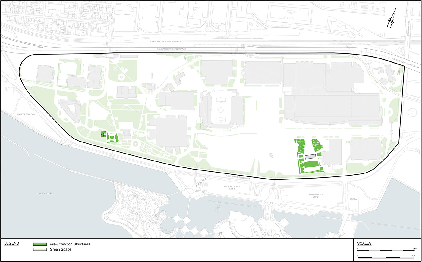
Pre-Exhibition Structures
Surface Materials
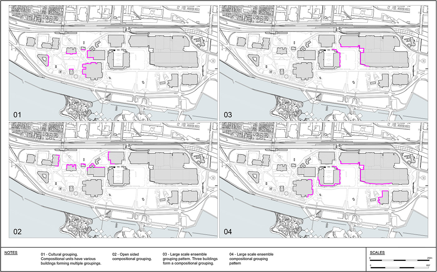
Compositional Groupings
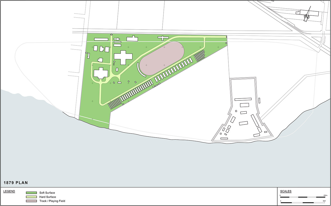
1878-1901: Toronto Industrial Exhibition
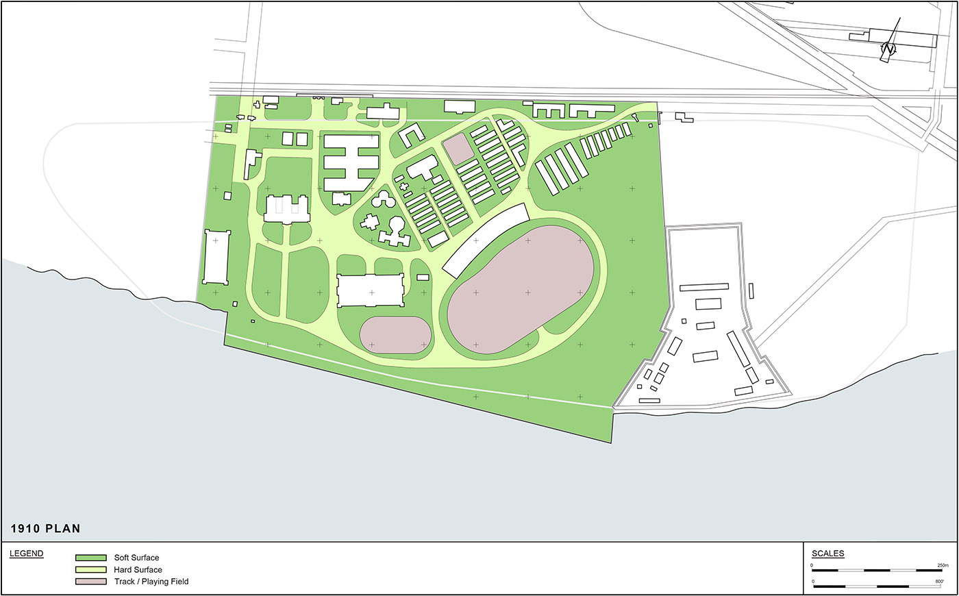
1902-1919: G.W. Gouinlock’s Buildings
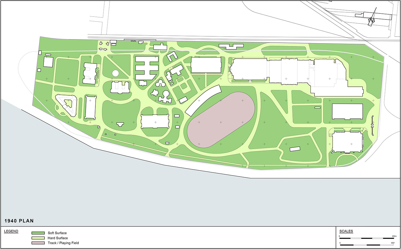
1920-1953: Chapman and Oxley Plan and The Royal Agricultural Winter Fair
1954-1970: End of the Military Reserve and Construction of the Gardiner Expressway